Sadnighaus - Sadnig (via mountain pasture Lindler (pot 149))
Starting point: Sadnighaus (1880 m)
| Latitude/Longitude: | 46,95480°N 12,96100°E |
| |
Route name: via mountain pasture Lindler (pot 149)
Walking time: 3 h 15 min
Difficulty: easy marked way
Elevation gain: 865 m
Elevation difference along the route: 920 m
Map: http://www.austria.info/us/interactive-map-austria#
Recommended equipment (summer):
Recommended equipment (winter): ice axe, crampons
Views: 632
 | 1 person like this post |
Access to starting point:
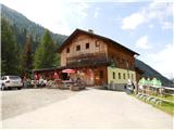
After crossing the border through the Karawanks Tunnel, we drive on a highway past Beljak / Villach and Spittal, where we turn from the highway in the direction of Knoten Spittal Millstätter See, Felbertauern, Lienz, Lendorf. Then at the sign for Großglockner we turn right (here we stop following the road towards Lienz). On the road, we then drive through the villages Möllbrücke and Obervellach, until we turn towards the village Mörtschach, into which we eventually turn. From here on we follow the signs for Asten. An asphalted and in parts steep road of a length of 10 to 11 km leads to a parking lot at the mountain hut Sadnig (Ger. Sadnighaus), where the asphalt also ends. Here we park. The drive from the state border to the destination is a little less than 2 hours.
Route description:
From the car we head a few steps down the asphalt road to the signposts Naturlehrweg Astern Moos, Schobertörl and Makernispitze, which direct us onto a footpath, on which we lose about 20 m of elevation to reach a lower-lying macadam road and continue left towards the head of the Asten valley, called Astern Moos. This section also features an educational trail, as the area is one of the rare high mountain moors in Hohe Tauern National Park and is known for its diverse and unique flora and fauna. Soon on the right we notice the turn-off for the steep path to Sadnig, but we continue straight along the road.
After 15 minutes of easy walking we reach the signposts and continue in the direction of trail 149 to the Lindler pasture (Ger. Lindleralm). Soon after, we cross the Asten stream (Ger. Astenbach) and begin to ascend. At the markers, Sadnig soon joins. The wide cart track continues past the Lindler pasture, where it narrows into a footpath that steeply ascends through a sparse larch forest. After about 200 elevation meters, like in a fairy tale, we enter the gentle world of high mountain pastures. The path crosses a stream, then passes small lakes or ponds, before reaching the junction Kapitzenbühel (2282 m). We have walked 1 hour and 45 minutes to here.
We head towards Sadnig along a path steeper only in places across high mountain meadows and after 2 hours and 30 minutes of walking from the start reach the pass Sadnigscharte (2484 m). Slightly below the pass along the path is a small lake, a good rest spot.
From the pass onward, after a few hairpin turns we reach the scree, which we cross and then steeply ascend towards the forepeak Vorsadnig (2696 m), which the path skirts just below the summit on the eastern side. From here the summit is already close. In the final steep section a few meters below the summit, where the path is steepest, the path splits into two branches, one of which offers slightly easier access to the summit.

Along the route: Sadnighaus (1880m), Naturlehrweg Astern Moos (1860m), Astenbach (1900m), Lindleralm (1980m), Kapitzenbühel (2282m), Sadnigscharte (2484m)
Photos:
 1
1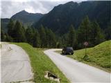 2
2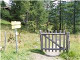 3
3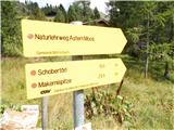 4
4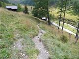 5
5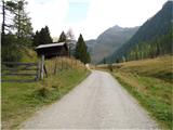 6
6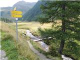 7
7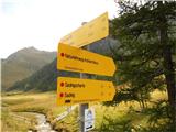 8
8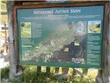 9
9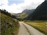 10
10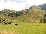 11
11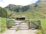 12
12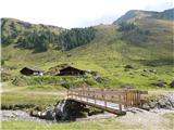 13
13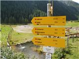 14
14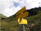 15
15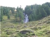 16
16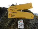 17
17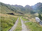 18
18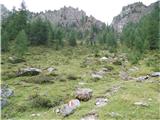 19
19 20
20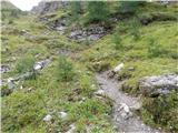 21
21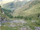 22
22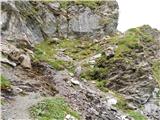 23
23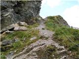 24
24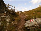 25
25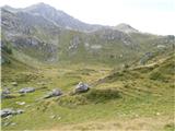 26
26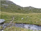 27
27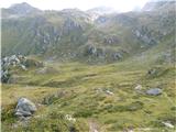 28
28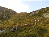 29
29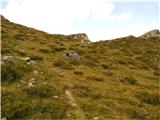 30
30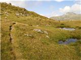 31
31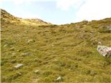 32
32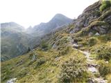 33
33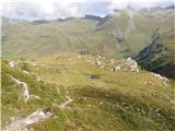 34
34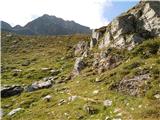 35
35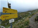 36
36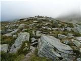 37
37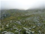 38
38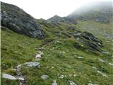 39
39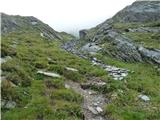 40
40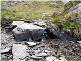 41
41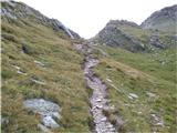 42
42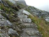 43
43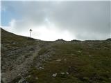 44
44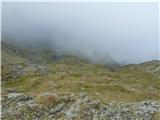 45
45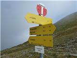 46
46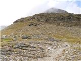 47
47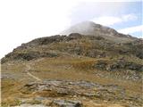 48
48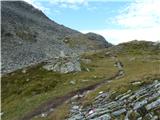 49
49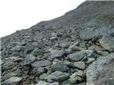 50
50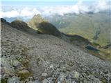 51
51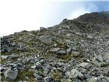 52
52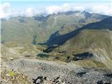 53
53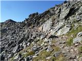 54
54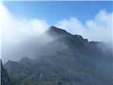 55
55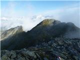 56
56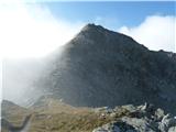 57
57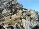 58
58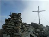 59
59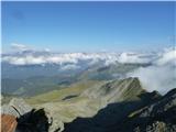 60
60
Discussion about the trip Sadnighaus - Sadnig (via mountain pasture Lindler (pot 149))
To post a comment you must log in:
If you do not yet have a username, you must first
register.