Schwarzkogelhütte - Zirbitzkogel
Starting point: Schwarzkogelhütte (1558 m)
| Latitude/Longitude: | 46,94523°N 14,69840°E |
| |
Walking time: 7 h 27 min
Difficulty: easy marked way
Elevation gain: 838 m
Elevation difference along the route: 1235 m
Map:
Recommended equipment (summer):
Recommended equipment (winter): ice axe, crampons
Views: 99
 | 1 person like this post |
Access to starting point:
a) Over the Ljubelj border crossing we drive into Austria and follow the signs for Klagenfurt am Wörthersee. In Celovec at McDonald's we go right on the south bypass road / Südring, and at the next larger crossroad we go once again right in the direction towards Velikovec / Völkermarkt and Mostič / Brückl. The road towards Velikovec we soon leave because a little after the store Obi we turn right in the direction of highway and Mostič. Further, we go past the store Ikea, where we follow the signs for Mostič and we go past the turn-offs to the highway. When we get to Mostič we follow the signs for Svinec / Eberstein and Hüttenberg. Still before Hüttenberg, more precisely after the settlement Mösel we turn right towards the mountain pass Klippitztörl and settlement Lölling. Further, we start considerably ascending through the valley of the stream Löllingbach, and higher after the settlement Lölling, we gradually go away also from the stream. We follow this road all the way to the Klippitztörl pass, from where we start descending. During the descent, the path leads us past the Naturfreundehaus hut, but we continue descending to the settlement of Klippitztörl, where we turn left and head uphill towards the Hohenwarthütte hut. A shorter ascent follows, then a left-hand hairpin, and we arrive at a large parking lot located next to the ski slope and the aforementioned hut.
b) We cross into Austria via the border crossings Jezerski Vrh, Holmec or Vič, then follow the signs for Velikovec / Völkermarkt, and from there the signs for Mostič / Brückl. When we get to Mostič we follow the signs for Svinec / Eberstein and Hüttenberg. Still before Hüttenberg, more precisely after the settlement Mösel we turn right towards the mountain pass Klippitztörl and settlement Lölling. Further, we start considerably ascending through the valley of the stream Löllingbach, and higher after the settlement Lölling, we gradually go away also from the stream. We follow this road all the way to the Klippitztörl pass, from where we start descending. During the descent, the path leads us past the Naturfreundehaus hut, but we continue descending to the settlement of Klippitztörl, where we turn left and head uphill towards the Hohenwarthütte hut. A shorter ascent follows, then a left-hand hairpin, and we arrive at a large parking lot located next to the ski slope and the aforementioned hut.
c) We leave the Klagenfurt am Wörthersee – Graz motorway at the Bad St. Leonhard im Lavanttal exit, then follow the signs for Zeltweg and Reichenfels. Further on, we drive along Obdacher Straße, but after a good 2 km we leave it and turn left towards the Klippitztörl pass. We then ascend along the rising asphalt road, following it to the settlement of Klippitztörl, where we turn sharply right towards the Hohenwarthütte hut. A shorter ascent follows, then a left-hand hairpin, and we arrive at a large parking lot located next to the ski slope and the aforementioned hut.
Route description:
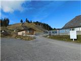
From the mountain hut, we head onto the road marked with signs for the peak Hohenwart and the mountain hut Hohenwarthütte, initially ascending moderately past a few more holiday cottages. A little further on, we leave the road slightly to the right and climb up a grassy slope, soon coming very close to the road again, but instead of following it, we continue ascending to the right of the road. Higher up, the path leads us through a strip of forest; once we emerge from the forest, we briefly descend a little and again come very close to the road. This is followed by a few minutes of steeper ascent along the line of a ski slope, after which we return to the road and follow it all the way to the mountain hut Hohenwarthütte. We bypass the hut on its left side and continue up the road to a broader ridge, then follow the ridge to a junction beside the reservoir lake.
We continue straight toward Zirbitzkogel (left: one of the paths to the mountain pass Klippitztörl; right: peak Hohenwart) and begin descending along a wide cart track; where the track temporarily flattens, we turn left downhill onto a footpath that descends somewhat more steeply. A few minutes lower down, we join a gently sloping path that comes from the mountain pass Klippitztörl toward the summit of Zirbitzkogel; we follow this path to the right toward Zirbitzkogel. When we reach the junction where a path branches slightly right to the mountain hut Grünhütte, we continue slightly left toward Zirbitzkogel.
Further on, we walk for some time along a pasture. When looking to the right, a view opens towards the Packalpe mountain group. When the path lower down stops descending, we cross a somewhat wider macadam road.
We continue following the signs for Zirbitzkogel. After a short ascent, we return into the forest, which begins to thin out higher up. A little further on, we ascend moderately along a panoramic clearing. With beautiful views that extend all the way to the Julian Alps, we return into sparse forest. We pass an interesting hunting observatory and then continue easily along a gentle, indistinct ridge, where we almost imperceptibly reach the summit of Angerlkogel, which we recognize by the trigonometric point.
A little further from the highest point of the peak we leave the forest and with a glance to the left side a view opens up that reaches all the way to Triglav and even further to the Italian mountains, while we start descending along a grassy slope towards a smaller saddle, where we cross a macadam road and then continue the ascent on a marked path in the direction of the mountain hut Feldalmhütte. Next follows an easy ascent, at first still through sparse forest, higher up along a gentle grassy slope, with the path leading us slightly to the right of the ridge of Pressner Alpe. A little further ahead, among the blueberry bushes the path completely flattens and we arrive at the cross Pfannegger Kreuz, where the marked path turns right.
We continue right along a cart track that gradually widens into a poorer road, which mostly descends gently while traversing the slopes to the right. A little further on, the path turns left and quickly brings us to the hut Feldalmhütte.
We bypass the cottage on the upper left side, then turn left from the road onto a footpath following the signs for St. Martiner Hütte and Zirbitzkogel, and ascend diagonally across the northeastern slopes of the peak Zöhrerkogel. A few minutes further on, we reach the northeastern ridge of the mentioned peak and at the same time a poor macadam road; we merely cross the ridge (left along the ridge of Zöhrerkogel 20 minutes) and continue walking along the gently sloping road. Later we leave the poor road and head slightly left onto a footpath, which we follow diagonally to the northwestern ridge of the peak Zöhrerkogel (here an unmarked path joins from the left, leading over the mentioned peak).
We continue to the other side of the ridge and keep following the signs for St. Martiner Hütte; the path ahead descends diagonally to the left. Lower down, where the path temporarily stops descending, we pass three crosses, then continue along a panoramic slope which offers a beautiful view of the nearby Gurktal Alps, until we reach St. Martiner Hütte.
We bypass the cottage and the auxiliary building on the left side, then cross a pasture fence and easily ascend over the last part of the pasture into the forest. In the forest as well, we continue for some time with an easy diagonal ascent to the left, following the blazes at several junctions. When we leave the forest the path flattens; after a cross we begin descending towards a junction near Stoanahütte.
From the junction we continue straight in the direction of Zirbitzkogel (right Stoanahütte 3 minutes; it is also possible to continue towards Zirbitzkogel past the hut, which adds only a few minutes) and at first ascend moderately, then steeply higher up; in addition to the classic Austrian blazes, winter markers also appear in the form of red poles. This is followed by approximately 30 minutes of fairly steep ascent; when we reach the elongated southern ridge of Fuchskogel higher up, the path flattens and increasingly beautiful views open up in all directions. Later the path flattens even more, and from the right joins another path that leads past Wildsee, starting from Waldheimhütte.
The path ahead ascends moderately; looking to the right, a beautiful view of lake Wildsee soon opens up. A little further on, the path flattens again and we reach a junction where a fairly short path branches off to the right to the summit of Fuchskogel (about 3 minutes). We continue left towards Zirbitzkogel.
The path gradually transitions onto a partly grassy ridge that connects Fuchskogel with Zirbitzkogel. At first we descend gently, then gradually begin to ascend along the southern ridge of Zirbitzkogel, where a path coming from the left joins us – the one that starts at Tonnerhütte.
We continue straight towards Zirbitzkogel (left Tonnerhütte, right lake Lavantsee) and follow the ridge. At first the ascent is still moderate, then come a few shorter steeper sections. As we approach the summit, the path leaves the ridge to the right, then in a traversing ascent reaches a cart track where the regular path from Waldheimhütte joins from the right.
We continue the ascent along the cart track, which quickly brings us to Zirbitzkogelhütte.
Here we go left and past a rocky chapel we quickly reach the panoramic peak, from which the view reaches all the way to Slovenian and Italian mountains.
Schwarzkogelhütte - Hohenwarthütte 0:30, Hohenwarthütte - Angerlkogel 2:15, Angerlkogel - Feldalmhütte 0:45, Feldalmhütte - St. Martiner Hütte 0:55, St. Martiner Hütte 0:55 - Stoanahütte 0:40, Stoanahütte - Fuchskogel 1:35, Fuchskogel - Zirbitzkogelhütte 0:45, Zirbitzkogelhütte - Zirbitzkogel 0:02.

Photos:
 1
1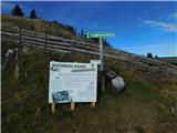 2
2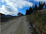 3
3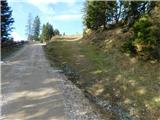 4
4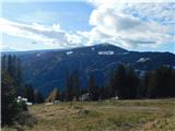 5
5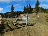 6
6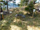 7
7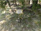 8
8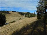 9
9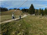 10
10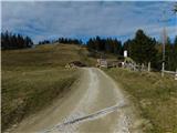 11
11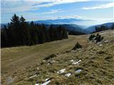 12
12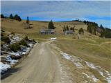 13
13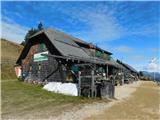 14
14 15
15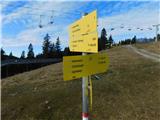 16
16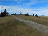 17
17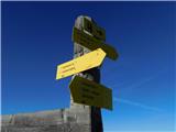 18
18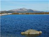 19
19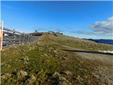 20
20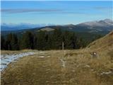 21
21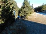 22
22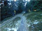 23
23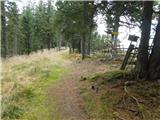 24
24 25
25 26
26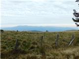 27
27 28
28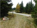 29
29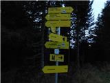 30
30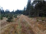 31
31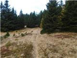 32
32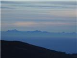 33
33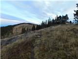 34
34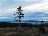 35
35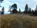 36
36 37
37 38
38 39
39 40
40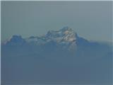 41
41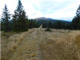 42
42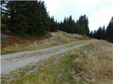 43
43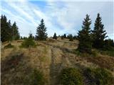 44
44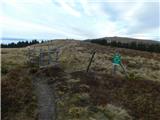 45
45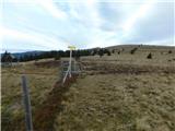 46
46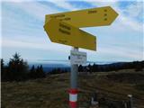 47
47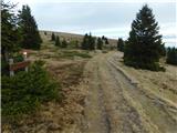 48
48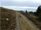 49
49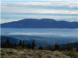 50
50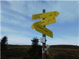 51
51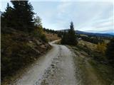 52
52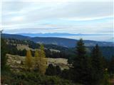 53
53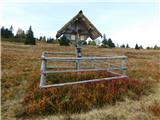 54
54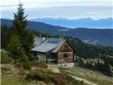 55
55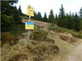 56
56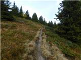 57
57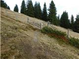 58
58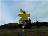 59
59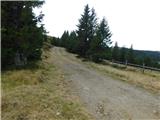 60
60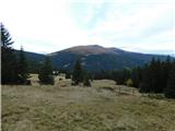 61
61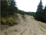 62
62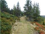 63
63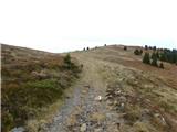 64
64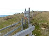 65
65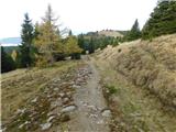 66
66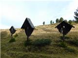 67
67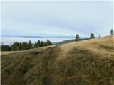 68
68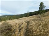 69
69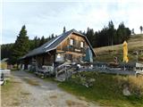 70
70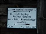 71
71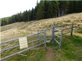 72
72 73
73 74
74 75
75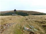 76
76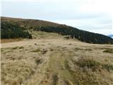 77
77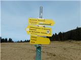 78
78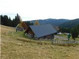 79
79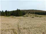 80
80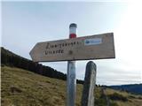 81
81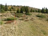 82
82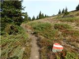 83
83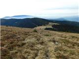 84
84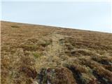 85
85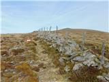 86
86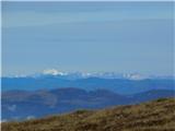 87
87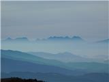 88
88 89
89 90
90 91
91 92
92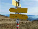 93
93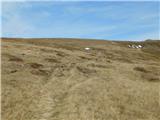 94
94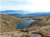 95
95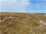 96
96 97
97 98
98 99
99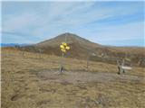 100
100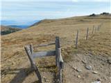 101
101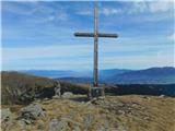 102
102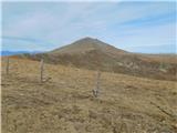 103
103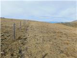 104
104 105
105 106
106 107
107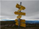 108
108 109
109 110
110 111
111 112
112 113
113 114
114 115
115 116
116 117
117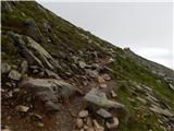 118
118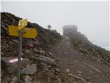 119
119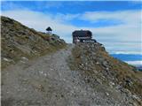 120
120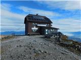 121
121 122
122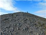 123
123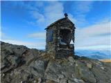 124
124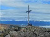 125
125 126
126
Discussion about the trip Schwarzkogelhütte - Zirbitzkogel
To post a comment you must log in:
If you do not yet have a username, you must first
register.