Starting point: Seichenbrunn (1668 m)
| Latitude/Longitude: | 46,91536°N 12,77544°E |
| |
Walking time: 5 h 30 min
Difficulty: difficult marked way
Elevation gain: 1615 m
Elevation difference along the route: 1700 m
Map:
Recommended equipment (summer):
Recommended equipment (winter): ice axe, crampons
Views: 25.847
 | 4 people like this post |
Access to starting point:
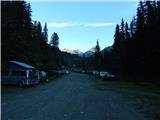
Through the Karawanks Tunnel, we drive to Austria, and then we continue driving towards Spittal and then towards Lienz (the highway ends a little after Spittal). Further, we drive on a relatively nice and wide road through the Drau Valley. A little before Lienz at the roundabout, we continue right towards the places Iselsberg and Winklern. The road starts ascending, and then we have to pay attention because the road soon branches off to the left towards the Debanttal valley (green sign). The road towards the Debanttal valley becomes macadam, and later it joins a somewhat nicer road from the place Nußdorf-Debant. When driving through the Debanttal valley, we then follow the signs for the huts Lienzer Hütte and Wangenitzseehütte. We follow the road all the way to the gate where we park on a large parking lot (Parkplatz Seichenbrunn).
Route description:
From the parking lot, we continue on a macadam road which is closed to traffic. Already after a few dozen meters, we come to a marked junction where we continue right over a bridge following the signs »Wangenitzseehütte«. Straight on the macadam road leads the path towards the hut Linzer Hütte.
Our path then turns right and climbs up a grassy slope, bringing us into the forest. For some time we then walk on a wide path which runs towards the east, and then signposts direct us left and the path starts to ascend more steeply. The path here runs mostly across grassy slopes beside increasingly sparse forest. Higher up we then cross a fence and the path brings us to a mountain pasture where livestock grazes in the summer months.
The path here becomes gentler and crosses grassy slopes below the cargo cableway towards the northwest. From the path we have here a nice view mainly on the mountains above the Debanttal valley. The path from the pasture then turns slightly right and starts ascending more steeply again, bringing us to a marked junction.
Left leads the path to the hut Linzer Hütte, while we continue right to the hut Wangenitzseehütte. From the junction the path then crosses somewhat steeper slopes below the summit Feldkopf towards the east, followed by another somewhat steeper ascent to the notch Untere Seescharte.
On the notch, where a view opens towards the east, the path descends slightly and takes us past the high-alpine lakes Kreuzsee and Wangenitzsee to the hut Wangenitzseehütte.
At the hut we continue towards the northeast following the signs »Petzeck«. After a short ascent we come to a marked junction where left branches the path to the summit Kruckelkopf.
We continue straight and then cross somewhat steeper slopes. On this section caution is required during the traverse, aided by a steel cable. Further on the path turns left and then ascends towards the north for quite some time. Higher up the path turns right onto somewhat steeper slopes; straight through the valley leads an unmarked path over the notch Petzeckscharte. The unmarked path is less steep overall, but snowfields can still be present even in late summer. The marked path then ascends steeply and from the path we have increasingly beautiful views of the surrounding peaks; along the path we will also notice a smaller waterfall. Higher up, where the path over the notch Petzeckscharte joins, the path turns right and ascends a rocky slope to the elevation 3136 meters from which a view opens towards the summit Petzeck. Here the path becomes gentler and leads us across snowfields towards the north. In the final section the path becomes somewhat steeper again and leads to the last ascent to the panoramic summit.

Photos:
 1
1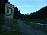 2
2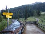 3
3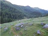 4
4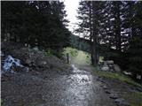 5
5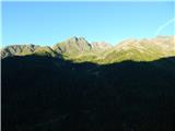 6
6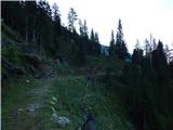 7
7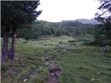 8
8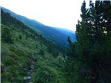 9
9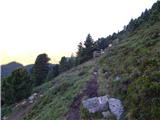 10
10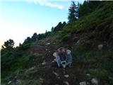 11
11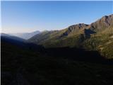 12
12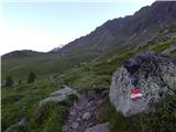 13
13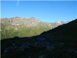 14
14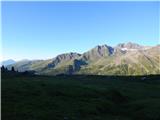 15
15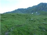 16
16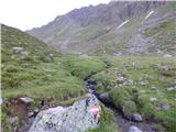 17
17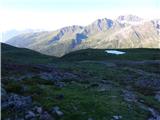 18
18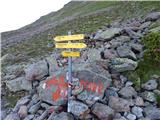 19
19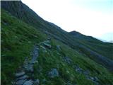 20
20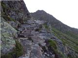 21
21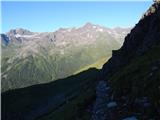 22
22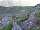 23
23 24
24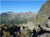 25
25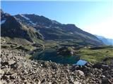 26
26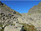 27
27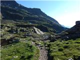 28
28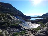 29
29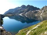 30
30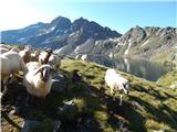 31
31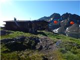 32
32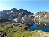 33
33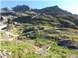 34
34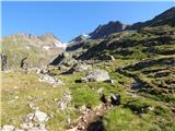 35
35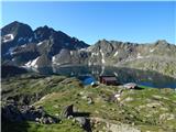 36
36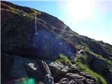 37
37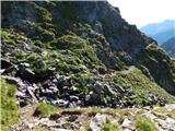 38
38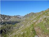 39
39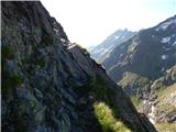 40
40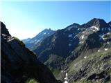 41
41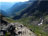 42
42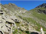 43
43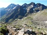 44
44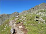 45
45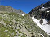 46
46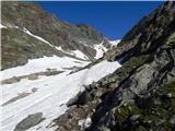 47
47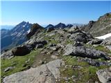 48
48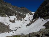 49
49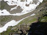 50
50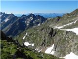 51
51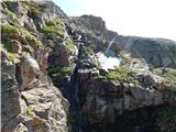 52
52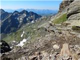 53
53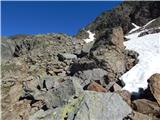 54
54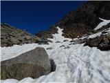 55
55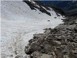 56
56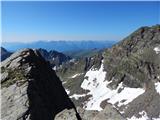 57
57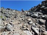 58
58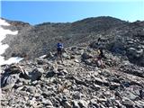 59
59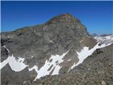 60
60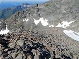 61
61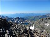 62
62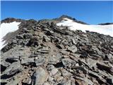 63
63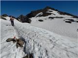 64
64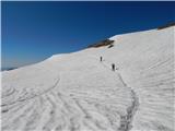 65
65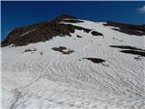 66
66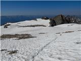 67
67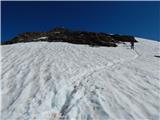 68
68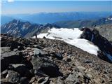 69
69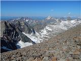 70
70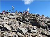 71
71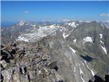 72
72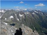 73
73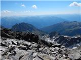 74
74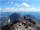 75
75
Discussion about the trip Seichenbrunn - Petzeck
|
| serznoz3. 09. 2013 |
Beautiful panoramic tour, done mid-August. I would just like to add that there was significantly less snow than shown in the pictures, in the steep part altogether around 10 meters of walking on it, higher up at least half less than the pictures show. Obviously, the contributor was up there earlier in the summer.
|
|
|
|
| zupi11. 03. 2015 |
I'm wondering if upon arrival at Wangenitzseehütte you can arrange overnight stay immediately, or if prior reservation is needed, or maybe overnight stay is not possible? Thanks for the answer!
|
|
|
|
| viharnik11. 03. 2015 |
Wangenitzseehütte is a spacious mountain hut with enough dormitory beds and rooms.
In summer it's of course good to announce yourself in advance, which helps with better occupancy overview of the hut, as well as arrangement with larger pre-announced groups.
The hut is quite well visited in summer, idyllic with beautiful twin high-alpine lakes below and excellent tours to the three-thousanders of the Schobergruppe. In recent years, friendly staff from Holland have taken over management again, so even unannounced guests won't be turned away.
|
|
|
|
| lepenatka19. 06. 2017 |
Hi, does anyone have any more recent info on this tour? info on this tour?
Regards R
|
|
|
|
| Uroš Kočnik2. 08. 2018 |
I much more recommend the tour from the other side: Wangenizalm parking lot. The path is full of streams, waterfalls... A bit more elevation gain, but it is worth it. The time on the path is longer only by a good half hour.
|
|
|
|
| zorkob8. 09. 2018 |
On 28.08.2018 my wife and I were at the summit. Start from Seichenbrunn parking at 09:30 (we drove directly from home - we live near Bled) and reached the summit the same day. We stopped at Wangenitzseehütte hut on the way, where we had a reserved room for overnight stay, to confirm arrival.
We reached the summit on 28.08. at about 14:40. Walking time to the summit is about 5h with good fitness; it's quite long and technically undemanding tour.
Phenomenal tour with wonderful views! It was the second day after a snowfall, so there was still a lot of snow above 2800m in shady spots, but less than in the description photos.
Above all, I want to praise the tidiness of the parking and the quality of the road + gravel road in the last section leading to the starting point in Seichenbrunn. Plus it's free. Dolina Vrata and TNP(?) can only marvel at this (with parking fee 3.50 EUR!!!??)!
Markings on the path are excellent and practically every 15-30 meters... really hats off!
In summer months and in general, reservation at Wangenitzseehütte hut is recommended. The hut is nicely arranged and costs 45 eur/person/overnight - half board, with valid PZS membership card (they check). For non-members 55 eur/person/overnight. This includes dinner at exactly 6pm (soup, meat or vegetable menu + dessert) and breakfast served at 06:30 and available with cereals, salami,... etc. Service, comfort, hut tidiness... at the highest level; considering you're at 2508m . Staff is extremely friendly and accommodating.
Two comments before me (Uroš Kočnik) describes the recommendation of the tour from the other side (due to water?). It's true that we went on the tour with my wife 2 days after snowfall (intense melting)... but I think there's still plenty of water sources on this side anyway.
When we went to the summit, water was plentiful everywhere; all springs were full and just from the hut to the summit, you could refill at at least 6 spots from powerful springs gushing from the peaks. Water in abundance. Below the hut, under 2500m I won't even mention... enough water for export. On the day we went up, I could have taken just 2-max.3 litres for both and refilled along the way. Snow was melting already almost 20 meters below the summit, so you could drink  . I don't know how it is on dry days?... so my comment doesn't mislead anyone! But I think there's no essential difference... . I don't know how it is on dry days?... so my comment doesn't mislead anyone! But I think there's no essential difference...
LP, Boštjan
|
|
|
|
| VanSims10. 09. 2018 |
Was there this weekend. There's still quite a bit of snow below the summit that can sink in but it's no issue if we follow the trampled path of predecessors.
I agree with the timetable given by the predecessor. The snow up top delayed me a bit so I was without breaks and at a moderate pace about 5h30 at the summit. Fog was quite present, not much in terms of views.
I also confirm that the road, as for a gravel one, is well maintained.
|
|
|
|
| Victorinox3. 07. 2022 00:39:45 |
Hello, I'm curious about the realism of the 5:30h data for this path or its comparability with signs in our mountains, as I need to decide whether to check if there are spots in the hut available sometime in August/September or if we should plan for a day trip. @zorkob wrote that the path takes 5h for someone in good condition. For me as by far the slowest member of the team (the only one who maybe does just 10 cardio activities in the whole year), paths marked 5:30 uphill take say 2:30-3h here, downhill accordingly less, but here I'd like to make sure it wouldn't actually mean 5+ hours for me.
|
|
|
|
| felix3. 07. 2022 07:46:55 |
The signs in Austria, as far as I've hiked myself, are realistic. If you look at the elevation gain - over 1600 m, the time is realistic even for this summit, an average hiker does 300 m elevation per hour. And given the long ascent, you'll hardly get down in 3 hours.
|
|
|
To post a comment you must log in:
If you do not yet have a username, you must first
register.