Seichenbrunn - Wangenitzseehütte
Starting point: Seichenbrunn (1668 m)
| Latitude/Longitude: | 46,91536°N 12,77544°E |
| |
Walking time: 2 h 30 min
Difficulty: easy marked way
Elevation gain: 840 m
Elevation difference along the route: 910 m
Map:
Recommended equipment (summer):
Recommended equipment (winter): ice axe, crampons
Views: 3.640
 | 4 people like this post |
Access to starting point:
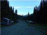
Through the Karawanks Tunnel, we drive to Austria, and then we continue driving towards Spittal and further towards Lienz (shortly after Spittal the highway ends). Further, we drive on a relatively nice and wide road through the Drau valley. A little before Lienz at the roundabout, we continue right towards the places Iselsberg and Winklern. The road starts ascending, and then we have to pay attention because the road soon branches off to the left towards the valley Debanttal (green sign). The road towards the valley Debanttal becomes macadam, and later joins a somewhat nicer road from the place Nußdorf-Debant. When driving through the valley Debanttal we then follow the signs for the mountain huts Lienzer Hütte and Wangenitzseehütte. We follow the road all the way to the gate where we park on the large parking lot (Parkplatz Seichenbrunn).
Route description:
From the parking lot, we continue on a macadam road which is closed to traffic. Already after a few tens of meters, we come to a marked junction where we continue right over the bridge following the signs »Wangenitzseehütte«. Straight on the macadam road the path leads towards the mountain hut Linzer Hütte.
Our path then turns right and ascends over a grassy slope, bringing us into the forest. For some time then we walk on a wide path which runs towards the east, then signposts direct us left and the path starts to ascend more steeply. The path here runs mostly over grassy slopes beside increasingly sparse forest. Higher up, we cross a fence and the path brings us to an alpine pasture where livestock grazes in the summer months.
The path here becomes gentler and crosses grassy slopes below the cargo cableway towards the northwest. From the path we have here a nice view mainly on the mountains above the Debanttal valley. The path from the pasture then turns slightly right and starts ascending more steeply again, bringing us to a marked junction.
Left the path leads towards the mountain hut Linzer Hütte, while we continue right towards the mountain hut Wangenitzseehütte. From the junction the path then crosses somewhat steeper slopes below the summit Feldkopf towards the east, then follows another somewhat steeper ascent to the notch Untere Seescharte.
On the notch, where the view opens towards the east, the path descends slightly and brings us past the high-alpine lakes Kreuzsee and Wangenitzsee to the hut Wangenitzseehütte.

Along the route: Untere Seescharte (2533m), Kreuzsee (2483m), Wangenitzsee (2465m)
Photos:
 1
1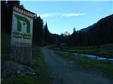 2
2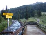 3
3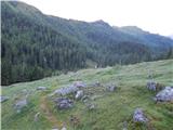 4
4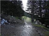 5
5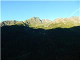 6
6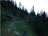 7
7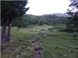 8
8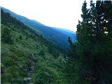 9
9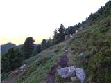 10
10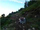 11
11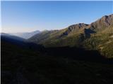 12
12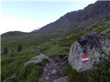 13
13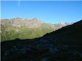 14
14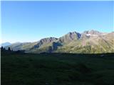 15
15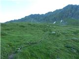 16
16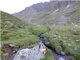 17
17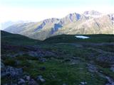 18
18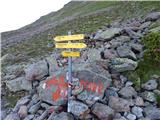 19
19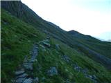 20
20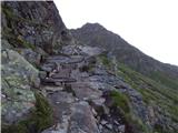 21
21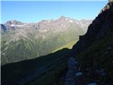 22
22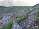 23
23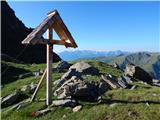 24
24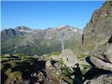 25
25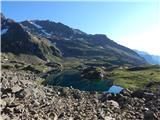 26
26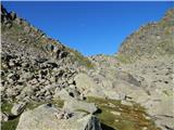 27
27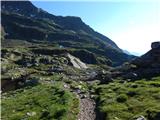 28
28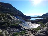 29
29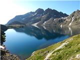 30
30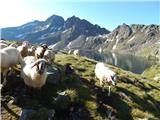 31
31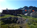 32
32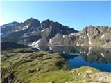 33
33
Discussion about the trip Seichenbrunn - Wangenitzseehütte
|
| Robie18. 08. 2023 12:39:25 |
I recommend the route via Nußdorf-Debant, significantly better asphalted road (in the lower part) than the one described. It's a bit annoying that if you want to go to the hut or the terrace, you have to leave the poles and backpack outside or in the gear room...
|
|
|
To post a comment you must log in:
If you do not yet have a username, you must first
register.