Sele pri Cerkvi / Zell - Pfarre - Cjajnik / Lärchenturm
Starting point: Sele pri Cerkvi / Zell - Pfarre (948 m)
| Latitude/Longitude: | 46,47170°N 14,38780°E |
| |
Walking time: 4 h 15 min
Difficulty: extremely difficult marked way
Via ferrata: D
Elevation gain: 1017 m
Elevation difference along the route: 1017 m
Map: Karavanke - osrednji del 1:50.000
Recommended equipment (summer): helmet, self belay set
Recommended equipment (winter): helmet, self belay set, ice axe, crampons
Views: 6.946
 | 1 person like this post |
Access to starting point:
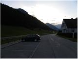
From the highway Ljubljana - Jesenice, we take the exit Ljubelj (Tržič), and then continue driving in the direction of Celovec / Klagenfurt. After the Ljubelj tunnel, the road starts descending, and we follow it to the crossroads, where slightly to the right and downwards the road towards the settlement Borovlje / Ferlach branches off. The road, which continues descending, quickly brings us to the mentioned settlement, where we soon cross the railway track. A little after the track, we join another road, which we follow to the right, driving along it in the direction of the settlement Sele / Zell - Pfarre. When we arrive in the mentioned settlement, we park on the parking lot opposite the church.
Route description:
From the parking lot, we return along the main road towards Borovlje, then still before the end of the village we notice signs for the mountain hut Koča pod Košuto, which direct us left onto the road leading to the yards of nearby houses. Behind the houses, the path turns into a cart track, which ascends diagonally across a meadow, from which a nice view opens up on Setiče / Freiberg. After a few minutes of ascent, we arrive at a hamlet of a few houses, where we step onto an initially still asphalted road leading towards the mountain hut Koča pod Košuto. For a short time, we walk along the asphalt road, from which a nice view opens up on the walls of Košuta, then the road enters the forest and loses its asphalt surface. Along the macadam road, which higher up leads past a smaller waterfall, we walk to a marked junction, where a marked path joins from the right from the homestead Ridovc / Ridovcsäge.
At the mentioned spot, we leave the road and continue left into a steep slope, through which a steep path leads us through the forest. Higher up, we return to the road, and along it we emerge from the forest into Mrzli log.
From here, we can continue right along the marked path, which proceeds along the bottom of the small valley, or along the parallel macadam road. Whichever way we continue, after approximately 15 minutes of further walking we will reach the mountain hut Koča pod Košuto and a few steps further the parking lot.
From the parking lot, we head southeast following the signs Lärchenturm / Cjajnik, Koschutnikturm / Košutnikov turn. At the start of the path, we will also notice a large board with a picture of Košuta and precisely drawn trails to Cjajnik and Košutnikov turn. The path then proceeds for some time through the forest towards the east, bringing us to a junction where we turn right following the signs for Cjajnik. Soon we emerge from the forest onto a scree field, which we cross during the ascent towards the west (in the direction of Cjajnik). While crossing the scree, we follow the red-white markers; the large yellow markers on the rocks should not confuse us, as they lead upwards across the scree towards the gully leading to Cjajnikova škrbina.
At the entrance to the climbing section of the path, we must equip ourselves with a helmet and via ferrata set; the use of climbing gloves is also highly recommended. The path steeply ascends right from the start and then traverses a steep wall to the right. The path is secured throughout with a steel cable; occasionally some pegs assist us, but far fewer than one might expect. There are not many footholds, and much of the ascent work must be done with the hands. The path then proceeds slightly to the right for quite some time and ascends almost vertically several times. Later, the path turns left and ascends a somewhat easier, slightly vegetated slope. For a short time, the summit of Cjajnik also comes into view, then we re-enter the wall. We ascend very steeply again, and the exposure increases. The steepness rarely eases further on, then the path turns slightly right, bringing us to a junction below the summit tower. We have two paths to choose from leading to the summit; whichever we select, very demanding climbing awaits. The left path is marked with difficulty grade D, the right with C.
Austrians grade the difficulty of climbing paths with grades from A to E, where A is the easiest and E the most difficult.
The right easier path first bypasses the summit on the right side, then ascends to the summit from the west side. The left path ascends vertically towards the summit from the junction. The climbing here is really very demanding, as there are not many holds in the rock. Assistance comes only from a few pegs and a vertical steel cable.
The path to Cjajnik is extremely demanding and suitable only for the most experienced mountaineers with sufficient arm strength and mandatory self-belaying. The path is among the most difficult in the Karawanks and harder than most Italian extremely demanding paths in the Julian Alps.
We can descend along the ascent path (in the upper part along the path of difficulty grade C). The second option is to descend south to Cjajnikova škrbina, from where we continue to the main ridge of Košuta and descend to the Slovenian side, or along the climbing path to Košutnikov turn back to the starting point. The path from Cjajnikova škrbina through the eastern gully is closed due to falling rocks.

Photos:
 1
1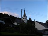 2
2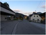 3
3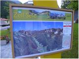 4
4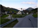 5
5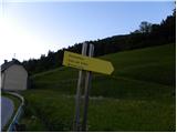 6
6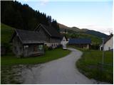 7
7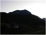 8
8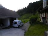 9
9 10
10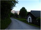 11
11 12
12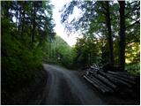 13
13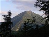 14
14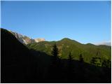 15
15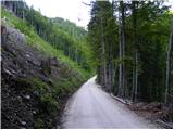 16
16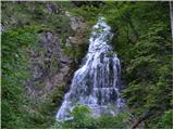 17
17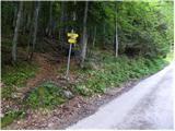 18
18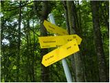 19
19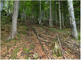 20
20 21
21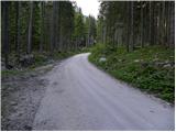 22
22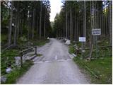 23
23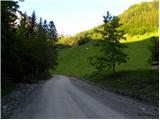 24
24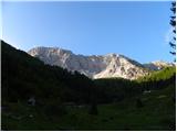 25
25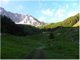 26
26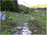 27
27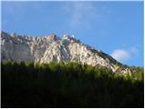 28
28 29
29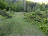 30
30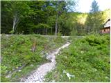 31
31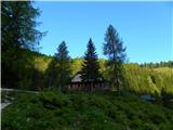 32
32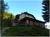 33
33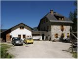 34
34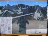 35
35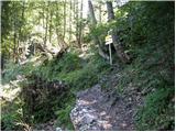 36
36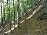 37
37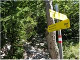 38
38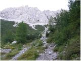 39
39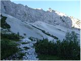 40
40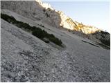 41
41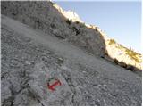 42
42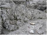 43
43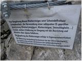 44
44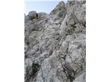 45
45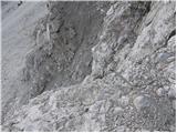 46
46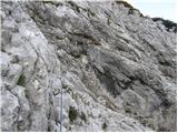 47
47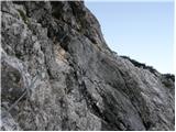 48
48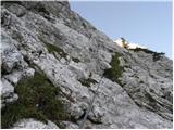 49
49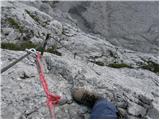 50
50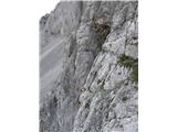 51
51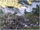 52
52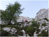 53
53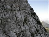 54
54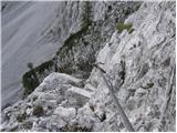 55
55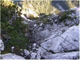 56
56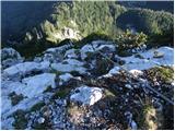 57
57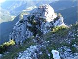 58
58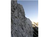 59
59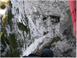 60
60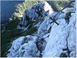 61
61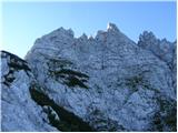 62
62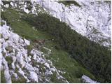 63
63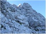 64
64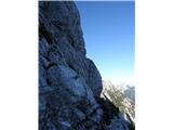 65
65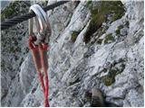 66
66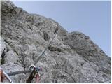 67
67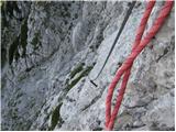 68
68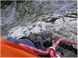 69
69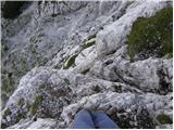 70
70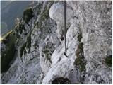 71
71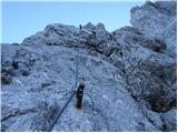 72
72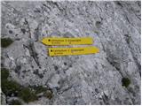 73
73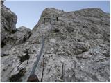 74
74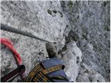 75
75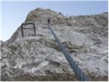 76
76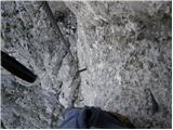 77
77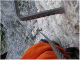 78
78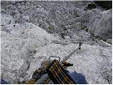 79
79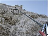 80
80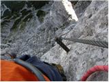 81
81 82
82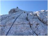 83
83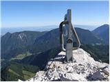 84
84
Discussion about the trip Sele pri Cerkvi / Zell - Pfarre - Cjajnik / Lärchenturm
To post a comment you must log in:
If you do not yet have a username, you must first
register.