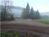
Starting point: Selski most (427 m)
| Latitude/Longitude: | 46,34590°N 14,10260°E |
| |
Walking time: 2 h 30 min
Difficulty: easy unmarked way
Elevation gain: 701 m
Elevation difference along the route: 775 m
Map: Karavanke - osrednji del - 1:50.000
Recommended equipment (summer):
Recommended equipment (winter): ice axe, crampons
Views: 4.464
 | 1 person like this post |
Access to starting point:
A) From the Ljubljana-Jesenice highway, take the Lesce exit, then continue driving towards Bled. In Bled "ignore" the left turn-offs towards Koritno, Bodešče, Ribno and Selo and continue driving to the traffic light, where the road branches off to the right towards Gorje and Pokljuka. At the mentioned intersection, continue straight and start descending towards Lake Bled. When on the left you notice the Chinese restaurant Peking, leave the main road towards Bohinjska Bistrica and behind the restaurant continue left onto Ulica Narodnih herojev. At a few smaller intersections, continue on the main road, then arrive at Cankarjeva cesta, along which you drive for some time, or to the intersection by the chapel, where you continue slightly right towards Selo and Dobra gora (still on the main Ribno road). Continue driving on a gradually narrower road, which for some time leads past meadows and fields, then transitions into the forest through which it begins to descend. Lower down the forest ends, and you arrive in the village Selo and a little further at a smaller intersection, where you continue straight (left and then immediately right) downhill towards Sava and Kupljenik (left Ribno, right Bled). There follows some descent on a still relatively narrow road, then the asphalt ends, and you drive on a somewhat wider macadam road to Selski most over the Sava Bohinjka river. Park at an appropriate place by the bridge.
B) First drive to Podbrdo, from there to Bohinjska Bistrica (by car shuttle train or over Soriška planina). From Bohinjska Bistrica continue driving towards Bled, and there, when you arrive at the lake, turn right towards Selo. Further on, drive on the narrow Mlinska cesta. Bled soon ends, and the still relatively narrow road brings you to the village Selo, where at the smaller intersection in the middle of the village you continue right towards Sava and Kupljenik (left Bled, straight Ribno). There follows some descent on a still relatively narrow road, then the asphalt ends, and you drive on a somewhat wider macadam road to Selski most over the Sava Bohinjka river. Park at an appropriate place by the bridge.
Route description:
From the starting point, we head over the bridge across Sava Bohinjka, from which a nice view opens onto Ribenska gora; behind the bridge, continue right towards Bohinjska Bela, Kupljenik and Talež. For a short time continue on the macadam road which continues along the river, then at the first intersection continue left onto the poorer road towards Talež (straight Kupljenik). The poorer road ascends for a few minutes along the pasture fence, at the end of which it splits into two cart tracks.
Continue on the left cart track (the junction is not marked), which gradually turns left and quickly brings us to a hay meadow, from which some view opens towards the Karawanks, but it is not as nice as below from the starting point, as part of the view is obscured by spruces. Behind the decaying hayloft located at the end of the meadow, the path returns to the forest and begins to ascend more steeply. Continue on a relatively wide cart track, where we "ignore" all right side turn-offs of side cart tracks. When higher we arrive at a smaller junction, where we notice signs for the hunting hut Na Taležu, continue slightly right on the still wider cart track. Ahead, the path ascends transversely to the right and runs along occasionally steeper slopes of Tolsti vrh (883 m). On the section where the path temporarily flattens somewhat, a technically somewhat more demanding path from Kupljenik joins from the right, which has been closed since 2014 due to an ice storm.
From the junction continue towards Talež on the temporarily marked path, along which with a few minutes of further ascent we arrive at a junction on a small saddle, where there is a small bench and a NOB monument.
On the saddle, the path continues left to Tolsti vrh and further to the hunting hut Na Taležu, straight leads the path to planina Talež, to the right continues the path towards planina Vršana and Jelovica.
Continue towards planina Vršana (there are no signs for planina Vršana at the junction) and begin to ascend transversely to the right. There follows a few minutes of moderate ascent, then the path brings us to the edge of planina Vršana, on which there is a feeding site for wildlife.
Bypass the planina on the right side and continue the ascent on the path along which we are accompanied by otherwise rare markers along the path in the shape of a mountaineer's boot. A few minutes higher we step onto a relatively new forest road, along which the signs are only for the direction from which we come. Follow the road left, then, when after a few steps we notice a path on the right, leave the road and head onto the mentioned path. There follows a few minutes of moderate ascent, then the path levels out and brings us to the edge of the plateau, where we notice a sign that we are on Baba and since we are over 1000 meters elevation, that there is no sin either.
From here continue for a short time on a fairly gentle path through the forest, then arrive at a poorer forest road, which we follow right; along it we quickly reach a smaller intersection, where we continue left, i.e., on the road along which on the trunk we notice a "boot" (straight less than 5 minutes to an exceptional viewpoint at the forestry hut on Baba). Continue on a fairly poor road, which at the smaller intersection we follow right. There follows a few-minute descent and the path brings us to planina Prihod.
From the planina continue left along the cart track, to which the marked path from Kupljenik immediately joins from the right. The cart track soon turns into a footpath which, with the "help" of a directional sign, leads us onto a precipitous ridge. The path mostly runs a few meters left of the precipice, so there is no major danger of slipping; we must be careful primarily when we step a few steps right from the marked path for a nice view. The path, from which beautiful views open through the tree canopies towards Bled, Bohinjska Bela and the highest peaks of the Julian Alps, brings us to the subpeak, where to the left a less noticeable path branches off towards the nearby planina Ricman.
Continue straight on the path which begins to descend visibly. After a few minutes the descent ends, and only a short moderate ascent separates us from the vantage point and summit register box of Babji zob.
Selski most - planina Vršana 1:15, planina Vršana - planina Prihod 45 minutes, planina Prihod - Babji zob 30 minutes.
Description and pictures refer to the condition in 2015 (April).

Photos:
 1
1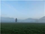 2
2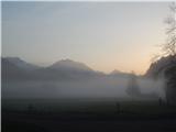 3
3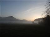 4
4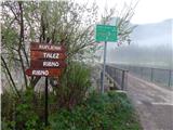 5
5 6
6 7
7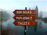 8
8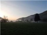 9
9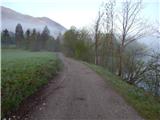 10
10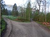 11
11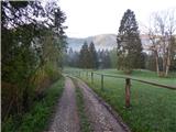 12
12 13
13 14
14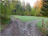 15
15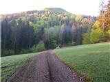 16
16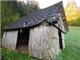 17
17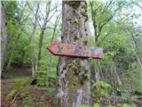 18
18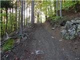 19
19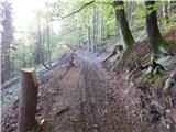 20
20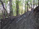 21
21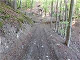 22
22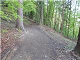 23
23 24
24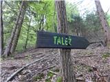 25
25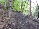 26
26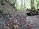 27
27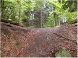 28
28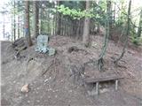 29
29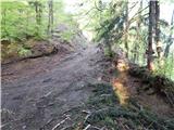 30
30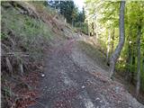 31
31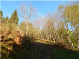 32
32 33
33 34
34 35
35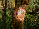 36
36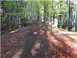 37
37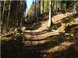 38
38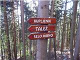 39
39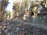 40
40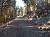 41
41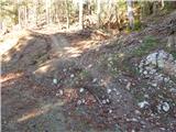 42
42 43
43 44
44 45
45 46
46 47
47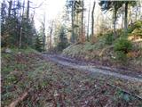 48
48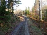 49
49 50
50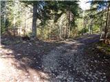 51
51 52
52 53
53 54
54 55
55 56
56 57
57 58
58 59
59 60
60 61
61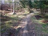 62
62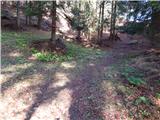 63
63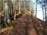 64
64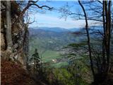 65
65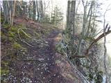 66
66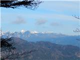 67
67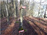 68
68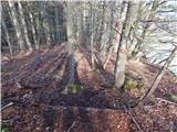 69
69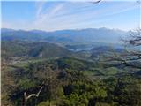 70
70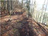 71
71 72
72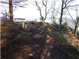 73
73 74
74
Discussion about the trip Selski most - Babji zob
|
| andi27. 10. 2025 19:49:00 |
Perhaps in the note, that there are no direction signs in the lower part (all the way to the saddle and NOB monument) for a long time. Likewise the 'senika' in picture 17.
|
|
|
To post a comment you must log in:
If you do not yet have a username, you must first
register.