Senično - Zavetišče v Gozdu (gentle path)
Starting point: Senično (540 m)
| Latitude/Longitude: | 46,33400°N 14,31310°E |
| |
Route name: gentle path
Walking time: 1 h 15 min
Difficulty: easy unmarked way
Elevation gain: 351 m
Elevation difference along the route: 360 m
Map: Karavanke - osrednji del 1:50.000
Recommended equipment (summer):
Recommended equipment (winter): ice axe, crampons
Views: 836
 | 1 person like this post |
Access to starting point:
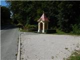
A) We leave the Gorenjska highway at the Kranj west exit, then follow the signs for Golnik. After Golnik we arrive at the settlement Senično, but already past the sign marking the end of the Golnik settlement, we park beside the larger chapel located on the right side of the road.
B) From the Naklo–Tržič road, in the Retnje settlement, we turn onto the road towards Križe and Golnik. In Križe, at the stop sign, we turn right towards Golnik, but we continue along the main road almost to the start of the Senično settlement. About 100 metres before the settlement, on the left side of the road, we notice a larger chapel beside which we park.
Route description:
Right of the chapel, along the left edge of the meadow, we notice a beaten path that quickly takes us into a strip of forest. After crossing a smaller stream, the path turns right and leads onto expansive hayfields; we follow the path that leads across the hayfields and brings us to an asphalt road after a few minutes, which we reach at the beginning or end of the village Spodnje Vetrno. We continue along the asphalt road, which ascends through the village; at a few smaller crossroads, we choose the slightly right direction. Higher up, at the last houses, the road turns right and enters the forest.
At the last house, the asphalt ends, and we continue along the road, which is closed to public traffic by a traffic sign. The road soon turns left, but we continue straight onto the cart track towards Gozd. Further on, we ascend along a wide cart track, to which the cart track from Golnik soon joins.
After the junction, the cart track narrows, and from it a steep path branches off slightly to the left, which higher up crosses the cart track a few more times.
We continue along the cart track, which first ascends moderately to steeply, then soon turns left and makes a longer, fairly gentle serpentine. When the cart track turns right, it begins to ascend moderately again, and we cross the steep path for the last time. A longer traverse ascent to the right follows; when the cart track levels out, we continue slightly left onto a somewhat narrower cart track, which continues ascending in the same direction. A few minutes further, the marked path from Golnik joins the cart track, and the cart track gradually turns into a mountain path. A little further on, an unmarked path branches off to the left from the marked path, leading towards Planica or the Gozd takeoff site; we continue along the gentle path, which turns increasingly to the left. A little further, we reach the "first" houses in the Gozd settlement, and a few dozen steps further, the marked junction.
From the junction, we continue straight towards Zavetišče v Gozdu (right: Storžič and Kriška gora) and further walk along the asphalt road, which past the church of St. Nikolaj brings us to Zavetišče v Gozdu in a few minutes.
The description and pictures refer to the conditions in 2018 (September).

Along the route: Spodnje Vetrno (600m), Gozd (890m)
Photos:
 1
1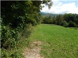 2
2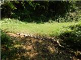 3
3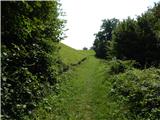 4
4 5
5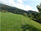 6
6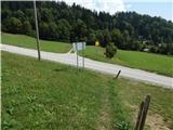 7
7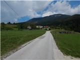 8
8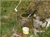 9
9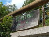 10
10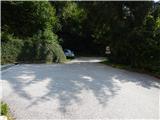 11
11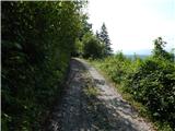 12
12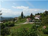 13
13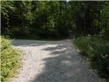 14
14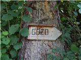 15
15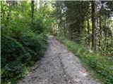 16
16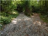 17
17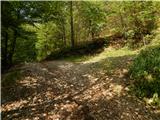 18
18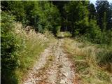 19
19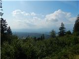 20
20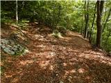 21
21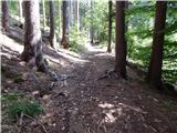 22
22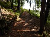 23
23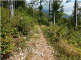 24
24 25
25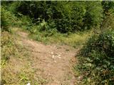 26
26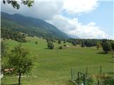 27
27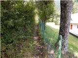 28
28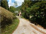 29
29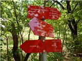 30
30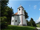 31
31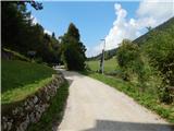 32
32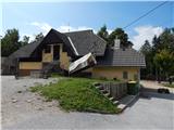 33
33
Discussion about the trip Senično - Zavetišče v Gozdu (gentle path)
To post a comment you must log in:
If you do not yet have a username, you must first
register.