Smrečje - Vrh Svetih Treh Kraljev (by road)
Starting point: Smrečje (708 m)
| Latitude/Longitude: | 46,01170°N 14,19100°E |
| |
Route name: by road
Walking time: 45 min
Difficulty: easy marked way
Elevation gain: 176 m
Elevation difference along the route: 176 m
Map: Škofjeloško in Cerkljansko hribovje 1:50.000
Recommended equipment (summer):
Recommended equipment (winter):
Views: 9.604
 | 1 person like this post |
Access to starting point:
Access from Horjul: From Horjul past Vrzdenec we drive towards Gorenja vas. In the first sharp right turn, the road branches off to the left towards the village Šentjošt nad Horjulom. We take this road and follow it to the next crossroad, where we turn right. The road then soon brings us to the village Smrečje. We follow it through the village and then park on one of the smaller parking lots by the road.
Access from Žiri: In Žiri we head onto the road which goes along the river Račeva upwards in the direction of the villages Smrečje and Žirovski vrh. We follow the road ahead in the direction of Smrečje and Vrh Svetih Treh Kraljev. Before we reach the village Smrečje, the road sharply branches off to the right towards Vrh Svetih Treh Kraljev. We park on one of the parking lots by the road near the crossroad.
Route description:
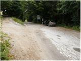
From a smaller parking lot by the road, we go to the crossroad, where we take the upper road in the direction of Vrh Svetih Treh Kraljev. The road after a few meters brings us out of the forest, where we continue straight. The road then in a gentle ascent crosses meadows by individual houses and soon brings us back into the forest. Here the road ascends a bit more steeply and brings us to the next crossroad, which is situated on grassy slopes. We go left and follow this road through part of the village, after which we reach the military tunnel of the Rupnik Line. For viewing the tunnels I recommend flashlights, and for continuing the path through the cave we must be trained cavers (with a guide) as the military tunnel transitions into a natural cave. From the cave entrance to the hut we have only one more minute of walking.
At the hut we take the left road, which after a short ascent brings us out of the forest. There follows only a few minutes of walking on the increasingly panoramic slope of the mountain. We reach the summit where the church stands without difficulty in about ten minutes of gentle ascent from the mountain hut.

Photos:
 1
1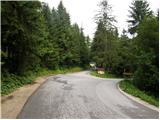 2
2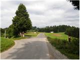 3
3 4
4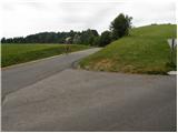 5
5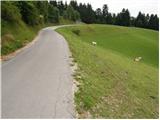 6
6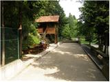 7
7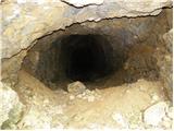 8
8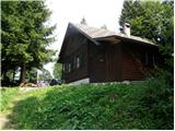 9
9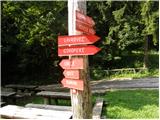 10
10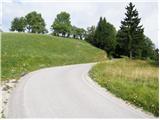 11
11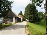 12
12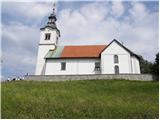 13
13 14
14
Discussion about the trip Smrečje - Vrh Svetih Treh Kraljev (by road)
|
| Gost2. 09. 2007 |
Pleasant Sunday afternoon walk, and many surrounding hills for those wanting something a bit more demanding. I recommend it also for small children.
Mojca
|
|
|
|
| Gost2. 01. 2008 |
If you have any free day left, this trip is suitable for these days. I recommend taking a flashlight to view the military trench.
|
|
|
|
| Gost3. 01. 2008 |
This military trench or rather the Rupnik Line was not completed because during digging they came across a natural underground karst cave.
|
|
|
To post a comment you must log in:
If you do not yet have a username, you must first
register.