Snežniška Grda jama - Snežnik (via Mali Snežnik)
Starting point: Snežniška Grda jama (1409 m)
| Latitude/Longitude: | 45,57800°N 14,41960°E |
| |
Route name: via Mali Snežnik
Walking time: 1 h 25 min
Difficulty: easy marked way
Elevation gain: 387 m
Elevation difference along the route: 425 m
Map: Snežnik 1:50.000
Recommended equipment (summer):
Recommended equipment (winter): ice axe, crampons
Views: 39.664
 | 2 people like this post |
Access to starting point:
A) From Cerknica or Nova vas na Blokah, we first drive to Bloška Polica, from there we continue driving in the direction of Lož and Babno Polje. In the settlement Pudob, we turn right in the direction of Snežnik, Ilirska Bistrica, Knežak and the nearby settlement Kozarišče. In Kozarišče, we continue slightly left in the direction of Snežnik and also in the following crossroads we follow the road in the direction of Snežnik. When Kozarišče ends, the asphalt also ends, and we immediately after the bridge over Mali Obrh continue left in the direction of Mašun and Knežak. There follows a long drive on a macadam road, after which after approximately 19 km from Kozarišče we arrive at a crossroads, where from the right the road from Mašun joins. Here we continue left in the direction of Sviščaki, to which we have approximately 10 km of macadam; at the crossroads we follow the signs for Sviščake. After approximately 29 km of macadam road we arrive at the Planinski dom na Sviščakih, after which at the crossroads we continue left in the direction of Snežnik. We continue driving on the road, on which the marked path to Snežnik also runs, and we drive along it for approximately 3.5 km, or to the crossroads, where slightly to the left a forest road branches off, which is closed to public traffic. We park at an appropriate place by the crossroads.
B) We drive to Pivka, from there we continue driving towards Knežak. In Knežak at the marked crossroads we continue left in the direction of Mašun and the settlements Bač and Koritnice. A little further, we go right in the direction of Mašun and Koritnice (straight Bač). After Koritnice the road starts to ascend noticeably, and after 18 km from the main crossroads in Knežak it brings us to Mašun, from where we continue driving right in the direction of Sviščaki, to which we have approximately 12 km of macadam road. When we arrive at the Planinski dom na Sviščakih we continue about 50 m towards Ilirska Bistrica, then we continue left in the direction of Snežnik. We continue driving on the road, on which the marked path to Snežnik also runs, and we drive along it for approximately 3.5 km, or to the crossroads, where slightly to the left a forest road branches off, which is closed to public traffic. We park at an appropriate place by the crossroads.
C) First, we drive to Ilirska Bistrica, then we continue driving towards Sviščaki (the turn-off is in the middle of Ilirska Bistrica and is marked, perhaps a little less noticeable). At first, we ascend on an asphalt road, then after a little less than 12 km of ascent the asphalt changes to macadam. There follows approximately 7 km of macadam, then we arrive at a crossroads in the immediate vicinity of the Planinski dom na Sviščakih, where we continue right in the direction of Snežnik. We continue driving on the road, on which the marked path to Snežnik also runs, and we drive along it for approximately 3.5 km, or to the crossroads, where slightly to the left a forest road branches off, which is closed to public traffic. We park at an appropriate place by the crossroads.
Route description:
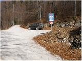
From the parking lot, we head onto the left lower road, which brings us to a sharp left turn, where on the left we notice Snežniška Grda jama. Soon after that, a footpath heads right upwards towards Mali Snežnik (here from the left the marked path from Grde drage joins us).
We head onto this path, which first ascends steeply, then in a traverse brings us to the place where the path from Mašun joins.
We continue right, again quite steeply upwards through the forest, which soon changes into dwarf pines. The path, which becomes increasingly scenic, brings us after one hour of walking from the starting point to the indistinct summit of Mali Snežnik, from where a nice view already opens up.
The path continues on and along a wide ridge, mostly in a gentle ascent. Less than ten minutes below the summit of Snežnik, from the right the path joins which most visitors use (path from Sviščaki). Here the path ascends a little and brings us to the Zavetišče na Snežnik without technical difficulties.
From the shelter to the summit we have only a few steps.
Starting point - Mali Snežnik 1:00, Mali Snežnik - Snežnik 25 minutes.

Photos:
 1
1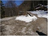 2
2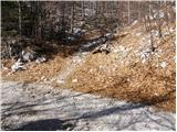 3
3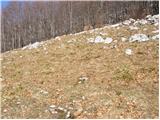 4
4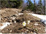 5
5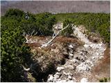 6
6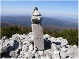 7
7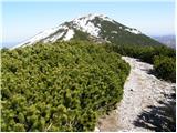 8
8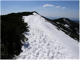 9
9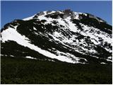 10
10 11
11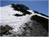 12
12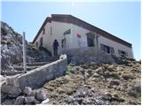 13
13 14
14
Discussion about the trip Snežniška Grda jama - Snežnik (via Mali Snežnik)
|
| andrej747. 05. 2011 |
It might not be superfluous to note - for those coming here for the first time, the best way to Sviščakov is via Ilirska Bistrica. The route is time-wise faster and more comfortable - recommended. 
|
|
|
To post a comment you must log in:
If you do not yet have a username, you must first
register.