Spodnja Kokra - Potoška gora
Starting point: Spodnja Kokra (530 m)
| Latitude/Longitude: | 46,30270°N 14,47540°E |
| |
Walking time: 2 h 10 min
Difficulty: easy marked way
Elevation gain: 753 m
Elevation difference along the route: 753 m
Map: Karavanke - osrednji del 1:50.000
Recommended equipment (summer):
Recommended equipment (winter): ice axe, crampons
Views: 12.220
 | 2 people like this post |
Access to starting point:
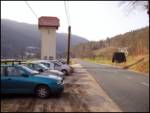
From the Ljubljana - Jesenice motorway, take the Kranj - east exit and continue following the road towards Jezersko. Just a few kilometres after the Preddvor turn-off, on the right side of the road we will spot a transformer and a parking lot next to it, where we park. There are also signposts for the Čemšenik hut here.
Route description:
From the parking lot, first carefully cross the road, then head to the hiking path towards the Čemšenik hut. The wide path barely noticeably ascends to the Polajnar farmstead, where we step onto the road, which we follow to the right.
The road steeply ascends immediately after the house, but a little higher it loses the asphalt surface. Further on, the road levels out and turns slightly to the left, where it comes very close to the Čemšeniški stream. A little further, we cross the mentioned stream and immediately after it reach a marked junction, where we continue along the left road towards the Čemšenik hut. The road then begins to ascend more steeply again and after less than 30 minutes of further walking brings us to the Čemšenik hut.
From the Čemšenik hut, continue towards Javorov vrh (sign Javorjev vrh) along the path that enters the forest after just a few metres. The initially moderately steep path soon brings us to a torrent gully, along which it then ascends for some time. Higher up, the path turns right and ascends even more steeply. We follow this relatively steep path, which runs through dense forest the whole time, all the way to the junction at the saddle between Potoška gora on the left and Javorov vrh on the right.
Continue left towards Potoška gora (slightly left sv. Jakob - path that bypasses the summit of Potoška gora, right Javorov or Javorjev vrh, Cjanovca, Shelter in Hudičevem borštu, Cjanovca, Srednji vrh, Kališče and Storžič) and continue the ascent along the summit slope of Potoška gora, covered with forest. After approximately 15 minutes of walking from the last junction, we reach the forested summit.
Starting point - Čemšenik Hut 0:50, Čemšenik Hut - Baba 0:45, Baba - Volčje jame 0:25, Volčje jame - Potoška gora 0:10.

The trip can be extended to the following destinations: Javorov vrh
Photos:
 1
1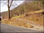 2
2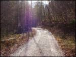 3
3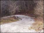 4
4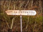 5
5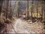 6
6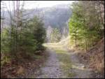 7
7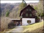 8
8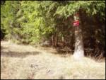 9
9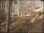 10
10 11
11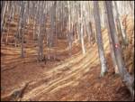 12
12 13
13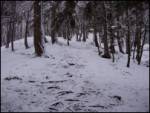 14
14 15
15
Discussion about the trip Spodnja Kokra - Potoška gora
|
| lubi22. 09. 2008 |
Yesterday I did a Sunday autumn excursion to the Dom and onwards to Potoška gora. The beautiful (election) Sunday kept the mountaineers or hikers in the valley or at grape harvesting. At midday there weren't many visitors, but the caretakers were therefore all the more hospitable and open for conversation.
I recommend it; especially because of the excellent vamps Trieste-style and homemade donuts.
Nadka
|
|
|
To post a comment you must log in:
If you do not yet have a username, you must first
register.