Stara Fužina - Triglavski dom na Kredarici
Starting point: Stara Fužina (573 m)
| Latitude/Longitude: | 46,29030°N 13,88680°E |
| |
Walking time: 6 h 50 min
Difficulty: easy marked way
Elevation gain: 1942 m
Elevation difference along the route: 1985 m
Map: Triglav 1:25.000
Recommended equipment (summer): helmet
Recommended equipment (winter): helmet, ice axe, crampons
Views: 2.120
 | 1 person like this post |
Access to starting point:
From the Ljubljana - Jesenice motorway, take the Lesce exit and follow the road towards Bled and further towards Bohinjska Bistrica. Continue driving towards Lake Bohinj (Ribčev laz), where we reach a junction, continuing right towards Stara Fužina. In Stara Fužina, at the junction by the chapel, turn sharply left onto the ascending road towards planina Blato, planina Vogar and dolina Voje. Follow this road to the parking lot where they collect road toll and parking fees.
Route description:
At the beginning of the parking lot, signs for the Mostnica gorges and waterfall direct us right onto a wide path, along which we arrive at Hudičev most in a few minutes. Continue straight (right over the Uskovnica bridge via planina Blatce and Stara Fužina), a little further, at the information board for the Mostnica gorges, go slightly right. At the next junction, go slightly right again (left Vogar, also possible to Voje), then arrive at the place where they collect the fee for maintaining the path through the Mostnica gorges (adult entrance fee was 3 eur in June 2018).
At the mentioned spot, the path splits, and we choose the left or right path. Both paths continue near the gorges (there is a side path off the right path to see the elephant, a natural feature), later they merge into one path, along which we ascend to the gravel road. Follow the road to the right, and quickly arrive at the Planinska koča na Vojah.
Continue along the road that continues through dolina Voje, keeping to the signs for slap Mostnice. A bit further, the road splits, and we can continue left on the slightly shorter road with signs for Velo polje, or right on the path a few minutes longer that passes by slap Mostnice.
Near the waterfall, at the head of dolina Voje, both paths merge, and we follow the marked path towards Triglav and Vodnikov dom na Velem polju.
The fairly wide path ahead enters dense forest and ascends above the waterfall, which we can partially see below the path, then the path turns left and ascends westwards in a few switchbacks, leading us along relatively steep slopes. At about 1150 meters above sea level, the path levels out, a bit further it takes us out of the forest to planina Spodnja Grintovica, where there is a water trough that is open only in summer months.
At the beginning of the planina, a path branches left towards planina Zgornja Grintovica and planina Krstenica, we continue straight and on the upper part of the planina re-enter the forest, the path ahead is narrower and no longer resembles a mule track. A steeper ascent follows through the forested slopes of Tisovec, a side ridge of the Stogov ridge, higher up as the path crosses to the northern slopes of the mentioned hill, it levels out and enters the indistinct dolinica Jurjevčeva vrtača.
Here, at the beginning of the dolinica, a fairly inconspicuous path branches right downwards towards the former planina Vrtača.
Continue along the marked path that leads us through gradually sparser forest, higher up the path turns right and after a few more minutes of walking brings us to a poorly marked junction at the area called Razorje, from which we continue right towards Vodnikov dom na Velem polju (slightly left planina pod Mišelj vrhom).
A steeper ascent follows again along the indistinct ridge of the lesser-known peak Na Zagonu (1819 m), then the path levels out and brings us to a marked junction where we join the path from Pokljuka or Uskovnica.
Continue left towards Vodnikov dom (sharply left Velo polje, right Pokljuka) and after about 20 minutes of traversing the slopes of Tosca, arrive at Vodnikov dom na Velem polju, where there is the next junction.
Here too, continue straight towards Triglav, the path begins to ascend transversely along the slopes of Vernar, higher up it also becomes technically demanding. Some traversing follows, aided by a fixed cable, higher up we reach a steep drop where we ascend rocky steps with the help of numerous pegs and a fixed cable.
The path ahead levels out, the slope becomes less steep and near Konjsko sedlo also somewhat more grassy.
We easily descend to Konjsko sedlo, from the marked junction on the saddle we head straight onto the path towards Triglavski dom na Kredarici and Staničev dom pod Triglavom (left Dom Planika pod Triglavom, right dolina Krma), just a few steps further the path splits again.
Continue slightly left towards Kredarica (slightly right Dom Valentina Staniča) and then ascend transversely across numerous gullies, where crossing them is generally not demanding. Further on, the path becomes technically more difficult and on some sections, fixed protections, mainly cables, and some pegs aid safer progress.
At an elevation of just under 2300 meters, we join the technically easier path from dolina Krme, continuing left towards Kredarica and Triglav.
A few minutes further, when the path levels out more, a path branches left past Snežna konta and over Štapce towards Dom Planika pod Triglavom, we continue right, first fairly gently, then ascending to the ridge above Vrh Snežne konte, the peak which we saw from below during the ascent over Kalvarija.
Here the path becomes steeper again, and we follow it all the way to Triglavski dom na Kredarici.
Stara Fužina - Koča na Vojah 0:45, Koča na Vojah - zatrep doline Voje 0:35, zatrep doline Voje - planina Spodnja Grintovica 1:20, planina Spodnja Grintovica - Razorje 1:25, Razorje - Na Zagonu 0:25, Na Zagonu - Vodnikov dom 0:20, Vodnikov dom - Konjsko sedlo 0:30, Konjsko sedlo - Kalvarija 0:55, Kalvarija - Triglavski dom 0:35.

Along the route: Hudičev most (572m), Korita Mostnice (595m),
Koča na Vojah (690m), Zatrep doline Voje (750m),
Planina Spodnja Grintovica (1165m), Jurjevčeva vrtača (1407m), Razorje (1677m), Na Zagonu (1819m),
Vodnikov dom (1817m), Konjsko sedlo (2020m), Kalvarija (2288m)
Photos:
 1
1 2
2 3
3 4
4 5
5 6
6 7
7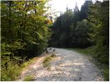 8
8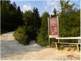 9
9 10
10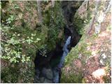 11
11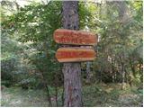 12
12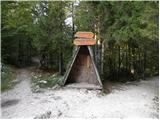 13
13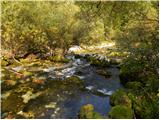 14
14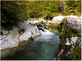 15
15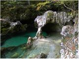 16
16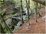 17
17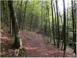 18
18 19
19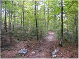 20
20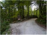 21
21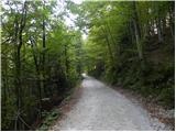 22
22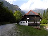 23
23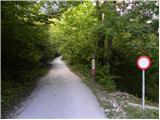 24
24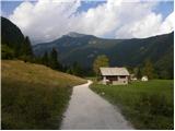 25
25 26
26 27
27 28
28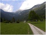 29
29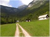 30
30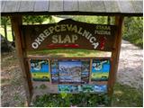 31
31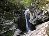 32
32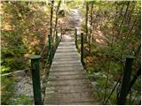 33
33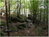 34
34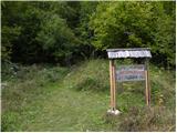 35
35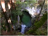 36
36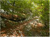 37
37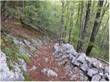 38
38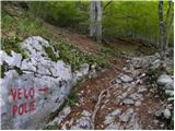 39
39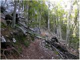 40
40 41
41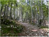 42
42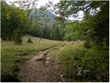 43
43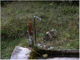 44
44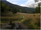 45
45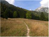 46
46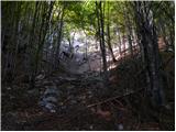 47
47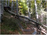 48
48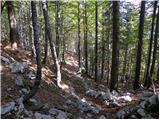 49
49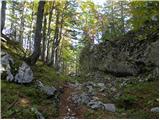 50
50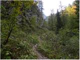 51
51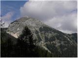 52
52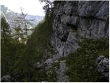 53
53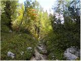 54
54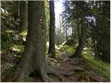 55
55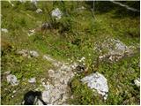 56
56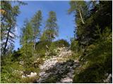 57
57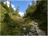 58
58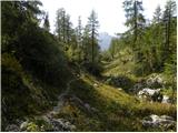 59
59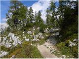 60
60 61
61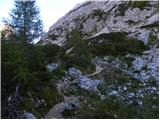 62
62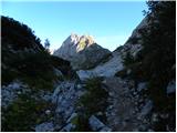 63
63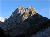 64
64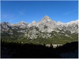 65
65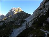 66
66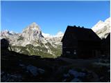 67
67 68
68 69
69 70
70 71
71 72
72 73
73 74
74 75
75 76
76 77
77 78
78 79
79 80
80 81
81 82
82 83
83 84
84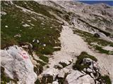 85
85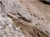 86
86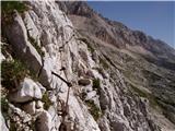 87
87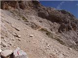 88
88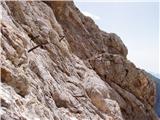 89
89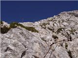 90
90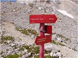 91
91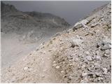 92
92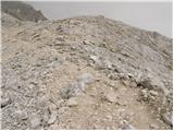 93
93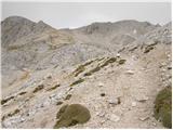 94
94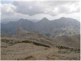 95
95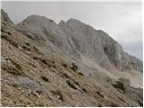 96
96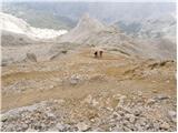 97
97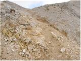 98
98 99
99
Discussion about the trip Stara Fužina - Triglavski dom na Kredarici
|
| bbugari12. 02. 2026 16:14:47 |
Old, beautiful classic ascent...
Nowadays it's all about speed, climbing as high as possible by car, Pokljuka, Blato... 
|
|
|
|
| dprapr3. 02. 2026 10:31:06 |
In youth, about 50 years ago, we did this path several times. Also via Uskovnica, Triglav, 7 lakes, all the way to Krn and back.
|
|
|
|
| bbugari13. 02. 2026 12:34:46 |
Drago, those were the times when you could overnight in huts, with mountaineering spirit.
Parking already in dusk in front of Mercator in Ribčev Laz (free, of course), then on foot: Stara Fužina, Voje, Velo polje, Triglav, 7 lakes, Komna, Savica and hitchhike to R. Laz. 
|
|
|
|
| lubadar3. 02. 2026 13:34:31 |
Yes, beautiful times when our master was the calendar, not the clock. 
|
|
|
|
| dprapr3. 02. 2026 21:26:37 |
Bojan, what parking? By train to Ljubljana and further by bus! We weren't burdened by the starting point and the end of the tour.
|
|
|
|
| bbugari14. 02. 2026 11:59:01 |
Also that way Drago, of course...
But from Pula the then Green train started the journey at 4am, after changing to the bus in Ljubljana arrival at the starting point in Bohinj or Mojstrana only at 11, but it worked...
Today that train is gone too...
|
|
|
|
| dprapr4. 02. 2026 17:50:01 |
Of course, around noon we arrived at the starting point. Then the same day on foot from Mojstrana or Bohinj to Kredarica. Finally, I repeated such a tour with a group of young curious people. From Mojstrana we turned after Peričnik straight into the stream bed and continued along it, because we got tired of the macadam. Then along Tominškova to Kredarica and the following days onwards.
Sometimes we also started in Kranjska Gora and went over Vršič to Kredarica and onwards. Or over Krnica. Of course, on the first day in the afternoon quickly to Špik.
|
|
|
To post a comment you must log in:
If you do not yet have a username, you must first
register.