Strane - Suhi vrh (Nanos) (gentle path)
Starting point: Strane (664 m)
| Latitude/Longitude: | 45,78610°N 14,08730°E |
| |
Route name: gentle path
Walking time: 2 h 25 min
Difficulty: easy marked way
Elevation gain: 649 m
Elevation difference along the route: 700 m
Map: Nanos 1:50.000
Recommended equipment (summer):
Recommended equipment (winter): ice axe, crampons
Views: 51.646
 | 2 people like this post |
Access to starting point:
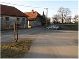
From the Ljubljana - Koper motorway we turn at the Razdrto exit and continue along the parallel old road towards Postojna. Soon we notice signs directing us left towards the villages of Veliko Ubeljsko and Strane. In the village of Malo Ubeljsko we reach the next intersection, where we continue slightly right towards Strane (left Veliko Ubeljsko). We follow the road, which rises a little more, to the center of Strane, where we see mountain direction signs. We park a few meters away near the children's playground (do not park on the playground).
Route description:
In Strane the signs for Nanos direct us onto the road that climbs past a few houses. The asphalt ends quickly and a little higher the path turns into a wide cart track that we continue on. Further on the track enters dense forest where at the area called Pri stajah a path from Veliko Ubeljsko joins from the left.
We continue straight and pass a spring, climbing moderately to the junction below the church of St. Bric. Here we turn right (left Suhi vrh and Vojkova koča on Nanos) and walk two minutes to the mentioned church.
From there we return to the nearby junction and continue the ascent towards Nanos. The path then climbs transversely on a somewhat narrower cart track over increasingly steep slopes. While walking on the otherwise easy path occasional views open through tree crowns and over nearby rock faces. Higher up we reach a junction where a marked path branches right towards the highest peak of Nanos – Suhi vrh.
We take this path (straight Vojkova koča) which turns right and levels completely. Higher the trail crosses a forest road then continues with moderate ascent through the forest. A little further we step onto gravel again and follow it to the right. The relatively gentle road brings us after a few dozen steps to the hunting lodge.
We continue on the road from which a steep path soon branches right. We go straight to the crossing where we turn right towards Suhi vrh. The road begins to descend a little further on then we notice a marked footpath that turns sharply right from the road. We take it and after a few minutes of somewhat steeper ascent reach Suhi vrh.
Strane - sv. Bric 0:50, sv. Bric - Na vrhu skal 0:30, Na vrhu skal - razpotje Boljunov vrh 0:10, razpotje Boljunov vrh - razcep pod Suhim vrhom 0:25, razcep pod Suhim vrhom - Suhi vrh 0:30.

Photos:
 1
1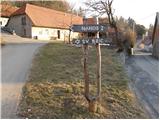 2
2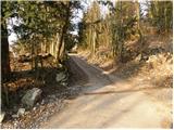 3
3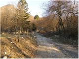 4
4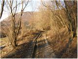 5
5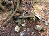 6
6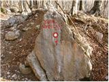 7
7 8
8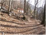 9
9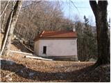 10
10 11
11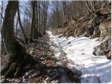 12
12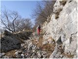 13
13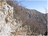 14
14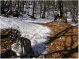 15
15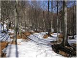 16
16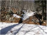 17
17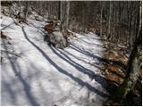 18
18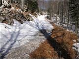 19
19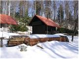 20
20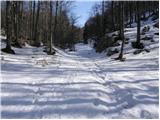 21
21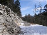 22
22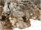 23
23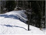 24
24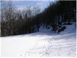 25
25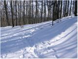 26
26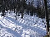 27
27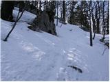 28
28 29
29
Discussion about the trip Strane - Suhi vrh (Nanos) (gentle path)
|
| yamahafazer20. 10. 2012 |
Just back from Nanos - nice weather and good food at the koča
|
|
|
|
| leroy25. 05. 2014 |
I don't know who measured the time on this path, but it can be nicely done in 1 hour and 40 minutes. Without rushing. The path is well laid out but little visited.
|
|
|
|
| miri25. 05. 2014 |
@Leroy, take a young female hiker with you and you'll see the times.
|
|
|
|
| SuzanaM22. 08. 2014 |
On Sunday, 17.8.2014, I headed to Suhi vrh from the village Strane. At the first faded sign for Suhi vrh (after about 1 hour of walking from the church in Strane), after a few steps I reached a junction and continued on the right path marked by a cairn. Maybe I should have gone straight and continued on the road I saw below me. A well-marked junction with direction signs and fresh markers on stones I saw on the return via the gentle path.
The path I took looks on the map somewhat shorter than the one described above. I spent just under two hours on it with stops for photos, starting from the church, which is a bit further than the described starting point, and I also deviated a little from the right path in between.
On the described path I would certainly spend just over two hours. Leroy probably has a long stride to have done it in such a short time without rushing.
More about my hike at the link below:
http://www.hribi.net/trenutnerazmere.asp?slo=1&gorovjeid=26&id=6167
|
|
|
|
| soraya200225. 04. 2021 14:14:52 |
Today a nice circular tour Strane - Sv. Bric - Boljunov vrh - Čeledinova koča - Suhi vrh - Votla stena - Maj - Strane. Time approx. 3h 15min.
Taste of high mountains, peace and beautiful views. Go, you won't regret it.
|
|
|
|
| Salsagirl2. 03. 2022 15:57:49 |
I'm wondering where one can park.
|
|
|
|
| garmont2. 03. 2022 16:57:01 |
I always parked on the edge of the playground. There's enough space so as not to disturb any possible basketball players.
|
|
|
|
| KarmenT6. 03. 2022 20:15:03 |
In the center of Stran there is a small children's playground, which today at its end was cordoned off with a rope. You can park by the bus shelter, we parked on the other side of the road, by some dilapidated house. Today we were the only ones. Good luck and stay safe.
|
|
|
To post a comment you must log in:
If you do not yet have a username, you must first
register.