Strane - Suhi vrh (Nanos) (steep way)
Starting point: Strane (664 m)
| Latitude/Longitude: | 45,78610°N 14,08730°E |
| |
Route name: steep way
Walking time: 2 h 15 min
Difficulty: easy marked way
Elevation gain: 649 m
Elevation difference along the route: 700 m
Map: Nanos 1:50.000
Recommended equipment (summer):
Recommended equipment (winter): ice axe, crampons
Views: 35.568
 | 2 people like this post |
Access to starting point:
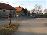
From the Ljubljana - Koper highway take the Razdrto exit and follow the parallel old road ahead in the direction of Postojna. Soon we will notice signs that direct us to the left in the direction of the village Veliko Ubeljsko and Strane. In the village Malo Ubeljsko we come to the next junction, where we continue slightly right in the direction of Strane (left Veliko Ubeljsko). We then follow the road, which ascends a little more steeply further on, to the center of the village Strane, where we notice hiking signposts. We park only a few meters away, near the children's playground (do not park on the playground).
Route description:
Signs for Nanos direct us onto an ascending road, along which we ascend past a few houses. The road soon loses its asphalt covering and only a little higher changes into a wide cart track, along which we continue the ascent. The cart track soon passes into a dense forest and past a spring, in a moderate ascent brings us to a marked junction. We continue right in the direction of Sveti Bric (left Nanos) on the path, which after 2 minutes of additional walking brings us to the mentioned church.
From Bric we return to the nearby junction, and then we continue the ascent in the direction of Nanos. The path ahead ascends transversely on a somewhat narrower cart track, which crosses increasingly steep slopes. Still an easy path, from which some views open up onto the nearby walls, brings us higher to a junction, where the marked path to Suhi vrh branches off to the right.
We take the mentioned path (straight Vojkova koča), which turns to the right and entirely flattens. The path higher crosses a forest road and continues in a moderate ascent through the forest. A little further we again step onto the forest road and follow it to the right. A relatively gentle road after a few dozen steps of additional walking brings us to the hunting cottage.
We continue the ascent on the forest road for some time, then signs for Suhi vrh - steep path direct us to the right downwards (straight on the road gentle path). The path ahead first steeply descends to the bottom of a hollow, then starts steeply ascending through the forest. After a few minutes of steep ascent the path brings us to the emergency bivouac (old military trench), after which the path slightly flattens. Only a short ascent follows and the path brings us to the panoramic Suhi vrh.

Photos:
 1
1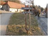 2
2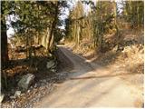 3
3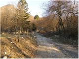 4
4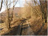 5
5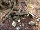 6
6 7
7 8
8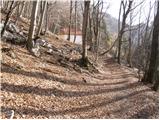 9
9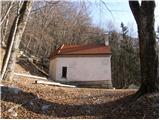 10
10 11
11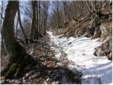 12
12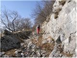 13
13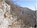 14
14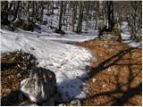 15
15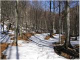 16
16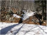 17
17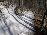 18
18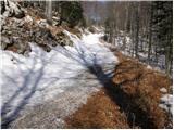 19
19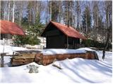 20
20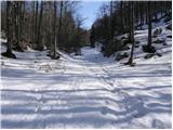 21
21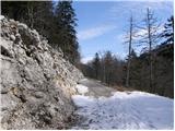 22
22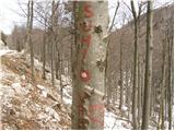 23
23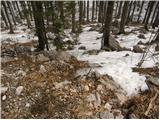 24
24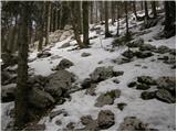 25
25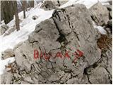 26
26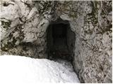 27
27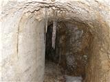 28
28 29
29 30
30
Discussion about the trip Strane - Suhi vrh (Nanos) (steep way)
|
| Lara0015. 12. 2011 |
Great bike tour!
|
|
|
|
| ulmusglabra21. 12. 2011 |
I often go first to Suhi vrh and then to Vojkova koča along the entire ridge... it's quite a demanding hike, takes approx. 4 hours of walking
Nanos rocks!
|
|
|
|
| bmiki30. 04. 2012 |
Hello. On Wednesday going to Nanos and now choosing the most suitable path. I'd like to go from Strane to Suhi vrh, from Suhi vrh to Vojkova koča. Then looked at the path from Vojkova koča to Veliki Ubeljski and from there to Strane to the car. Is the path from Ubeljski to Strane long? Would it be better to return from Vojkova koča back the same way?
|
|
|
|
| B230. 04. 2012 |
From Veliki Ubeljski to Strane there is about two kilometers of asphalt. The mountain trail from Vojkova koča to Veliki Ubeljski is quite steep... It would be better to ascend from Veliki Ubeljski to Vojkova koča and then "walk" along the edge to Strane and on asphalt to the car. That's my opinion...
|
|
|
|
| SunnyDay14. 01. 2014 |
Well-marked, quite muddy in the lower part (with bypass options), but very comfortable, just steep enough path. In contrast to the ascent from Razdrto, very little crowded even on a warm and sunny winter day. Really steep only the last part, from the basin under the road to the top. Down it's probably more comfortable to go along the gentle path. The detour really doesn't significantly lengthen the path, even uphill. View super, also the walk to the end of the tunnel is interesting.
|
|
|
|
| valerija11231. 05. 2014 |
Today we walked this path (back via the easier one). Nice walk in these days when there's still snow in the high mountains. You enjoy fresh air and peace. We'll come back to these parts, good luck.
|
|
|
|
| Mikens23. 06. 2019 |
Today did a nice little tour: Strane - Suhi vrh - Pleša - Razdrto (Via Hieronim), walking from the car to Stranje is the icing on the cake (I assume this is the tour "Ulmusglabra"). I recommend the path from Stranje for mountain running training. Nice hunting regards.
|
|
|
|
| bizgo936. 03. 2021 |
Great hike. For the first time so far, I also visited the highest peak of Nanos and I don't regret it. The trail is extremely picturesque - especially from the springs onwards (wild garlic is already growing at this time), when we ascend more steeply to the idyllic rocky path and have the famous Nanoško ostenje on the right and can follow the Postojnska kotlina on the left through it. The trail then levels out considerably and crosses a beautiful beech forest with numerous clearings and dolines. Somewhere after the hunting hut (before the junction to the steep trail) a chamois surprised me by jumping onto the road. Just below the summit, also visit the bivouac, which was probably once an old Italian bunker (cavern), but I recommend caution and a strong flashlight. From the bivouac to the summit there are only two more steps and from there a magnificent view opens up to the Alps, the Nanoški massif behind us, the entire Pivška kotlina with its hills to Snežnik!
The stamp and logbook are not yet at the summit, as they were supposedly carried away by the bora wind, but according to reports from friendly people from PD Postojna, they will be placed in 2-3 weeks.
For the descent, it's good to choose the gentle trail, which extends the route by less than 1 km, but is much more foot-friendly. Perhaps for the next few days for the last ascent or descent on the gentle trail it would be appropriate to wear crampons, as the trail is on the north side and there are still quite a few frozen snow patches there.
|
|
|
|
| Salsagirl2. 03. 2022 15:58:22 |
I'm wondering where one can park.
|
|
|
|
| turbo2. 03. 2022 16:01:34 |
|
|
|
|
| di8. 05. 2023 06:33:08 |
Visit: Debeli vrh, Boljunov vrh, Suhi vrh, Votla stena.
|
|
|
|
| Clemente28. 02. 2025 21:02:05 |
I recommend a circular tour from Strane over Vrh stene and Maj to Suhi vrh and back to Strane via one of the routes in the description. The path is not marked, but it is entered in one of the more popular navigation apps.
|
|
|
|
| di22. 12. 2025 09:25:20 |
Debeli vrh has been conquered again.
The summit is more prominent than Suhi vrh (as it has a "thicker" top).
It has considerably less visits than S. v. Orientation was effectively aided by the digital map.
|
|
|
|
| mikkeni6. 05. 2026 06:26:53 |
Nice circular path via Maj past the window and to Nanos then return back to nicely close the circular path.. nothing special…more here:
Link
|
|
|
To post a comment you must log in:
If you do not yet have a username, you must first
register.