Strane - Vojkova koča na Nanosu
Starting point: Strane (664 m)
| Latitude/Longitude: | 45,78610°N 14,08730°E |
| |
Walking time: 2 h 15 min
Difficulty: easy marked way
Elevation gain: 576 m
Elevation difference along the route: 650 m
Map: Nanos 1:50.000
Recommended equipment (summer):
Recommended equipment (winter): ice axe, crampons
Views: 27.854
 | 1 person like this post |
Access to starting point:
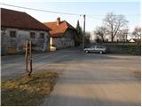
From the Ljubljana–Koper motorway we take the Razdrto exit and continue on the parallel old road towards Postojna. Soon we notice signs directing us left towards the villages Veliko Ubeljsko and Strane. In the village Malo Ubeljsko we reach a crossroads where we continue slightly right towards Strane (left Veliko Ubeljsko). We follow the road which rises somewhat more until the centre of Strane, where mountain direction signs are visible. We park near the children's playground taking care not to park directly on the playground.
Route description:
In Strane the signs for Nanos direct us onto the road by which we ascend past a few houses. The asphalt ends quickly and a little higher the road turns into a wide cart track on which we continue the ascent. Further on the cart track enters dense forest where at the area called Pri stajah a path from Veliko Ubeljsko joins from the left.
We continue straight and past a spring in moderate ascent reach the junction below the church of St. Bric. Here we turn right (left Suhi vrh and Vojkova koča na Nanosu) and in two minutes we walk to the mentioned church.
From St. Bric we return to the nearby junction, then continue the ascent towards Nanos. The path next ascends transversely on a somewhat narrower cart track crossing increasingly steep slopes. Still an easy path from which some views of nearby rock faces open, we are led higher to a junction where a marked path to Suhi vrh branches off to the right.
We continue straight towards Vojkova koča on a path that gradually levels. From it higher up a path to Suhi vrh branches off twice to the right and in both cases we continue straight. Higher the path steepens briefly and leads us out of the forest onto scenic slopes from which a view opens into the valley and onto the slopes of Nanos.
The path continues ascending for some time, then crosses to the other side of the ridge where it descends briefly. It continues through somewhat sparser forest with a few short ascents and descents. We follow this pleasant and technically undemanding path all the way to Vojkova koča na Nanosu.
Strane - sv. Bric 0:50, sv. Bric - Na vrhu skal 0:30, Na vrhu skal - Vojkova koča 0:55.

Photos:
 1
1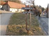 2
2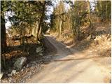 3
3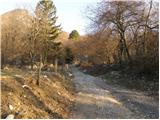 4
4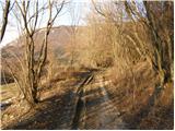 5
5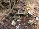 6
6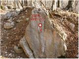 7
7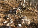 8
8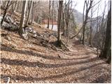 9
9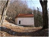 10
10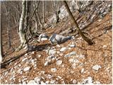 11
11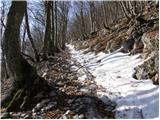 12
12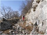 13
13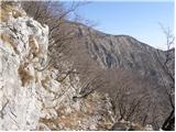 14
14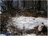 15
15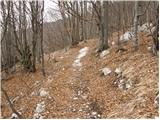 16
16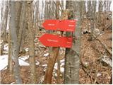 17
17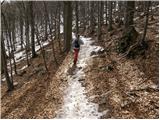 18
18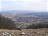 19
19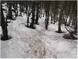 20
20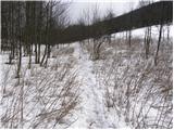 21
21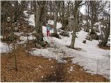 22
22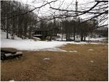 23
23 24
24
Discussion about the trip Strane - Vojkova koča na Nanosu
|
| lipnes10. 02. 2011 |
Went last summer with my wife. Nice tour. But on the way back during descent we strayed from the path because it's not well visible where the path is. Luckily some hikers passed by soon and we spotted them and found the trail. 
|
|
|
|
| darh16. 02. 2011 |
We climbed this path last Tuesday. Conditions were quite similar to those in these pictures; maybe there was a bit more snow. You can read more here.
|
|
|
To post a comment you must log in:
If you do not yet have a username, you must first
register.