Straža (Jesenice) - Jelenkamen (via Kozjek - east path)
Starting point: Straža (Jesenice) (560 m)
| Latitude/Longitude: | 46,42900°N 14,08250°E |
| |
Route name: via Kozjek - east path
Walking time: 1 h 15 min
Difficulty: easy unmarked way
Elevation gain: 536 m
Elevation difference along the route: 536 m
Map: Karavanke - osrednji del 1 : 50.000
Recommended equipment (summer):
Recommended equipment (winter): ice axe, crampons
Views: 7.312
 | 2 people like this post |
Access to starting point:
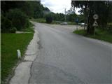
From the highway Ljubljana - Jesenice, we take the exit Lipce, where we turn right towards Jesenice. In the settlement Slovenski Javornik, at the intersection with traffic lights, we turn left towards the town centre. At the second traffic-light intersection (at the secondary school), we turn right, back towards Tomšičeva cesta past the primary school on the left. We drive a further 2.5 km to the end of Tomšičeva ulica, or to the spot where, by the railway tracks, there is the last bus stop below the hill. Here there is a large parking lot, our starting point.
Route description:
From the parking lot, we head up the asphalt road, where just below the top on the left we notice a path, onto which we step and turn left past the gardens on our left. We immediately come near residential buildings on the left, where we cross a short cart track (leading to the nearby water reservoir on the right). The path now ascends slightly towards the power line, which we quickly reach. Here we turn right uphill to the east on a gravel path.
We soon reach the second power line, where the path turns left into a short woodland (depending on the season we encounter a wire fence), after which we step onto the (hunting) east-west path. We turn left (westwards) across the pasture, at the end of which we notice a small bench, but here we continue right, steeper uphill. Soon the steepness eases, and the path turns left towards the exposed rocky "baba", where we can enjoy the view.
We continue into the deciduous forest (direction west), where the path, crossing the slope, first descends slightly, then brings us to a forest clearing. Here among ferns we reach its edge, where there is a small junction. We continue right along the edge, and after approx. 40 m we encounter another junction (left branch), where we go straight uphill. Initially a wider forest path, it soon turns right and narrows. It then ascends the forest slope in zigzags. After some time, at the top of the eastern ridge of Jelenkamen, the path levels out somewhat and continues straight uphill to the north. Soon (at the fallen tree) the path turns sharply left, where it first crosses a somewhat steeper slope, then brings us to a partly open spot, where a view opens up to the Julian Alps and the main viewpoint of Jelenkamen, which lies more than 100 vertical metres below its summit. Here the path turns right, steeply uphill (careful on descent when wet!), which does not last long. When the path levels out and directs us slightly to the left, we notice various markers on the trees. Soon, on the eastern slope in a northwest traverse, the path ascends for the last time towards the summit of Jelenkamen. After a few minutes, upon reaching the summit, we turn left (right to Pristava), and along the forest ridge we soon arrive at the goal, where a view opens towards the Ljubljana Basin, Jesenice, Karawanks, Ratitovec and Mežakla.

Photos:
 1
1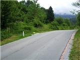 2
2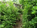 3
3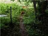 4
4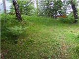 5
5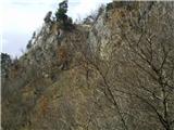 6
6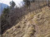 7
7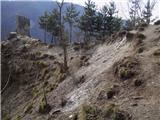 8
8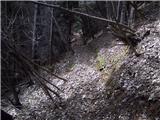 9
9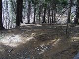 10
10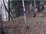 11
11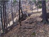 12
12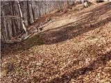 13
13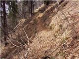 14
14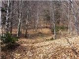 15
15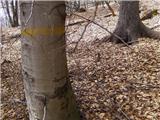 16
16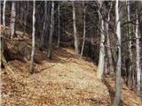 17
17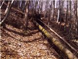 18
18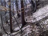 19
19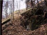 20
20 21
21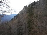 22
22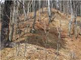 23
23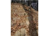 24
24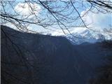 25
25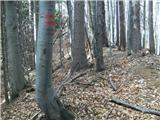 26
26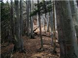 27
27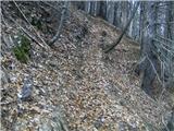 28
28 29
29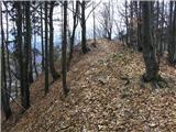 30
30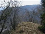 31
31
Discussion about the trip Straža (Jesenice) - Jelenkamen (via Kozjek - east path)
|
| Jusk30. 01. 2020 |
Today first time on this trail, purely by chance.. Started from Trebež, but at junction left to "pot po pomolih" went right on unmarked cart track. Path gently steep past one pasture then short valley, at end spot path from ridge, probably from Straža. Continued up, saw described path and went return via Planina Dole, path down to Kalvarija slightly icy there return via Planina Dole, path down to Kalvarija slightly icy there
|
|
|
To post a comment you must log in:
If you do not yet have a username, you must first
register.