Suhadolnik - Bivak pod Grintovcem
Starting point: Suhadolnik (901 m)
| Latitude/Longitude: | 46,33520°N 14,51020°E |
| |
Walking time: 3 h 45 min
Difficulty: difficult marked way
Elevation gain: 1199 m
Elevation difference along the route: 1350 m
Map: Kamniške in Savinjske Alpe 1:50.000
Recommended equipment (summer): helmet
Recommended equipment (winter): helmet, ice axe, crampons
Views: 16.625
 | 2 people like this post |
Access to starting point:
From the highway Ljubljana - Jesenice we go to the exit Kranj - East and follow the road ahead in the direction of Jezersko, but only to the village Kokra. In the mentioned village, we will notice only a few meters before the road crosses a bridge over the river Kokro a road which runs towards Suhadolnik. The turn-off of the road is located when we are on the right side of the river (left bank); the road sign is approximately 7 km. We follow this road to a parking lot, which is located approximately 300 meters before the farm Suhadolnik.
Route description:
At the beginning of the parking lot, we notice hiking signposts, which point us on a road, on which in less than 5 minutes of walking we arrive at a smaller crossroad at the farm Suhadolnik. Here we continue on the right road, which we follow for approximately 5 minutes, or to the spot where the blazes lead us onto an ascending cart track. Further, for a short time we ascend the cart track, then the blazes direct us right onto a footpath which moderately ascends through the forest. Higher, we return to the cart track, which only a few meters ahead brings us to a forest road, which we then follow to its end (to here we need approximately half an hour).
At the end of the road the marked path splits into two parts. We continue on the left path (right somewhat easier "Old path"), which further ascends on a gentle cart track. Somewhat further the blazes direct us slightly right onto torrent deposits of sand, and the path on the other side continues through the forest, where it starts to ascend steeper and steeper. Higher we come to a smaller cavity, and the path behind it becomes technically demanding. With the help of a steel cable we ascend one level higher, and the path then continues on a steep slope, where occasionally some peg helps us. Higher the path turns to the right, traverses up over steep and especially in wet slippery-dangerous slopes and then brings us to an excellently secured passage. With the help of wooden steps or a ladder and help of a steel cable, we ascend the steep slope, which without the mentioned safety gear would be very dangerous. Higher some more pegs help us, the path then flattens and crosses a short exposed slope, where an emergency fence helps us. Only a little further we come to the next ladder, next to which there is no steel cable, but the passage is not particularly demanding. A short descent into a smaller gully follows and then we cross it too. On the other side of the gully we steeply ascend (some brackets help us), then the path gradually flattens and brings us in a few 10 steps of further walking to the place where the somewhat easier "Old path" joins.
A short traversing ascent follows and the path brings us to a larger plain, where the "old hut" once stood. Through high grass we walk to the other side of the plain, where we arrive at a marked junction.
We continue straight ahead (left Kočna over Grdi graben) on a moderately steep path, which further ascends through a belt of shrubs. Higher the path temporarily completely flattens, then brings us among dwarf pines, where it starts to ascend more steeply. We follow this somewhat steeper path, from which increasingly beautiful views open up, all the way to Cojzova hut on Kokrsko sedlo.
From the saddle we continue left in the direction of Grintovec, Kočna and Skuta. The path immediately above the saddle steeply ascends and somewhat higher brings us to a junction, where to the right branches the path to the bivouac under Grintovec and Skuta (straight Grintovec over Streha and Kočna). We turn right onto this initially somewhat less visible path, which in a moderate ascent brings us to a picturesque passage over Mala vratca. Behind the narrow passage of Mala vratca, the path starts to descend on a steep and occasionally somewhat exposed slope. At the end of the descent, which takes us approximately 100 elevation meters, some pegs help us. Crossing of the gully follows and then ascent through high-alpine terrain to the bivouac under Grintovec.
Suhadolnik - Kokrsko sedlo 2:30, Kokrsko sedlo - Bivak pod Grintovcem 1:15.

Photos:
 1
1 2
2 3
3 4
4 5
5 6
6 7
7 8
8 9
9 10
10 11
11 12
12 13
13 14
14 15
15 16
16 17
17 18
18 19
19 20
20 21
21 22
22 23
23 24
24 25
25 26
26 27
27 28
28 29
29 30
30 31
31 32
32 33
33 34
34 35
35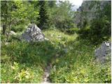 36
36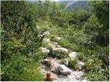 37
37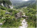 38
38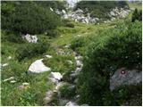 39
39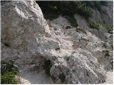 40
40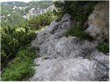 41
41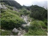 42
42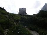 43
43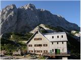 44
44 45
45 46
46 47
47 48
48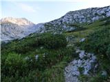 49
49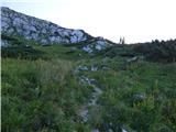 50
50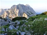 51
51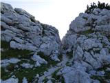 52
52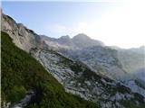 53
53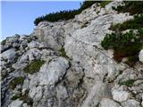 54
54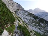 55
55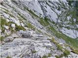 56
56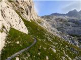 57
57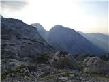 58
58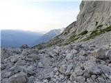 59
59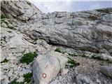 60
60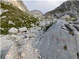 61
61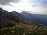 62
62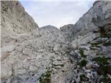 63
63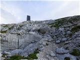 64
64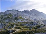 65
65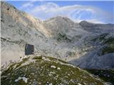 66
66
Discussion about the trip Suhadolnik - Bivak pod Grintovcem
|
| Gost16. 06. 2007 |
 Excellent trip Excellent trip
|
|
|
|
| Gost16. 06. 2007 |
Yes, I liked it too and further to Grintovec it's beautiful all the way. But how is it if you go at the old Frischauf bivouac left towards Kočni (through Grdi graben or something like that)
|
|
|
|
| Gost11. 07. 2007 |
even prettier
 
|
|
|
|
| Gost11. 07. 2007 |
but more dangerous
|
|
|
|
| Gost25. 07. 2007 |
I agree, more demanding and exposed! Great risk of slipping!
|
|
|
|
| velkavrh18. 06. 2011 |
Today my final goal was the bivouac, because there was too much fog and snow for a safe hike to Skuta. Unfortunately, the bivouac was also almost hidden in fog, so I couldn't even take a good photo. There were four Czechs in it, so I couldn't even look at the nice and usable interior at first glance. Next time maybe.
|
|
|
|
| svetilka22. 07. 2013 |
Very nice tour. In summer really idyllic, a slightly more difficult section is at the crossing, as shown in picture 53 or a bit after. There are about 100-200m quite dangerous, a hiker would appreciate some additional wire rope.
|
|
|
|
| Nosko14. 09. 2014 |
Are there already any fixed ropes added on this section?
|
|
|
|
| rodica14. 09. 2014 |
On this section there are 2 or 3 wire ropes, each a few meters long. I think it's been the same for a couple of years.
|
|
|
|
| Branee14. 09. 2014 |
why would the Jurjevo slope need a wire rope?
|
|
|
|
| jax14. 09. 2014 |
No, that is actually a fairly exposed passage over terrain with fairly poor quality substrate, so the question about any safety gear is not entirely out of place. Ultimately, it's a question of criteria for installing safety devices. I dare say that in many places in the Julian Alps such a passage would be secured, but most hikers have probably noticed that the Kamnik Alps are overall somewhat less secured. Now, which approach is "better" or "more appropriate" is of course entirely dependent on individual preferences.
|
|
|
|
| Branee14. 09. 2014 |
soon they'll need gondolas..
|
|
|
|
| Nosko17. 09. 2014 |
Wow great, will have to go check it out In 2012, when I first went to the bivouac, they weren't there yet.
|
|
|
To post a comment you must log in:
If you do not yet have a username, you must first
register.