Suhadolnik - Jezerska Kočna (via Kokrsko sedlo and Kokrska Kočna)
Starting point: Suhadolnik (901 m)
| Latitude/Longitude: | 46,33520°N 14,51020°E |
| |
Route name: via Kokrsko sedlo and Kokrska Kočna
Walking time: 6 h 15 min
Difficulty: very difficult marked way
Elevation gain: 1639 m
Elevation difference along the route: 1800 m
Map: Kamniške in Savinjske Alpe 1:50.000
Recommended equipment (summer): helmet, self belay set
Recommended equipment (winter): helmet, self belay set, ice axe, crampons
Views: 10.191
 | 1 person like this post |
Access to starting point:
From the Ljubljana - Jesenice highway take the Kranj - east exit and follow the road ahead in the direction of Jezersko, but only to the village of Kokra. In the mentioned village, a few meters before the road crosses the bridge over the river Kokra, we will notice a road that leads towards Suhadolnik. The road turn-off is located when we are on the right side of the river (left bank), the road sign is approximately 7 km. We then follow this road to the parking lot, which is located approximately 300 m before the Suhadolnik farm.
Route description:
At the beginning of the parking lot we notice hiking signposts, which direct us to the road, along which in less than 5 minutes of walking we arrive at a smaller intersection at the Suhadolnik farm. Here we continue on the right road, which we follow for approximately another 5 minutes, or until the place where the blazes lead us onto an ascending cart track. Further we ascend the cart track for a short time, then the blazes direct us right onto a footpath that moderately ascends through the forest. Higher we return to the cart track, which a few meters further brings us to a forest road, which we then follow to its end (to here we need approximately half an hour).
At the end of the road the marked path splits into two parts. We continue on the left path (right somewhat easier "Old path"), which further ascends along a gentle cart track. A little further the blazes direct us slightly right onto torrent deposits of sand, and the path on the other side continues through the forest, where it starts to ascend steeper and steeper. Higher we come to a smaller cavity, and the path behind it becomes technically demanding. With the help of steel cables we ascend one level higher, and the path then continues on a steep slope, where some pitons occasionally assist us. Higher the path turns right, ascends transversely across steep and especially in wet slippery-dangerous slopes, and then brings us to an excellently secured passage. With the help of wooden steps or ladder and assistance of steel cable, we ascend the steep slope, which would be very dangerous without the mentioned safety gear. Higher some pitons assist us, the path then levels out and crosses a short exposed slope, where an emergency fence assists us. Only a little further we come to the next ladder, next to which there is no steel cable, but the passage is not particularly demanding. Follows a short descent into a smaller gully and we then cross it too. On the other side of the gully we steeply ascend (some staples assist us), then the path slowly levels and brings us in a few dozen steps of further walking to the place where the somewhat easier "Old path" joins.
Follows a short transverse ascent and the path brings us to a larger plain, where the "old hut" once stood. Through high grass we walk to the other side of the plain, where we arrive at a marked junction.
We continue straight (left Kočna over Grdi graben) along a moderately steep path, which further ascends through a belt of bushes. Higher the path temporarily completely levels out, then brings us among dwarf pines, where it starts to ascend more steeply. This somewhat steeper path, from which increasingly beautiful views open up, we follow all the way to the Cojzova hut on Kokrsko sedlo.
From the saddle we continue left in the direction of Grintovec, Kočna and Skuta. The path immediately above the saddle steeply ascends and a little higher brings us to a junction, where right branches the path to the bivouac under Grintovec and Skuta. We continue straight on the "main" path, which levels out and turns slightly left, where it crosses the slopes of the indistinct valley named Jame. The path then ascends in a traverse to the summit slope of Grintovec - Streha (this part is very dangerous for slipping in winter), where we come to the next junction. We continue left towards Kočna, right leads the path to the summit of Grintovec. The path then crosses steep grassy slopes to the west and then starts descending. Later the path turns right and continues slightly descending, crossing slightly exposed slopes all the way to gentle grassy slopes (Srednji Dolci). Here we join the path that leads over Grdi graben, a few meters later we are again at the junction.
We head left towards the bivouac and Kokrska Kočna, right leads the path towards Dolška škrbina and then further towards Jezerska Kočna or Grintovec. The path then crosses scree to the left and ascends over a short gully.
A little above the gully an unmarked path to the Bivouac under Kočna branches left, which we can already see and which is only a few minutes' walk from the marked path. We continue on the marked path right upward and soon start ascending over scree. In the upper part of the scree the path turns left and brings us to a somewhat more demanding rocky section of the path. Here we turn slightly right again and ascend the slope with easier climbing. The path in this section is not secured, but there are enough holds in the rock, so the ascent does not cause major difficulties. In the final part towards the summit the path becomes a little steeper and some steel cables assist us.
From Kokrska Kočna we continue on the marked path in the direction of Jezerska Kočna. The well-secured path first descends into the gully between both Kočnas, then starts ascending towards the summit of Jezerska Kočna. Just a little before the summit we come to a marked junction, where we continue left (right Jezersko and (Z)Dolška škrbina). Only a few steps of walking remain and the very panoramic path brings us to the somewhat spacious summit of Jezerska Kočna.

Photos:
 1
1 2
2 3
3 4
4 5
5 6
6 7
7 8
8 9
9 10
10 11
11 12
12 13
13 14
14 15
15 16
16 17
17 18
18 19
19 20
20 21
21 22
22 23
23 24
24 25
25 26
26 27
27 28
28 29
29 30
30 31
31 32
32 33
33 34
34 35
35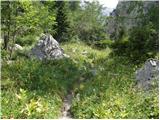 36
36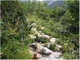 37
37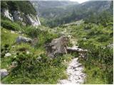 38
38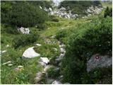 39
39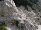 40
40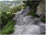 41
41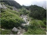 42
42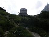 43
43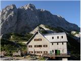 44
44 45
45 46
46 47
47 48
48 49
49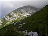 50
50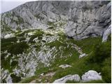 51
51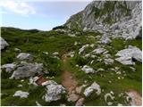 52
52 53
53 54
54 55
55 56
56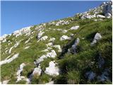 57
57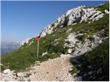 58
58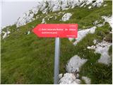 59
59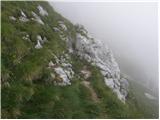 60
60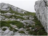 61
61 62
62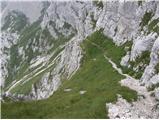 63
63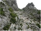 64
64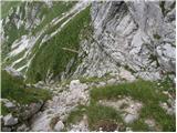 65
65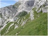 66
66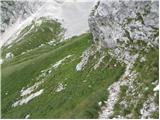 67
67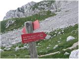 68
68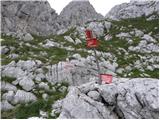 69
69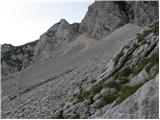 70
70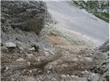 71
71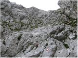 72
72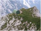 73
73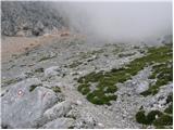 74
74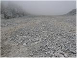 75
75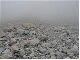 76
76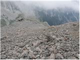 77
77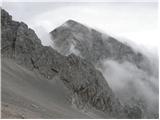 78
78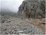 79
79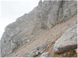 80
80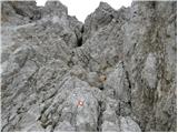 81
81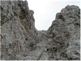 82
82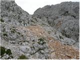 83
83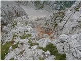 84
84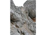 85
85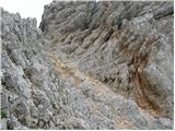 86
86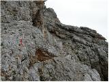 87
87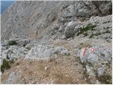 88
88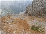 89
89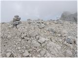 90
90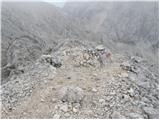 91
91 92
92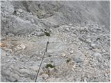 93
93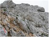 94
94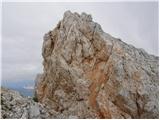 95
95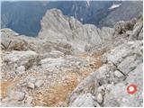 96
96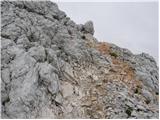 97
97 98
98 99
99
Discussion about the trip Suhadolnik - Jezerska Kočna (via Kokrsko sedlo and Kokrska Kočna)
|
| MPS23. 08. 2019 |
Video report from the hike Suhadolnik - Kokrsko sedlo - Dolci - Kokrska Kočna - Jezerska Kočna - Grintovec. The path is interesting and demanding. The road to the parking lot, located a few 100 m before the Suhadolnik farm, is normally drivable.
Little film:Kokrska Kočna, Jezerska Kočna and Grintovec, 11.8.2019
Good luck and safe steps.
|
|
|
To post a comment you must log in:
If you do not yet have a username, you must first
register.