Sveti Jurij ob Ščavnici - Lake Blaguš
Starting point: Sveti Jurij ob Ščavnici (223 m)
| Latitude/Longitude: | 46,56850°N 16,02350°E |
| |
Walking time: 20 min
Difficulty: easy marked way
Elevation gain: -3 m
Elevation difference along the route: 20 m
Map:
Recommended equipment (summer):
Recommended equipment (winter):
Views: 1.640
 | 2 people like this post |
Access to starting point:
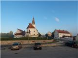
A) From the highway Maribor - Lendava, we take the exit Sveti Jurij ob Ščavnici, then follow the signs to the mentioned settlement, where we park in the center of the settlement on a well-maintained asphalt parking lot below the parish church of St. Jurij, by the bus stop and the Jasmina confectionery. There are two parking lots, one by the main road, the other somewhat larger approximately 60 meters away.
B) We drive to Ptuj, then follow the signs towards Radenci, along the main road to the settlement Sveti Jurij ob Ščavnici, where we park in the center of the settlement on a well-maintained asphalt parking lot below the parish church of St. Jurij, by the bus stop and the Jasmina confectionery. There are two parking lots, one by the main road, the other somewhat larger approximately 60 meters away.
Route description:
From the parking lot, we walk to the main road, carefully cross it at the pedestrian crossing, then continue along the sidewalk by the road that leads towards Lenart v Slovenskih goricah. Initially, we bypass the parish church of St. Jurij on the right side, then the sidewalk continues only on the right side of the road, where we also go past the primary school Sveti Jurij ob Ščavnici. The path further leads us through the settlement Blaguš, where at the hunting lodge LD Videm ob Ščavnici the sidewalk ends. Here we carefully go back to the left side of the road and continue walking through the forest. When we arrive at the marked intersection, where a road branches off to the left towards the settlements Sovjak, Ženik, Kokolajnščak, Stara Gora, Kutinci and Galušak, we continue to the right, again across the road into the forest, where along the marked path we quickly descend to Blaguško jezero.
The description and pictures refer to the situation in June 2020.

Along the route: Blaguš (234m)
Photos:
 1
1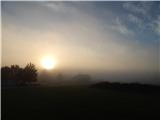 2
2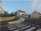 3
3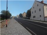 4
4 5
5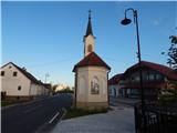 6
6 7
7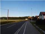 8
8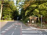 9
9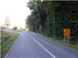 10
10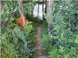 11
11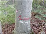 12
12 13
13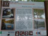 14
14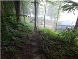 15
15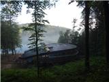 16
16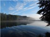 17
17
Discussion about the trip Sveti Jurij ob Ščavnici - Lake Blaguš
To post a comment you must log in:
If you do not yet have a username, you must first
register.