Svino - Monte Mataiur/Matajur
Starting point: Svino (250 m)
| Latitude/Longitude: | 46,24240°N 13,56900°E |
| |
Walking time: 3 h 45 min
Difficulty: easy marked way
Elevation gain: 1392 m
Elevation difference along the route: 1392 m
Map: Julijske Alpe - zahodni del 1:50.000
Recommended equipment (summer):
Recommended equipment (winter): ice axe, crampons
Views: 29.428
 | 3 people like this post |
Access to starting point:
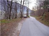
a) Access from Tolmin: From Tolmin we drive towards Kobarid. On the new bypass that goes around Kobarid on the right side, we continue straight towards the city center. Just before the center of Kobarid, a road branches off to the left towards the village of Svino (the junction is marked with a directional sign). We follow this road to the point where it starts to ascend, and park in a suitable parking spot by the road. We do not continue driving to the village of Svino itself, as there are no suitable parking places there.
b) Access from Bovec: From Bovec we drive towards Kobarid. When we reach the bypass, we leave it and turn right towards the center of Kobarid. We drive through the city center, where a road first branches off to the right towards the former border crossing Robič. At this intersection we continue straight (slightly left) in the direction of Tolmin, but only a few dozen meters, as we then immediately see a marked turnoff to the right for the village of Svino. We turn onto this road and follow it to the point where it starts to ascend, then park in a suitable parking spot by the road.
Route description:
From the parking lot we continue along the road where we parked, and after a good five minutes of walking we arrive in the village of Svino. In the village we notice markings that direct us left towards Matajur (right Sužid). We continue the path left between the houses, where the markings are initially less visible. The correct trail leads somewhat more to the left, soon takes us past the last houses and crosses pastures, after which we enter the forest. In the forest the markings become more frequent, so further orientation is significantly easier.
The path then begins to ascend more steeply and after about half an hour of walking brings us to a wider cart track that comes from the village of Sužid. We continue the ascent along the cart track, which has quite a few junctions, but the path is well marked. Just before a dilapidated old military hut the markings for Matajur direct us left upwards. Here the cart track turns into a steep military mule track that ascends over a rather steep slope, but higher up the terrain levels out somewhat. The path then brings us to a newer forest road, which we merely cross. On the other side of the road we climb a few steps upwards, where we already see the shepherd's huts on Svinska planina ahead of us.
On the mountain pasture we notice markings for the direction left (Idrska planina) and right (planina Sužid). There is no marking for Matajur at this point, but the path ahead is well marked. We find the trail among the huts on the pasture, from where it ascends moderately along a small indistinct valley. Despite the markings, the trail is in places less visible and somewhat overgrown in spots. After about 15 minutes of walking from the pasture we reach a water reservoir, near which we notice mountain direction signs. Here we continue straight in the direction of Matajur along a still less visible but marked trail. The path leads us across an overgrown meadow, above which we join a well-trodden and worn path that comes from the villages of Avsa or Livka.
We turn right onto this path, which ascends moderately and soon brings us to the next direction signs, where we turn left upwards in the direction of Matajur. After just a few steps we step onto the border ridge between Slovenia and Italy. Here the path turns right and continues ascending along a wide, gentle ridge. We follow this path, which offers increasingly beautiful and wider views, all the way to the summit of Matajur, which we already see ahead of us.
Svino - Svinska planina 2:40, Svinska planina - Matajur 1:05.

Photos:
 1
1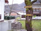 2
2 3
3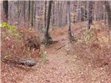 4
4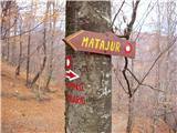 5
5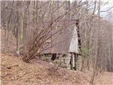 6
6 7
7 8
8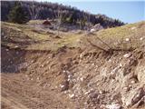 9
9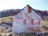 10
10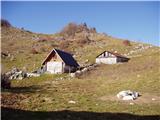 11
11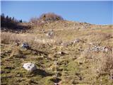 12
12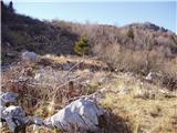 13
13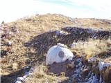 14
14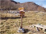 15
15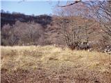 16
16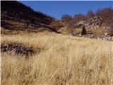 17
17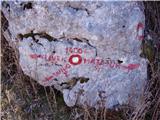 18
18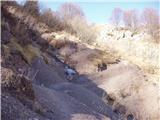 19
19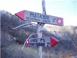 20
20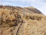 21
21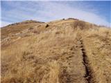 22
22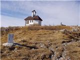 23
23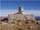 24
24
Discussion about the trip Svino - Monte Mataiur/Matajur
|
| pier14. 01. 2010 |
I plan to do the hike on this path on Sunday, so I ask for info on snow conditions and, if any, orientation difficulties.
Many thanks
|
|
|
|
| mojcej'723. 08. 2010 |
Yesterday 2.8.2010 I chose this version of the ascent to Matajur, as one of the points of the SLOVENE alpine transversal. But on the summit I was horrified to find only an ITALIAN logbook, and even that in a wooden box inside the church filled with entries to the end and even on the covers. No stamp inside, outside at the scenic stone point, nothing, even the tin box was empty. Is PD Gorica on vacation?, or don't we know anymore whose Matajur it is - Slovenian or Italian. And where is the Slovenian logbook? On the other side in Dom pod Matajurjem (Pelizzo pass) they do have a stamp in the hut - triangular - but I don't know if it counts for our transversal. Moreover it says MONTE NERO, which translates to Črni vrh. But that's the next peak to the west, if you're doing Italian chain hikes. However on maps Črni vrh is listed under the Italian version MONTE FUSCO. It would be nice if peaks, stamps and maps in border areas were aligned. Well, the day was nice anyway.
|
|
|
|
| mojcej'723. 08. 2010 |
Yesterday 2.8.2010 I chose the ascent to Matajur from the village Svino. On the summit of Matajur as a point of the SLOVENE transversal but horrified to find only ITALIAN logbook (in wooden box inside the church) and even that filled with entries to the end and even on the covers. No stamp inside, outside at the scenic stone point, nothing, even the tin box was empty. Is PD Gorica on vacation?, or don't we know anymore whose Matajur it is - Slovenian or Italian. And where is the Slovenian logbook? On the other side in Dom pod Matajurjem (Pelizzo pass) they do have a stamp - the only one - but it's triangular and it says MONTE NERO (Črni vrh), Rifuggio Pelizzo. Now I don't know who is more confused, us or them. Črni vrh is namely the peak further west marked on Slovenian maps as Črni vrh with translation Monte Nero, on Italian maps as Monte Fusco and below with Slovenian translation Črni vrh. It would be nice to align peaks with stamps (PZS) and maps in border areas also with the Surveying and Mapping Authority. Well, even without that the day was nice.
|
|
|
|
| mojcej'723. 08. 2010 |
Well then they stole it, what do I know, now it wasn't there.
|
|
|
|
| klm7. 02. 2013 |
The stamp was already taken away by a raven on 3. 7. 2012. Otherwise, just a note to the above description: along the path we do not pass "collapsing old military huts" especially not military ones, but a collapsing hay barn, such as are scattered all around Matajur and it is a typical architectural type of building that served for storing hay on hayfields. These were most in use between the 1950s and late 1970s of the previous century, after which they began to gradually overgrow.
|
|
|
|
| Skovik8. 10. 2014 |
Is there or isn't there a stamp at the top now?
|
|
|
|
| slavkoo8. 10. 2014 |
There IS a stamp at the top. That "railway one", you need to bring your own ink pad. Near the scenic stone viewpoint, you have to look carefully, it's on some pipe...
|
|
|
|
| Skovik9. 10. 2014 |
Super, thanks for the reply 
|
|
|
|
| Sarak1. 08. 2025 13:14:06 |
And who suggests a circular tour, for example, if after the first day overnight at rifugio peluzzo. Is it too far from Svino to (over Matajur summit) rifugio peluzza? I have the condition, but so far I've been on tours where it's all 5 hours of walking (up and down...)
|
|
|
|
| mirank1. 08. 2025 13:26:36 |
From the summit to Koča Pelizzo it's at most half an hour walk, but whether the hut is open and has overnight capacity, I have no idea.
|
|
|
To post a comment you must log in:
If you do not yet have a username, you must first
register.