Sviščaki - Snežnik (via Mali Snežnik)
Starting point: Sviščaki (1242 m)
| Latitude/Longitude: | 45,57420°N 14,40100°E |
| |
Route name: via Mali Snežnik
Walking time: 2 h 15 min
Difficulty: easy marked way
Elevation gain: 554 m
Elevation difference along the route: 580 m
Map: Snežnik 1:50.000
Recommended equipment (summer):
Recommended equipment (winter): ice axe, crampons
Views: 29.820
 | 1 person like this post |
Access to starting point:
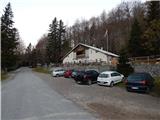
A) From Cerknica or Nova vas na Blokah, we first drive to Bloška Polica, from there we continue driving in the direction of Lož and Babno Polje. In the settlement Pudob we turn right in the direction of Snežnik, Ilirska Bistrica, Knežak and nearby settlement Kozarišče. In Kozarišče we continue slightly left in the direction of Snežnik and also in the next crossroads we follow the road in the direction of Snežnik. When Kozarišče ends, the asphalt also ends, and we immediately after the bridge over Mali Obrh continue left in the direction of Mašun and Knežak. There follows a long drive on a macadam road, after which after approximately 19 km from Kozarišče we arrive at a crossroad, where the road from Mašun joins from the right. Here we continue left in the direction of Sviščaki, to which we have approximately 10 km of macadam, at the crossroads we follow the signs for Sviščaki. After approximately 29 km of macadam road we arrive at the mountain hut Planinski dom na Sviščakih, where we park.
B) We drive to Pivka, from there we continue driving towards Knežak. In Knežak at the marked crossroad we continue left in the direction of Mašun and settlements Bač and Koritnice. A little further we go right in the direction of Mašun and Koritnice (straight Bač). After Koritnice the road starts to ascend more noticeably, then after 18 km from the main crossroad in Knežak it brings us to Mašun, from where we continue driving right in the direction of Sviščaki, to which we have approximately 12 km of macadam road. When we arrive at the mountain hut Planinski dom na Sviščakih we park.
C) First we drive to Ilirska Bistrica, then we continue driving towards Sviščaki (the turn-off is in the middle of Ilirska Bistrica and is marked, perhaps a little less noticeable). At first we ascend on an asphalt road, then after a little less than 12 km of ascent the asphalt changes to macadam. There follows approximately 7 km of macadam, then we arrive at a crossroad in the immediate vicinity of the mountain hut Planinski dom na Sviščakih, where we continue straight towards the nearby mountain hut, where we park.
Route description:
On the opposite side of the road from the mountain hut Planinski dom na Sviščakih, we notice signposts for Snežnik and Pogled na Snežnik, which direct us onto a macadam road that continues without change in elevation across a meadow. On the other side of the meadow the path leads past a water catchment, behind it the path turns slightly left into the forest, through which it moderately ascends for a while. After a short ascent we reach another road, which we follow to the right; along it past some holiday cottages we arrive at a wider macadam road, which we follow left (right is the main road Ilirska Bistrica - Sviščaki). There follows an easy ascent along the wider macadam road, along which we continue, and in approximately 10 minutes we arrive at a marked junction, where to the left branches the path to the viewpoint "Pogled na Snežnik", to the right continues the marked footpath that leads to Snežnik.
We continue along the road, which continues to lead through the forest, along it past an abyss we quickly arrive at a marked crossroad below Lom, which is located at 1330 meters above sea level.
Here too we continue straight (along the right road we can join the aforementioned footpath or continue to the hunting cottage in Travnih dolcih, from there too it is possible to ascend to Snežnik, but the path is not marked) in the direction of Snežnik along the road. Higher a little view opens up temporarily, then we arrive at the next crossroad (in descriptions starting point Snežniška Grda jama), where we continue along the left lower road (along the right road leads the usual path to Snežnik).
Along the lower road along which we continue the path, first we walk past a parking lot, then we continue along the road that is closed to public traffic (beside the sign there is a chain across the road). For a short time we continue parallel to the upper road, then our road turns more to the left and leads us past Snežniška grda jama. There follows a few minutes of traversing, then we join the marked path from Grda draga, where we continue right.
We continue in the direction of Snežnik along the path that continues through dense forest. Higher we cross a smaller clearing, then we return to the forest, and the path starts to ascend transversely to the left. After a few minutes of transverse ascent we reach a marked junction, where the path from Mašun joins us.
Again we continue in the direction of Snežnik, this time along a somewhat steeper path that leads us past a memorial. Above the memorial the first extensive view opens up, reaching across Nanos all the way to the Alps. Continuing we ascend along the path that leads us through dwarf pines. When the steepness eases we arrive at the old stone trigonometric point, which is located on the summit, or a few steps below the summit of Mali Snežnik, from where a view opens up on Veliki Snežnik, Istria, Primorska, Notranjska...
From Mali Snežnik we continue along the path that barely noticeably descends along the indistinct eastern ridge of Mali Snežnik. Continuing, the path passes to the western and very panoramic ridge of Veliki Snežnik, along which it continues mostly in gentle to occasionally moderate ascent. Somewhat further the Matetova pot joins us from the right, a little further also the usual path from Sviščaki.
At both junctions we continue straight, then we ascend transversely along the steeper slope of Veliki Snežnik, which is dangerous for slipping in snow. After a few minutes we reach Zavetišče na Velikem Snežniku, in front of which we continue left and in a few steps ascend to the 1796 m high summit.
Description and pictures refer to the condition in 2015 (October).

Photos:
 1
1 2
2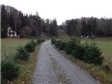 3
3 4
4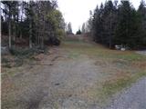 5
5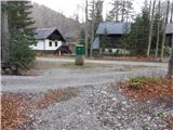 6
6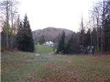 7
7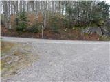 8
8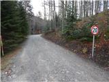 9
9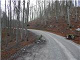 10
10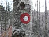 11
11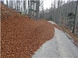 12
12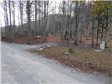 13
13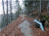 14
14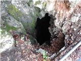 15
15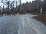 16
16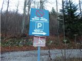 17
17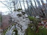 18
18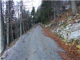 19
19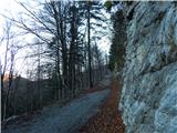 20
20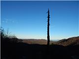 21
21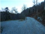 22
22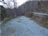 23
23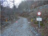 24
24 25
25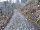 26
26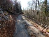 27
27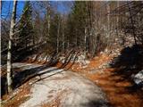 28
28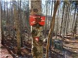 29
29 30
30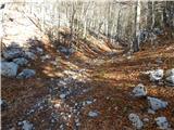 31
31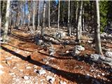 32
32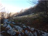 33
33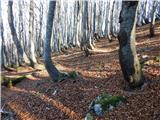 34
34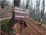 35
35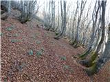 36
36 37
37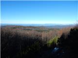 38
38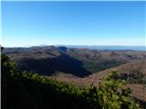 39
39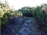 40
40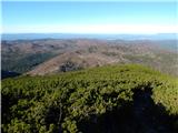 41
41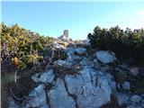 42
42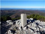 43
43 44
44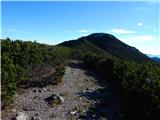 45
45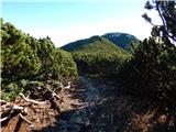 46
46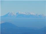 47
47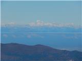 48
48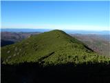 49
49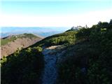 50
50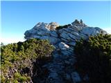 51
51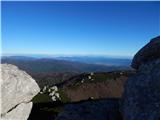 52
52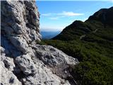 53
53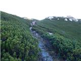 54
54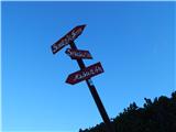 55
55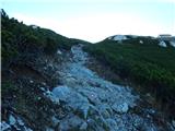 56
56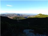 57
57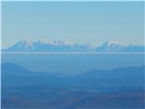 58
58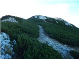 59
59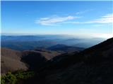 60
60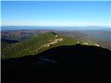 61
61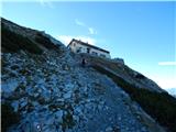 62
62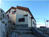 63
63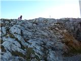 64
64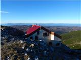 65
65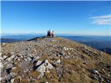 66
66 67
67
Discussion about the trip Sviščaki - Snežnik (via Mali Snežnik)
|
| Pohodnica1314. 10. 2023 11:53:20 |
Caution, today a fairly large bear was spotted a little below Sviščaki along the macadam road.
|
|
|
To post a comment you must log in:
If you do not yet have a username, you must first
register.