Tacen - Šmarna gora (via Spodnja Kuhinja)
Starting point: Tacen (303 m)
| Latitude/Longitude: | 46,11830°N 14,46150°E |
| |
Route name: via Spodnja Kuhinja
Walking time: 55 min
Difficulty: easy marked way
Elevation gain: 366 m
Elevation difference along the route: 366 m
Map: Ljubljana - okolica 1:50.000
Recommended equipment (summer):
Recommended equipment (winter): crampons
Views: 116.417
 | 1 person like this post |
Access to starting point:
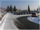
From Celovška cesta in Ljubljana, only a little after the on-ramp to the Gorenjska motorway, the road towards Vižmarje and Tacen branches off to the right (if we come from the Medvode side, only a little before the on-ramp to the motorway, we continue left). We continue driving towards Tacen, immediately after crossing the bridge over the Sava River, we park on a large parking lot.
From the Gorenjska motorway we go to the exit Šmartno, and then we follow the road in the direction of Šmartno pod Šmarno goro and later Tacen, where we then also park on a large parking lot.
Route description:
At the beginning of the parking lot, we notice signposts for Šmarna gora, which at first lead us along the sidewalk, then direct us to the right onto Thumova ulica. After a few minutes of easy walking we come to the intersection of Thumova ulica and Ulica Janeza Rožiča, and we continue straight on a narrower mountain path. After a short gentle ascent we step onto the road, we only cross it and continue the ascent on a steeper and steeper mountain path. The path, which continues through the forest, flattens higher up and brings us to the plain Spodnja Kuhinja.
We continue straight (left Mazijeva steza, right Romarska pot) on the so-called path "čez korenine" ("over roots"). The path ahead again starts to ascend steeply and flattens slightly only when we join the path from Šmartno. We continue in the direction of Šmarna gora on a wider path, which soon makes a sharp right turn and brings us to the chapel just a few steps ahead. Above the chapel we notice signs for Grmada, and we continue straight and already step out of the forest onto the saddle Sedlo between Grmada on the left and Šmarna gora on the right. Here we step onto the road (access from Zavrh), along which we continue the ascent, which soon splits into two parts. We can continue the ascent on the road, in this case we ascend to the summit past the wish bell, or we continue right on the marked footpath, which past the chapel of sv. Sobote also brings us to the summit of Šmarna gora.

Along the route: Spodnja Kuhinja (450m), Na Sedlu (580m)
Photos:
 1
1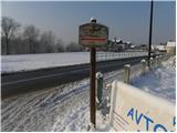 2
2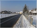 3
3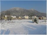 4
4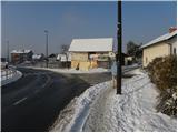 5
5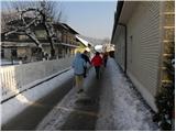 6
6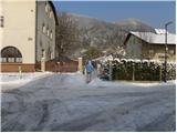 7
7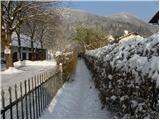 8
8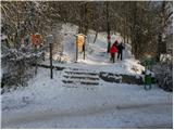 9
9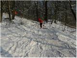 10
10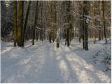 11
11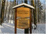 12
12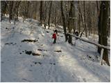 13
13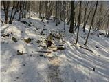 14
14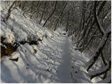 15
15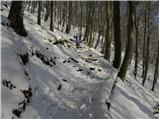 16
16 17
17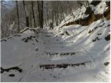 18
18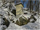 19
19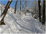 20
20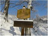 21
21 22
22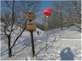 23
23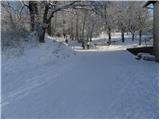 24
24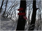 25
25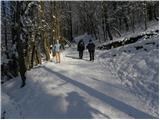 26
26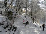 27
27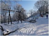 28
28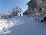 29
29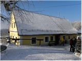 30
30 31
31
Discussion about the trip Tacen - Šmarna gora (via Spodnja Kuhinja)
|
| miho1130. 03. 2012 |
I'm interested in what "easy" trail means. To me, the "easy marked trail" via Spodnja Kuhinja to Šmarna Gora seems extremely demanding, as it's full of rocks, roots and very steep. Maybe it's easy for top alpinists, but not for me. Unfortunately. Difficulty should be viewed from the perspective of average people. 
|
|
|
|
| Kriška30. 03. 2012 |
You can read about the classification of hiking trails in some mountaineering guide, probably something can be found on the web too. It is described very precisely what each marking represents (easy, demanding, very demanding) and these descriptions do not depend on an individual "average person". Difficulty is not the same as demandingness. For many, a technically easy trail can be difficult due to e.g. lack of fitness or other subjective reasons.
|
|
|
To post a comment you must log in:
If you do not yet have a username, you must first
register.