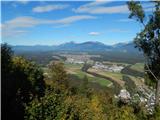
 | Kranj (Kalvarija) - Šmarjetna gora (by road)
Šmarjetna gora is a panoramic peak rising above Kranj. From the summit, where the Church of St. Margaret and the Hotel Bellevue stand, a beautifu...
40 min |
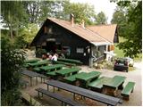 | Ljubljana (Podutik) - Toško Čelo
Toško Čelo is a 590-metre hill above the village of the same name. From the summit, or slightly below it, a beautiful view opens over part of Lju...
1 h |
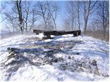 | Vrzdenec - Kožljek
Kožljek is a 788 m high peak located west of Koren, more precisely above the village of Samotorica. From the summit, where there are several benc...
1 h 5 min |
 | Horjul - Koreno (gentle path)
Koreno (also known as Korena) is a 729 m high hill located north of Horjul. From the summit, which features a large cross, the church of St. Moho...
1 h 5 min |
 | Briše - Koreno
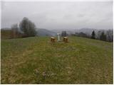
Koreno (also known as Korena) is a 729 m high hill located north of Horjul. From the summit, which features a large cross, the church of St. Moho...
50 min |
| Horjul - Koreno (steep path)
Koreno (also known as Korena) is a 729 m high hill located north of Horjul. From the summit, which features a large cross, the church of St. Moho...
1 h |
 | Sora - Hom
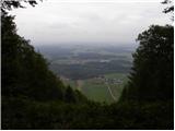
Hom is a 715 m high peak that rises steeply southwest of the village of Sora. From the summit, which is partly forested, there is a beautiful vie...
50 min |
 | Sora - Hom (by road)
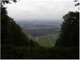
Hom is a 715 m high peak that rises steeply southwest of the village of Sora. From the summit, which is partly forested, there is a beautiful vie...
1 h 5 min |
 | Sora - Hom (less steep path)
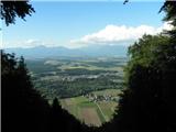
Hom is a 715 m high peak that rises steeply southwest of the village of Sora. From the summit, which is partly forested, there is a beautiful vie...
55 min |
 | Skalnica - Sveta Gora (by road)
Sveta Gora is known mainly among believers and locals. It is a well-known pilgrimage center above Nova Gorica. Believers come here from all over ...
1 h |
 | Skalnica - Sveta Gora (footpath)
Sveta Gora is known mainly among believers and locals. It is a well-known pilgrimage center above Nova Gorica. Believers come here from all over ...
55 min |
 | Šmartno - Grmada
Grmada is a 676-meter-high mountain located west of the much more visited Šmarna gora. From the summit, which has a small takeoff area, a beautif...
55 min |
 | Vikrče - Grmada (Mazijeva steza)
Grmada is a 676-meter-high mountain located west of the much more visited Šmarna gora. From the summit, which has a small takeoff area, a beautif...
1 h 5 min |
 | Tacen (Sveti Jurij) - Grmada
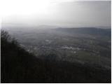
Grmada is a 676-meter-high mountain located west of the much more visited Šmarna gora. From the summit, which has a small takeoff area, a beautif...
1 h 5 min |
 | Vikrče - Grmada (Kovačeva steza)
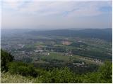
Grmada is a 676-meter-high mountain located west of the much more visited Šmarna gora. From the summit, which has a small takeoff area, a beautif...
1 h 10 min |
 | Lipa - Grmada (path via Peski)
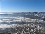
Grmada is a 676-meter-high mountain located west of the much more visited Šmarna gora. From the summit, which has a small takeoff area, a beautif...
1 h |
| Lipa - Grmada (by road)
Grmada is a 676-meter-high mountain located west of the much more visited Šmarna gora. From the summit, which has a small takeoff area, a beautif...
1 h 10 min |
 | Star maln - Koča na Planini nad Vrhniko
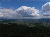
Planina nad Vrhniko is for Vrhnika locals something like Šmarna gora for those from Ljubljana. It is 733 m high, reachable by several paths from ...
1 h |
 | Blatni dol - Koča na Planini nad Vrhniko
Planina nad Vrhniko is for Vrhnika locals something like Šmarna gora for those from Ljubljana. It is 733 m high, reachable by several paths from ...
1 h 10 min |
 | Vrhnika - Koča na Planini nad Vrhniko (via bukev)
Planina nad Vrhniko is for Vrhnika locals something like Šmarna gora for those from Ljubljana. It is 733 m high, reachable by several paths from ...
1 h 5 min |
 | Vrhnika - Koča na Planini nad Vrhniko (via Špica)
Planina nad Vrhniko is for Vrhnika locals something like Šmarna gora for those from Ljubljana. It is 733 m high, reachable by several paths from ...
1 h |
 | Brezje pri Dobrovi - Ključ
Ključ is a forest-covered peak located north of the village Brezje pri Dobrovi and south of Dolenja vas. The summit, which has a stamp box with l...
45 min |
 | Zazid - Jampršnik
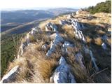
Jampršnik is a little-known and even less visited peak located in the mountain chain southwest of Črni Kal. Despite its modest height, there is a...
1 h |
 | Kekec - Škabrijel
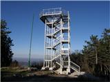
Škabrijel is a hill northeast of the town of Gorica. Since the vegetation on the summit was cleared and a tall metal observation tower was erecte...
50 min |
 | Prevala - Škabrijel (via Veliki hrib)
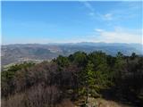
Škabrijel is a hill northeast of the town of Gorica. Since the vegetation on the summit was cleared and a tall metal observation tower was erecte...
1 h 5 min |
| Prevala - Škabrijel
Škabrijel is a hill northeast of the town of Gorica. Since the vegetation on the summit was cleared and a tall metal observation tower was erecte...
50 min |
| Prevala - Škabrijel (via Hungarian pyramid)
Škabrijel is a hill northeast of the town of Gorica. Since the vegetation on the summit was cleared and a tall metal observation tower was erecte...
1 h |
 | Migojnice - Dom na Bukovici
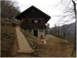
The mountain hut Dom na Bukovici is situated just a few meters below the summit of the forested Bukovica. From the hut, near which there is a lar...
45 min |
 | Zabukovica - Dom na Bukovici
The mountain hut Dom na Bukovici is situated just a few meters below the summit of the forested Bukovica. From the hut, near which there is a lar...
45 min |
 | Kasaze - Dom na Bukovici
The mountain hut Dom na Bukovici is situated just a few meters below the summit of the forested Bukovica. From the hut, near which there is a lar...
45 min |
 | Šešče pri Preboldu - Dragov dom na Homu (via Lajnarjev hrib)
Dragov dom is located on a scenic hill south of Šempeter. From the summit, where there is also the Church of St. Magdalena, there is a fine panor...
1 h |
 | Lipa - Trstelj
Trstelj is the highest peak in the ridge of Črni hribi. From the spacious summit, which has TV transmitters, the view is divided. From the north ...
40 min |
 | Košnica - Veliki Slomnik
Veliki Slomnik is a peak located between Košnica pri Celju and Liboje. The summit has a logbook box, but due to the surrounding forest, there are...
40 min |
 | Tremerje - Veliki Slomnik
Veliki Slomnik is a peak located between Košnica pri Celju and Liboje. The summit has a logbook box, but due to the surrounding forest, there are...
1 h |
 | Liboje - Veliki Slomnik
Veliki Slomnik is a peak located between Košnica pri Celju and Liboje. The summit has a logbook box, but due to the surrounding forest, there are...
45 min |
 | Jakob pri Šentjurju - Rifnik
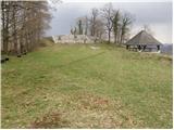
Rifnik is a 568-meter-high peak situated south of Šentjur pri Celju. The summit, known for its archaeological site, offers nice views towards Šen...
45 min |
| Šentjur - Rifnik
Rifnik is a 568-meter-high peak situated south of Šentjur pri Celju. The summit, known for its archaeological site, offers nice views towards Šen...
45 min |
 | Vezovje (bus station Vezovje most) - Rifnik
Rifnik is a 568-meter-high peak situated south of Šentjur pri Celju. The summit, known for its archaeological site, offers nice views towards Šen...
45 min |
 | Slovenske Konjice (pokopališče) - Skala (harder path)
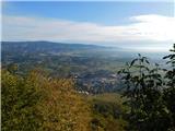
Skala (750 m) is a popular and scenic mountain area in the eastern part of Konjiška gora. From the summit, where tables, benches, and a registrat...
1 h 10 min |
 | Galicija - Planinski dom Šentjungert
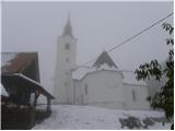
The mountain hut is located just a few meters below the summit of Gora, where the Church of St. Kunigunda stands; it was built in the 14th centur...
45 min |
 | Grad Pišece - Veliki Špiček
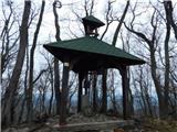
Veliki Špiček is the highest peak of Brežice municipality. From the top a nice view spreads towards the south and east. Most of Brežice municipal...
1 h 5 min |
 | Šober (Perkova graba) - Tojzlov vrh
Tojzlov vrh is a forested hill on the eastern part of Kozjak. On the summit stands a small stone NOB monument and, more recently, also a summit l...
1 h |
 | Belica - Kregovnik
Kregovnik is a lesser-known peak on the southeastern ridge of the 898-meter-high Polhograjska Grmada. From its mostly forested summit, there are ...
1 h |
 | Log - Pečke (steep path)
Pečke is an easily accessible peak that has seen fewer visitors lately, located north of the main Pohorje ridge. It gets more visits only on May ...
1 h |
 | Trebnje Castle - Trebni vrh (steep path)
Trebni vrh is a 581-meter-high hill located south or southwest of Trebnje. On the forested summit stands a bench, and nearby is a logbook box wit...
45 min |
| Trebnje Castle - Trebni vrh (via caves)
Trebni vrh is a 581-meter-high hill located south or southwest of Trebnje. On the forested summit stands a bench, and nearby is a logbook box wit...
50 min |
 | Trebnje Castle - Trebni vrh (steep path via hunting cottage)
Trebni vrh is a 581-meter-high hill located south or southwest of Trebnje. On the forested summit stands a bench, and nearby is a logbook box wit...
55 min |
| Trebnje Castle - Trebni vrh (via caves and hunting lodge)
Trebni vrh is a 581-meter-high hill located south or southwest of Trebnje. On the forested summit stands a bench, and nearby is a logbook box wit...
1 h |
 | Zagorica pri Dobrniču - Lisec (Liška gora)
Lisec is a 565-meter-high peak located north to northeast of Žužemberk and southwest of Dobrnič. On the summit stands a metal cross with an attac...
1 h |
 | Okrog (Lazar) - Zaplaz
Zaplaz is a 543-meter-high hill located above Čatež, a settlement best known as the endpoint of the Levstik Trail (From Litija to Čatež). The sum...
1 h 10 min |
 | Haag - Stradner Kogel
Stradner Kogel is the highest hill in southeastern Styria, Austria. The hill is of volcanic origin, and the summit offers no views in any directi...
1 h 10 min |
 | Zvodno - Bavč (via Suhi potok)
Bavč is a wooded peak located south of Celje and Zvodno in the Posavsko hribovje between Grmada and Srebotnik. On the way to the summit, views re...
1 h 10 min |
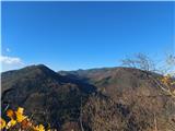 | Socka - Kozjek (above Socka)
Kozjek (above Socka) is an interesting peak located west of the ridged Kislica, like a sharpened extension of it with precipitous walls on its we...
1 h 10 min |
 | Naraplje - Church of St. Bolfenk (Jelovice)
The Church of St. Bolfenk is situated on a 537-meter-high hill above the settlement of Jelovice. From the top, a nice view opens up towards Haloz...
1 h |
| Stogovci (Vabča vas) - Church of St. Bolfenk (Jelovice)
The Church of St. Bolfenk is situated on a 537-meter-high hill above the settlement of Jelovice. From the top, a nice view opens up towards Haloz...
1 h |
 | Hetinj / Hosszúhetény - Zengő (Mecsek) (pot rumeni trikotnik)
Zengő is the highest peak of the Mecsek Mountains, located in southern Hungary. A large observation tower stands at the summit, offering exceptio...
1 h |
 | Bad Gleichenberg (Eichgraben Weg) - Gleichenberger Kogel (via Mühlsteinbruch)
Gleichenberger Kogel is a 598-meter-high mountain of volcanic origin located above Bad Gleichenberg in Styria....
1 h 10 min |
| Bad Gleichenberg (Eichgraben Weg) - Gleichenberger Kogel
Gleichenberger Kogel is a 598-meter-high mountain of volcanic origin located above Bad Gleichenberg in Styria....
1 h 5 min |
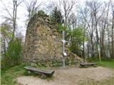 | Gleichenberg Dorf - Gleichenberger Kogel
Gleichenberger Kogel is a 598-meter-high mountain of volcanic origin located above Bad Gleichenberg in Styria....
50 min |
 | Podčetrtek (sveti Lovrenc) - Zavetišče Šmarnica on Mala Rudnica (past castle Podčetrtek)
The Šmarnica shrine is located on Mala Rudnica within the Rudnica range, a smaller hill chain above Podčetrtek. From the shrine there opens a bea...
1 h 5 min |
| Podčetrtek (sveti Lovrenc) - Zavetišče Šmarnica on Mala Rudnica
The Šmarnica shrine is located on Mala Rudnica within the Rudnica range, a smaller hill chain above Podčetrtek. From the shrine there opens a bea...
1 h |
 | Lovnik - Rančka
Rančka is a 615-meter-high peak located west to southwest of Boč. Just below the summit is a stamp box with a bench nearby; the highest point its...
1 h |
 | Kozje - Vetrnik
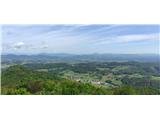
Vetrnik is a 709 m panoramic peak in Kozjanski Park above Kozje on the eastern edge of Bohor. Besides the summit logbook and stamp, it also featu...
1 h |
| Šentjanž - Leskovški hrib
Leskovški hrib is a 721-meter peak in Posavsko hribovje above the Church of Our Lady of Sorrows in Leskovec, Podboršt. From the top there is a be...
1 h |
 | Donji Borki - Petrov vrh above Daruvar
Petrov vrh is one of the peaks on Papuk Mountain. It is located above the town of Daruvar and is a popular destination for local residents. There...
1 h |
 | Prebold - Žvajga (northern peak) (eastern path)
The northern peak of Žvajga is a 620-meter-high hill located south to southwest of Prebold and northwest of the slightly higher southern peak. A ...
50 min |
 | Prebold - Žvajga (northern peak) (western path)
The northern peak of Žvajga is a 620-meter-high hill located south to southwest of Prebold and northwest of the slightly higher southern peak. A ...
1 h 5 min |
 | Liganj - Lužinski breg
Lužinski breg is a panoramic peak above Lovran on Učka. From the summit, where there is a bench with a table and a logbook, the highest peak of U...
1 h |
 | Liganj - Gorica (above Lovran)
Gorica is a panoramic peak above Lovran, which is on Učka. The summit has a logbook. From the top, parts of Učka are visible, highlighted by its ...
1 h 10 min |
 | Stojdraga (Glažuta) - Tuščak (Žumberačka gora)
Tuščak is a forested hill above the Bregana River valley on Žumberačka gora. The summit features a logbox....
1 h 10 min |
 | Grad Pišece - Intermedija (via Velika bukva)
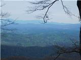
Intermedija is a 662-meter-high peak in the Orlica range. From the summit, there is a beautiful view mainly to the north and northeast, where on ...
1 h 5 min |
 | Pišece (Pri mlinu) - Velika Vagla
Velika Vagla is a 667-meter-high peak located in the Orlice mountain range, specifically along the marked trail from Pišece to Veliki Špiček....
1 h 5 min |
 | Kamnolom Ljubelj - Peca (Kalnik) (Pot 162)
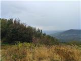
Peca is one of the peaks in the northern part of Kalnik. From the summit, an exceptional view opens to the east and north. In good visibility, th...
1 h 10 min |