Zvodno - Bavč (via Suhi potok)
Starting point: Zvodno (254 m)
| Latitude/Longitude: | 46,21223°N 15,27846°E |
| |
Route name: via Suhi potok
Walking time: 1 h 10 min
Difficulty: easy marked way
Elevation gain: 438 m
Elevation difference along the route: 438 m
Map: Celjska kotlina, 1:50000
Recommended equipment (summer):
Recommended equipment (winter):
Views: 1.110
 | 1 person like this post |
Access to starting point:
From the Ljubljana–Maribor motorway, take the Celje - center exit and continue driving in the direction of Laško and Zidani Most. The road leads through the center of Celje, then brings us to a roundabout with a fountain. Here we continue "straight" (direction Laško and Zidani Most) and follow the road to the next traffic-light intersection, where we continue left, drive over the Savinja River and then at the intersection behind the bridge continue right. Further, we reach the underpass under the railway track and only a few meters ahead to the fire station in Zagrad. We continue straight and follow the road through the village, and higher it brings us to a smaller intersection, where we notice signs for Suhi potok right, Hudičev graben straight. At the intersection, we park near the bus stop.
Route description:
In Zvodno, at the crossroad at the bus stop in accordance with the signposts we continue right in the direction of the Pečovniška koča cottage on Grmada (and Suhi potok - once there was a visible inscription on a concrete retaining wall), straight on asphalt goes the path to Hudičev graben, from where we can also ascend to Bavč. We follow the macadam surface or forest road for a few hundred meters. At the marked junction we continue left and slightly upwards along the forest path or the bed of Suhi potok stream. Further on, once again slightly to the left (right leads to an abandoned quarry) and we follow the hiking forest path upwards, where we bypass the quarry on the left side. The path is well trodden and marked. It winds pleasantly along the bed of Suhi potok stream higher into the area between Bavč on the left side and Grmada on the right side. Soon we reach a junction, continue left along Bavč (right goes the path to the Pečovniška koča cottage on Grmada). We join a macadam road coming from the right. We continue upwards along the road and after some time we reach a junction, where we turn sharply left in the direction from which the path from Hudičev graben towards the Pečovniška koča cottage is coming. A few hundred meters more and we reach a larger path junction at the hunting observatory. We continue left onto the ridge of Bavč (slightly less left downwards goes the marked path into Hudičev graben, straight goes the unmarked path towards Srebotnik). We continue northwards along the ridge of Bavč and soon arrive at our destination along an unmarked path.

Along the route: Pečovniška koča na Grmadi (620m)
Photos:
 1
1 2
2 3
3 4
4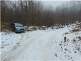 5
5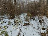 6
6 7
7 8
8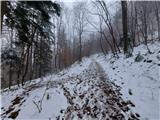 9
9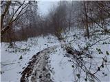 10
10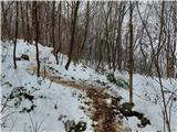 11
11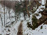 12
12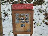 13
13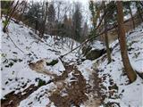 14
14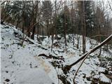 15
15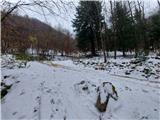 16
16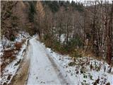 17
17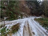 18
18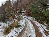 19
19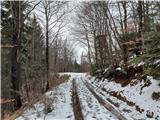 20
20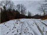 21
21 22
22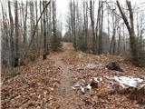 23
23 24
24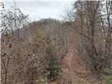 25
25 26
26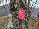 27
27 28
28 29
29
Discussion about the trip Zvodno - Bavč (via Suhi potok)
|
| zdejan27. 12. 2020 |
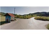
Today I noticed that at the intersection of the above-described starting point (picture 1) they have installed a new traffic sign indicating that the parking lot is 1.2 km further ahead (before the fish farm at the beginning of Hudičev graben - picture 29). So we can walk back to our starting point. An alternative option is also to return from the parking lot at Hudičev graben only about 300 meters back along the road and then turn sharply left into the forest, where we follow the signs for Pečovniška koča and the marked path through the forest towards Suhi potok. The marked path joins our above-described path near the quarry (picture 9), so it is practically the same length as going from the basic starting point (picture 1).
|
|
|
|
| zdejan20. 02. 2021 |
The alternative path from the new exemplary arranged parking lot in Zvodno (in front of the fish farm at the beginning of Hudičev graben - picture 29) to Suhi potok (picture 9) is now shown in more detail on the path "Zvodno - Tolsti vrh nad Celjsko kočo (through Suhi potok)" or on the website https://www.hribi.net/izlet/zvodno_tolsti_vrh_nad_celjsko_koco_skozi_suhi_potok/25/879/8083 from picture 1 to picture 18. I think it is more appropriate to park at the new parking lot by the fish farm than near the intersection by the bus stop.
|
|
|
To post a comment you must log in:
If you do not yet have a username, you must first
register.