Tale / Tallach - Quadiaalm (via Kaltwasser)
Starting point: Tale / Tallach (540 m)
| Latitude/Longitude: | 46,53240°N 14,06490°E |
| |
Route name: via Kaltwasser
Walking time: 2 h 15 min
Difficulty: easy marked way
Elevation gain: 731 m
Elevation difference along the route: 750 m
Map: Karavanke 1:50.000 - osrednji del
Recommended equipment (summer):
Recommended equipment (winter): ice axe, crampons
Views: 377
 | 1 person like this post |
Access to starting point:
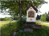
A) Through the Karawanks Tunnel, we drive to Austria, and then we leave the highway on the first exit. When we reach the main road we go left in the direction of the settlement Šentjakob v Rožu / St. Jakob im Rosental. Further, we drive on the road Rosentalstraße, and after the settlement Šentjakob v Rožu we cross also the stream Rosenbach. A little after the bridge we leave the main road and we continue driving right into settlement Tale / Tallach. Next follows driving through the settlement, and when at Pension Lindenhof we reach another road, we only cross it, and then we park on a parking lot behind the chapel.
B) Over the border crossing Ljubelj we drive to Austria and follow the main road towards Celovec / Klagenfurt. When we already get into a valley, at the second roundabout, which is situated on the right bank of the river Drau, we turn onto the exit Bistrica v Rožu / Feistritz im Rosental, and then we drive on the main road to the settlement Podgorje / Maria Elend. After the mentioned settlement we turn left towards Podrožca / Rosenbach. Further, the road brings us into settlement Tale / Tallach, where before Pension Lindenhof we turn left and then we park on a parking lot by the chapel.
Route description:
From the starting point, we continue in the direction of the mountain pasture Kladje / Quadiaalm, Golica / Kahlkogel and chapel Maria Elend / Bergkapellen Maria Elend. The road which is closed for public traffic soon leads through the underpass under the railway track, and then we already get to the first junction, where we continue right in the direction of Golica (straight chapel). A fairly demanding road, by which we notice a notice that we are entering the bear area, then over a bridge it crosses Radischgraben, after a few additional minutes of walking we get to the next junction, where we go left (straight Podrožca / Rosenbach). From the junction we walk a few more minutes on the road, and then higher at the left bend we leave it, because signs for path 675 direct us slightly right onto a cart track. We ascend the cart track which quickly ends, and we continue the ascent through an overgrown meadow. Higher, we reach another cart track which for a short time still leads through the overgrown part, and then the path enters the forest and continues transversely to the right. After a shorter traverse, we reach another cart track, from it we go a few steps higher right. A shorter traverse follows, and then we join the path from Podrožca.
We continue in the direction of Golica and nearby spring, to which we arrive after approximately 5 minutes of additional walking.
From the spring, by which there are a religious symbol and a bench, we continue on the path, which first leads through a small valley, from which the path soon turns sharply left and steeply ascends transversely. A few minutes of ascent through the forest follow, and then the path quickly widens into a macadam road, on which we then ascend briefly. Higher, we leave the road, then a little further we cross it again, and after that we stay on it. When a little further the forest thins, a nice view opens towards Golica, and a little further we cross a grazing fence. From crossing the fence a few more minutes of walking on the road follow and we already arrive at the mountain pasture Kladje.
Description and pictures refer to the condition in the year 2017 (June).

Along the route: Hladna voda / Kaltwasser (915m)
Photos:
 1
1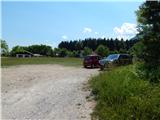 2
2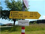 3
3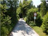 4
4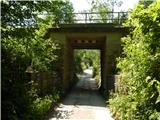 5
5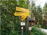 6
6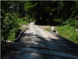 7
7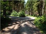 8
8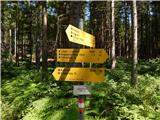 9
9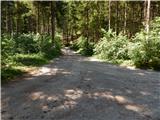 10
10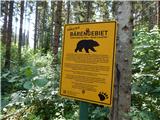 11
11 12
12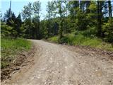 13
13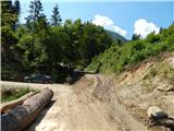 14
14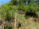 15
15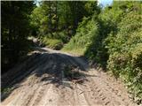 16
16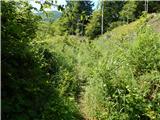 17
17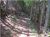 18
18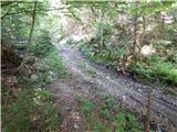 19
19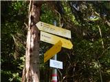 20
20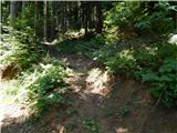 21
21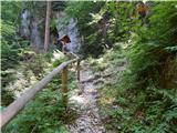 22
22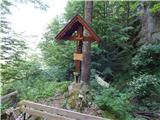 23
23 24
24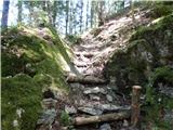 25
25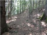 26
26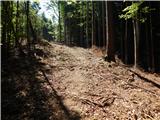 27
27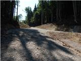 28
28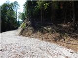 29
29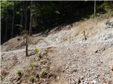 30
30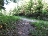 31
31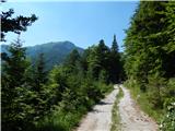 32
32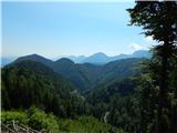 33
33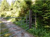 34
34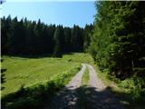 35
35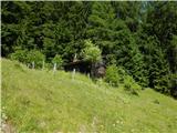 36
36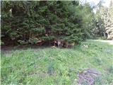 37
37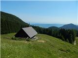 38
38
Discussion about the trip Tale / Tallach - Quadiaalm (via Kaltwasser)
To post a comment you must log in:
If you do not yet have a username, you must first
register.