Tatabanya - Turul Emlekmű
Starting point: Tatabanya (154 m)
Walking time: 40 min
Difficulty: easy marked way
Elevation gain: 136 m
Elevation difference along the route: 136 m
Map:
Recommended equipment (summer):
Recommended equipment (winter):
Views: 505
 | 1 person like this post |
Access to starting point:
We go to Hungary via the border crossing Pince / Tornyszentmiklos and drive towards Budapest. When we reach the Budapest suburb Törökbalint, at the junction we turn towards the town of Győr. We drive another about 50 kilometers to the Tatabanya Ovaros exit, where we leave the motorway. In the town we drive to the roundabout, where we will turn northwest and drive all the way to the new part of the town Ujvaros (Tatabanya greatly resembles Velenje). When we reach the Railway Station (Hungarian vasutakallomas) we spot the first signs. We park somewhere in the town.
Route description:
The trail officially starts at the railway station in Tatabanya, where we will also notice the first signs. Initially, white, blue, green and yellow circles accompany us, and in the town there are also quite a few tourist signs for the Turul emlekmü monument. When we reach Almos Vezer street, we will see signs in the form of a red line in a white square, which will accompany us further east. We go up the stairs, then around the building and we are at the place where it seems there is no more trail. We find the continuation through the gate of the sound barrier, after which we cross the traffic road. We cross the road and continue, then under the motorway and further along the blue fence of the waterworks facility. The trail begins to climb the stairs, then we reach Szöloshegy ut street.
Here we go right, then immediately left onto the stairs (straight ahead are the climbing paths Kata ut and Het Vezer). We climb the stairs for about 15 minutes, during the ascent a path branches off to the left to the nearby cliffs. When we reach the top of the stairs we turn right and after a minute of further walking we are at the eagle monument, from which an excellent view opens up to Tatabanya below us, the town of Oroszlany and the Vertes mountains.
The described trail is suitable for descent if we have climbed to the monument via the via ferrata Kata ut or Het Vezer.

Photos:
 1
1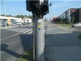 2
2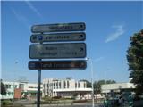 3
3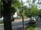 4
4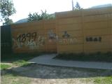 5
5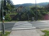 6
6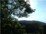 7
7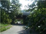 8
8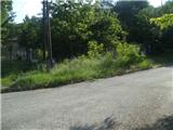 9
9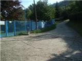 10
10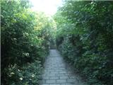 11
11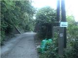 12
12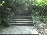 13
13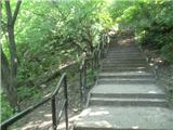 14
14 15
15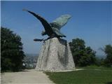 16
16
Discussion about the trip Tatabanya - Turul Emlekmű
To post a comment you must log in:
If you do not yet have a username, you must first
register.