Starting point: Dolina Kot (950 m)
| Latitude/Longitude: | 46,41570°N 13,89770°E |
| |
Walking time: 6 h 25 min
Difficulty: very difficult marked way
Elevation gain: 1914 m
Elevation difference along the route: 2065 m
Map: Triglav 1:25.000
Recommended equipment (summer): helmet, self belay set
Recommended equipment (winter): helmet, self belay set, ice axe, crampons
Views: 77.459
 | 9 people like this post |
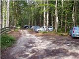
Access to starting point:
We drive to Mojstrana, then follow the signs for the Kot Valley and Krma Valley. At Kosmačev Preval, we leave the road leading further towards Krma, Radovna and Bled, and continue driving right onto the side road in the direction of the Kot Valley. This is followed by driving on a gravel road, which we follow to the mountain direction signs at the end of the drivable road in Lengarjev Rovt.
Route description:
From the end of the road, continue along the wider marked path towards Stanič's hut and Kredarica, which gently ascends through the forest. After a few minutes, we reach the Kotarica scree field, which we cross transversely to the other side, where the trail reappears.
This is followed by some easy walking through the forest; after about half an hour of walking, the path quickly becomes quite steep and, due to often slippery ground, also dangerous for slipping, especially on the descent, so extra caution is needed on this section. On this part, a few pegs assist at the more difficult spots. Higher up, the steepness eases, and the path leads us to the spring Pri studenčku, which dries up in dry periods.
Here, an unmarked path branches left towards Macesnovec; we continue straight across the torrent bed, and after the torrent, we cross a short secured but not particularly difficult section. This is followed by an ascent through a belt of dwarf pines; higher up, we enter an increasingly rocky terrain, where we can already see a large boulder ahead. Here, our path is crossed quite unobtrusively by the PP trail (Planica - Pokljuka trail), and we ascend with increasingly beautiful views to the aforementioned boulder called Debeli kamen.
At Debeli kamen, the dwarf pines occasionally end definitively, and we continue through increasingly high-alpine terrain, mostly ascending on scree. On this section, looking back, we get a nice view of Ladja (Ladja is a prominent sheer, dwarf pine-covered promontory or peak rising above the Kot Valley); we then ascend to a marked junction where a climbing path to Vrbanove špice, or Lojze Rekar's path, branches right.
We continue on the left path towards Triglav, Rjavina, and Dom Valentina Staniča pod Triglavom, where the steepness eases, and the path leads along the left side of the Pekel gully.
Here, first a marked very difficult secured path to Rjavina branches left; we ascend transversely above the gully along the northwestern slopes of Rjavina. As we approach Dovška vrata further ahead, a passage opens left to the Rjavina ridge, or the passage leads directly to the mentioned gates, from which a marked ridge path leads to Rjavina; we continue straight along the marked path towards Dom Valentina Staniča.
In the continuation, we mostly ascend moderately through high-alpine terrain, following such a path all the way to Dom Valentina Staniča pod Triglavom, from where we get a nice view of Triglav and the surrounding peaks.
We continue towards Triglav and Triglavski dom na Kredarici (left Rjavina via ridge path, Krma Valley, slightly right Vrata Valley, right Begunjski vrh, Cmir, and Visoka Vrbanova špica); the path soon turns slightly left and continues south towards nearby Rž. When we reach the scree slopes below Rž, the path turns right and ascends transversely across the scree, where later a passage to the top of Rž opens left; we follow the marked path, which increasingly approaches the ridge connecting Rž with Kredarica. Here the path becomes technically demanding and partly exposed in places, with some safety devices assisting at the more difficult spots. This is followed by a short unsecured descent through fairly friable terrain, then we enter a panoramic and occasionally still exposed ridge. As we approach the top of Kredarica, the ridge widens, and we then reach the cairn on Kredarica without major difficulties.
Beyond the top of Kredarica, the ridge widens into a gentle slope, where the path turns left, and we descend in a few minutes to Triglavski dom na Kredarici, located above the Marija Snežna chapel.
We continue towards Triglav (left Krma Valley and Pokljuka, right Vrata Valley) and descend on a technically still undemanding path to Ledeniški preval, from where we begin ascending towards the wall of Mali Triglav. Here we follow the markers and the larger one visible from afar, near which the very demanding path to Triglav begins.
Initially, we ascend a not yet very steep slope with the help of some pegs and individual fixed cables; when we reach the wall of Mali Triglav, we begin traversing upwards to the left, where fixed cables were added to the pegs a few years ago, allowing self-belaying with a via ferrata set. This is followed by some quite steep and exposed ascents, where we must take care not to slip; on the section with loose rocks on the path, we must also be careful not to dislodge stones as this can be deadly dangerous for hikers below us. The path ahead is quite narrow, and with a larger number of visitors, congestion can occur due to difficult passing between hikers.
Higher up, the steepness eases, and from the left, the path from Dom Planika pod Triglavom joins us, namely the path via Mali Triglav, which we reach shortly afterwards.
From Mali Triglav, there is some gentle descent along an occasionally less exposed ridge; when we start ascending again, the ridge narrows, and the path becomes precipitous on both sides. In the continuation, there are still some quite steep ascents; the path is mainly well secured with fixed cables and individual pegs, and on nice days, congestion is possible due to passing all the way to the top. Below the summit, the path becomes less demanding but still precipitous. Just below the summit, a path towards Staničevo zavetišče (emergency bivouac carved into the Triglav massif) branches slightly left; we follow the still cautious but last few meters less steep path to Aljažev stolp, located on the summit of Triglav, the highest peak of the Julian Alps and Slovenia.
Starting point - Pri studencu 1:25, Pri studencu - Debeli kamen 1:20, Debeli kamen - Pekel 0:45, Pekel - Dom Valentina Staniča 0:40, Dom Valentina Staniča - Kredarica 0.55, Kredarica - Triglavski dom na Kredarici 0:05, Triglavski dom na Kredarici - Ledeniški preval 0:05, Ledeniški preval - Mali Triglav 0:35, Mali Triglav - Triglav 0:35.

Photos:
 1
1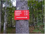 2
2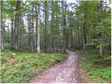 3
3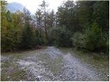 4
4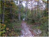 5
5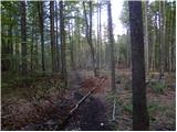 6
6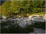 7
7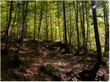 8
8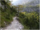 9
9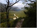 10
10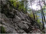 11
11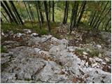 12
12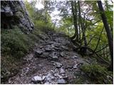 13
13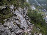 14
14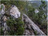 15
15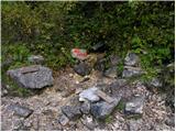 16
16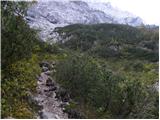 17
17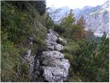 18
18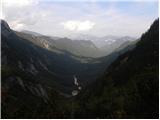 19
19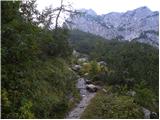 20
20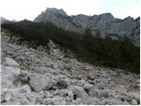 21
21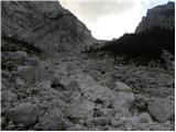 22
22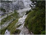 23
23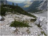 24
24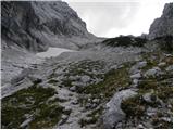 25
25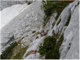 26
26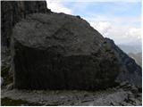 27
27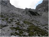 28
28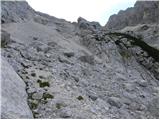 29
29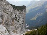 30
30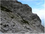 31
31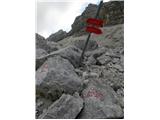 32
32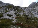 33
33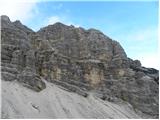 34
34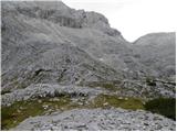 35
35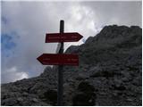 36
36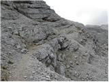 37
37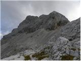 38
38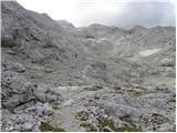 39
39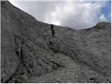 40
40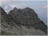 41
41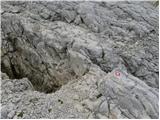 42
42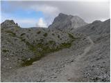 43
43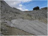 44
44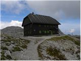 45
45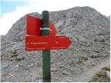 46
46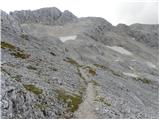 47
47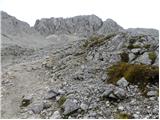 48
48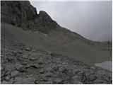 49
49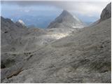 50
50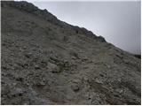 51
51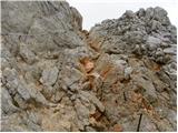 52
52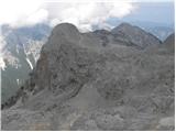 53
53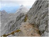 54
54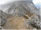 55
55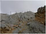 56
56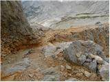 57
57 58
58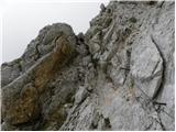 59
59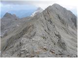 60
60 61
61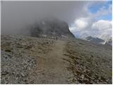 62
62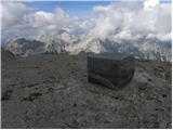 63
63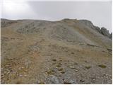 64
64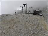 65
65 66
66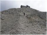 67
67 68
68 69
69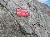 70
70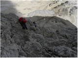 71
71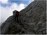 72
72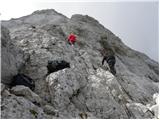 73
73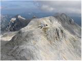 74
74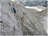 75
75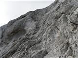 76
76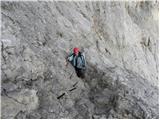 77
77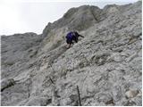 78
78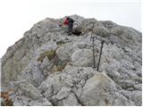 79
79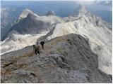 80
80 81
81 82
82 83
83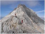 84
84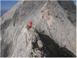 85
85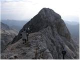 86
86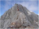 87
87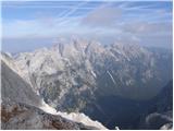 88
88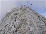 89
89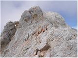 90
90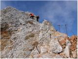 91
91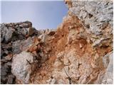 92
92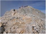 93
93 94
94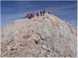 95
95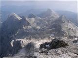 96
96 97
97
Discussion about the trip Dolina Kot - Triglav
|
| Gost13. 07. 2006 |
Nice. I got inspiration from which direction to visit Triglav this year. Brane
|
|
|
|
| skespr21. 08. 2006 |
you won't regret it. and if you'll have some time it's worth going also to Rjavina (up via the ridge path back via the climbing one) you won't regret it. mandatory helmet
|
|
|
|
| Nickster22. 07. 2008 |
This trail is excellent for me except the part where you walk on scree I don't like that so much. I also tried to go to Rjavina but didn't make it the same day as night caught me. A bit faster I could have gone. Nice photos turned out.
lp and lots of enjoyment!
|
|
|
|
| Janiel746. 08. 2011 |
Yesterday did this trail uphill, then down to Krma. First time on Triglav
|
|
|
|
| kungočan30. 08. 2012 |
On Thursday 23 August we set off on this trail, started at six o'clock, after an hour and a half a thunderstorm caught us, heavy rain and wind, we waited towards the end of the forest, thought about going back, called Kredarica, got encouraging information and continued towards Staničev dom, the weather improved and it was nice. We arrived at the summit around two o'clock. Weather clear. We returned to Planika, where we slept, there were ten of us. The next day through Škrbina over Plemenice to Luknja and to Aljažev dom in Vrata. Very adrenaline-filled...
|
|
|
|
| maregol22. 09. 2016 |
Has anyone already gone this path at night? Is it suitable for that? I would like to arrive at Triglav around 8:00 in the morning so that the summit part would already be lit.
|
|
|
|
| redbull22. 09. 2016 |
have a good headlamp and no panic
good luck
|
|
|
|
| mukica23. 09. 2016 |
Part of the trail in the lower section of Kot is always a bit slippery, be careful at night, especially if temperatures are around the glacier...
|
|
|
|
| Zdenkob14. 09. 2018 |
On Wednesday, 12.9. I went along this path. I planned to go only to Stanič's hut, but due to very nice weather I extended the tour to Kredarica and Triglav. The crowd was tolerable. The path back to Kot dragged on for me, especially from Debeleg kamen onwards, where due to wet rocks a good deal of caution was needed.
|
|
|
|
| fjr23. 09. 2018 |
Yesterday with friends I did this path. Up at 7 o'clock and back to the valley in the afternoon due to forecast bad weather. During the path, darkness caught us so we continued with headlamps. I would like to write and warn all hikers that the path in the lower part when you enter the forest is extremely slippery, exposed and in the exposed sections insufficiently secured.
|
|
|
|
| Vrhovka5. 09. 2025 12:46:15 |
On 4.9.2025 the road is nicely drivable to Kot, even with a low car. Path ok, except up to Debeleg kamen, the path is quite wet and slippery at this time, so it requires extra caution, especially for descent, because the rocks don't dry.
|
|
|
To post a comment you must log in:
If you do not yet have a username, you must first
register.