Dolina Krma - Dom Valentina Staniča
Starting point: Dolina Krma (944 m)
| Latitude/Longitude: | 46,38510°N 13,90710°E |
| |
Walking time: 5 h 15 min
Difficulty: easy marked way
Elevation gain: 1388 m
Elevation difference along the route: 1485 m
Map: Triglav 1:25.000
Recommended equipment (summer):
Recommended equipment (winter): ice axe, crampons
Views: 40.735
 | 3 people like this post |
Access to starting point:
a) Leave the Gorenjska motorway at the Hrušica exit and continue following the road towards Kranjska Gora. Just before the village of Dovje, a road branches off to the left from the main road leading to Mojstrana (Vrata, Kot and Krma). Continue following the road towards the village of Radovna and the Krma and Kot valleys. The fairly steep road then takes us past the TNP sign, after which the road soon levels out and brings us to a junction where a gravel road branches off to the right into the Kot valley. Continue straight on the road, which begins to descend. Midway through the descent, the road to the Krma valley branches off to the right (straight to Radovna). A little further on, we reach the next junction, where we continue right towards Krma. The gravel road then brings us to the Kovinarska koča, which we follow further. The occasionally somewhat poorer road then takes us to the parking lot in front of the barrier.
b) Drive to Kranjska Gora, then continue driving towards Jesenice. At Dovje, leave the main road and continue right towards Mojstrana and the Vrata, Kot and Krma valleys, and at the following junctions follow the signs for Krma. The fairly steep road then takes us past the TNP sign, after which the road soon levels out and brings us to a junction where a gravel road branches off to the right into the Kot valley. Continue straight on the road, which begins to descend. Midway through the descent, the road to the Krma valley branches off to the right (straight to Radovna). A little further on, we reach the next junction, where we continue right towards Krma. The gravel road then brings us to the Kovinarska koča, which we follow further. The occasionally somewhat poorer road then takes us to the parking lot in front of the barrier.
Route description:
From the last parking lot in the Krma Valley, called Pri lesi, continue along the poor road that continues along the valley and soon brings us to a clearing, where we bypass the nearby building on the left side. Continue along the gravel path that approaches the torrent and crosses it a little further on. On the other side of the torrent, the path enters the forest and first ascends gently, then quite steeply for a while. Higher up, we leave the forest for the belt of dwarf pines and shrubs, and from the path we have beautiful views of the nearby walls of the peaks, which descend more gently to the other side towards Pokljuka.
Higher up, at an altitude of just over 1400 m, the path temporarily levels out and brings us to the beautiful grassy plain of Vrtača.
After the grassy section, the path begins to ascend again along a path that is often quite slippery in this section, leveling out on the Malo polje plain.
Here the path turns right and forks.
To the left, the path branches off towards Bohinjska vrata and Vodnikov dom on Velem polju, while we continue straight and easily along the foot of Vernar to the spring with a trough.
After the trough, the path forks, and we continue straight along the marked path (left unmarked shortcut to planina Zgornja Krma). This is followed by some moderate ascent, higher up somewhat steeper, through sparse, partly larch forest. Higher up, the path turns left and levels out, and from the left the aforementioned shortcut joins us.
After the junction of both paths, we quickly reach the shepherd's hut on planina Zgornja Krma, called Prgarca.
From here, the path continues with a moderate ascent to the west and brings us to the last spring along the path; above the spring, the path forks again.
To the left, the path continues over Kurica to Konjsko sedlo and further to Dom Planika pod Triglavom, while we go right onto the path leading further towards Kredarica and Staničev dom.
Just a few steps further, the "old path" to Kredarica branches off to the left from the usual path to Kredarica.
Here are the only signs for Kredarica in this direction along the path, while we continue straight along the easy marked path, which has no signs for Kredarica (September 2025), bringing us a few minutes later to a marked junction where the paths to Kredarica and Staničev dom separate.
The path ahead leads us through the partly grassy area called Murava, later ascending transversely through increasingly sparse, mostly larch forest. Higher up, the path gradually levels out and brings us to the lower part of Kravja dolina, where first an unmarked path joins from the right leading past the hunting hut Zgornja Krma, and a little higher another unmarked path branches off to the right leading to the central part of Kravja dolina and further to Veliki Pršivec, the remains of an airplane from World War II and Rjavina via Temen, while we continue following the well-trodden marked path that transitions into increasingly rocky terrain.
Once we ascend above 2000 meters above sea level, in the area called Pungrt, we unobtrusively cross the PP trail (Planica - Pokljuka trail), continue briefly along the valley between Rž on the left and Rjavina on the right, then move to the slopes of Rjavina, where we ascend transversely over scree. Below Dovška vrata, where a shortcut to Rjavina leads, the marked path turns left.
Continuing, we moderately ascend towards the Rž massif, where we can observe the natural window, the window in Rž, and higher up the path becomes steeper and a marked but rarely visited path from Konjsko sedlo joins from the left.
We continue right towards Triglav and Staničev dom, along a gradually easier path that brings us to a junction at the beginning of the ridge leading towards Dovška vrata and further to Rjavina.
Here, a marked path to Rjavina also branches off to the right, while we begin to gradually descend towards the more plateau-like area around Dom Valentina Staniča pod Triglavom.
Lower down, the path levels out and from the next junction we continue straight towards the nearby mountain hut.
Krma - Zgornja Krma 2:30, Zgornja Krma - Dom Valentina Staniča 2:45.

Along the route: Vrtača (1430m), Malo polje (1585m),
Planina Zgornja Krma (1720m), Murava (1790m), Kravja dolina (1905m), Pungrt (2118m), Apnenica (2337m), Ravnica pod Ržjo (2371m)
Photos:
 1
1 2
2 3
3 4
4 5
5 6
6 7
7 8
8 9
9 10
10 11
11 12
12 13
13 14
14 15
15 16
16 17
17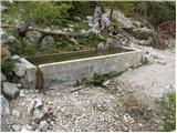 18
18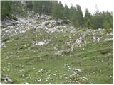 19
19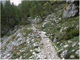 20
20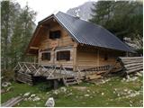 21
21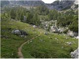 22
22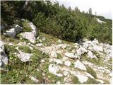 23
23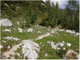 24
24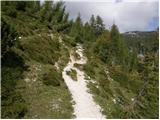 25
25 26
26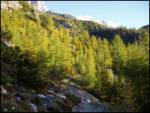 27
27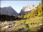 28
28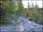 29
29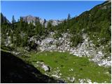 30
30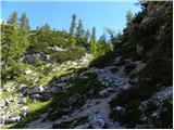 31
31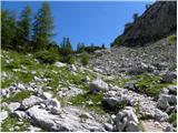 32
32 33
33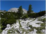 34
34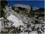 35
35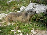 36
36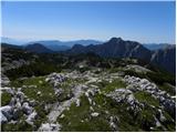 37
37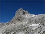 38
38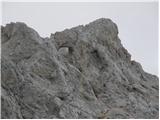 39
39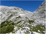 40
40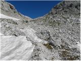 41
41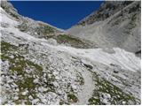 42
42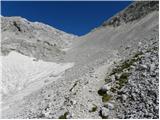 43
43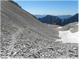 44
44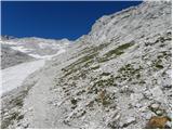 45
45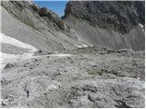 46
46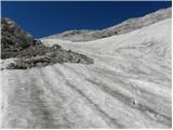 47
47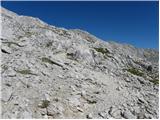 48
48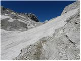 49
49 50
50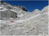 51
51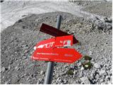 52
52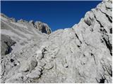 53
53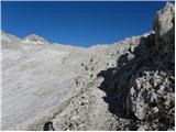 54
54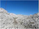 55
55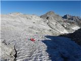 56
56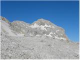 57
57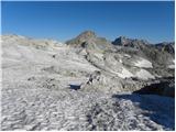 58
58 59
59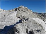 60
60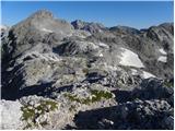 61
61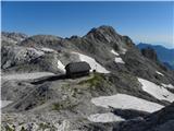 62
62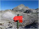 63
63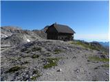 64
64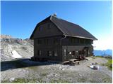 65
65
Discussion about the trip Dolina Krma - Dom Valentina Staniča
|
| velkavrh12. 08. 2008 |
Today I went from this direction to Dom Valentina Staniča. I did this path for the first time and it thrilled me. It's much nicer than from Vrata via Prag, Tominškova is too climbing. From Kot it was always somehow annoying to me. In hiking length they are similar, only from Kot it's shorter. It's completely safe, so suitable even for elementary school children. It offers wonderful views of Rjavina from the south. Highly recommend. It's less visited, so we enjoy the views and peace.
|
|
|
|
| pohodnik0113. 08. 2008 |
I'm interested in what the road from Mojstrana past Kovinarska koča to the parking lot before the barrier is like? Also, where can I get that map that shows the path? Please answer nicely.
lp
|
|
|
|
| velkavrh13. 08. 2008 |
The road past Kovinarska koča to the last parking lot before the barrier is in poor condition. Drive extremely slowly and carefully. Not for cars with low clearance. Your car shouldn't be pitied at all. Yesterday the parking lot was already full a little after six in the morning. Most hikers set off here for Planika and from there to Triglav, because it's the easiest path to Triglav.
|
|
|
|
| Klin14. 08. 2008 |
And how is the road to Kovinarska koča?
|
|
|
|
| velkavrh14. 08. 2008 |
The bad road is from the end of the asphalt towards Kovinarska koča, which turns right, left goes towards Bled. To Kovinarska koča is surely less of an evil for the car than going to the end. Otherwise hikers aren't scared of a bad road. Proof I logged yesterday.
|
|
|
|
| velkavrh12. 08. 2010 |
Again I went to Stanič hut from Krma. For this hut, this is my favorite approach. This time I started from Gori via Radovna to Krma. It makes sense if we're from Ljubljana, Kranj. Until now I always went from Mojstrana. I was positively surprised because the gravel road to Krma is purely school five. Really need to praise the road builders who maintain this road. You can drive to the parking lot in Krma quite fine. This path to Stanič is used less, but I met a column of twenty hikers who were returning from Triglav to Krma via this path. The weather held. Triglav had occupation today. I find it quite pleasant to walk under Rjavina.
|
|
|
|
| cebelca18. 06. 2012 |
Has anyone hiked this path recently? Are there any larger snowfields on this path that might still be snowy?
|
|
|
|
| Kokta22. 07. 2013 |
Some smaller snowfields that can be crossed without problems. I agree with velkavrh, the path is really wonderful.
|
|
|
|
| tango9. 09. 2018 |
I just can't believe that in these days in the Triglav area such a little-visited path as the upper part of the circular (part above Zg. Krma pasture), which I walked today. Classic from Krma to the hut, back to Krma via Travnata dolina. In this part chamois and marmots can also enjoy peace
|
|
|
|
| Enka28. 09. 2019 |
I'm wondering if you can get the SPP stamp when the hut is closed, and where?
|
|
|
To post a comment you must log in:
If you do not yet have a username, you must first
register.