Tinčkova koča - Hochstuhl/Stol (via Smokuška planina)
Starting point: Tinčkova koča (1070 m)
| Latitude/Longitude: | 46,42280°N 14,19910°E |
| |
Route name: via Smokuška planina
Walking time: 4 h 15 min
Difficulty: easy marked way
Elevation gain: 1166 m
Elevation difference along the route: 1350 m
Map: Karavanke - osrednji del 1:50.000
Recommended equipment (summer):
Recommended equipment (winter): ice axe, crampons
Views: 18.431
 | 2 people like this post |
Access to starting point:
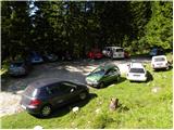
From the Ljubljana - Jesenice highway, take the Lesce exit and follow the road ahead towards Žirovnica and Jesenice. After a few km of driving, we will arrive at an intersection where the road to Žirovnica and Moste branches off to the right (from the Jesenice direction, to the left). Just a few meters ahead, at the next intersection, we turn left to Moste (right to Žirovnica). We drive further past the monument to the fallen fighters, where the road begins to climb under the railway track. At the top of the hill, the road branches right (at the sign Vila Karin), but we continue straight towards Završniško jezero and Valvasorjev dom. The road then flattens and brings us to an intersection where the road to Valvasorjev dom branches off to the left, and we continue straight on the initially still asphalted road. The road soon becomes macadam, and we follow it to the parking lot near Tinčkova koča. The road in the upper part is often in quite bad condition.
Route description:
From the parking lot at Tinčkova koča we continue on a wide rocky cart track in the direction of Koča pri izviru Završnice. Already after a few steps of walking the blazes direct us slightly right onto a somewhat steeper footpath that ascends over a panoramic grassy slope, then returns to the aforementioned cart track, which we follow to the right. The cart track, which ascends relatively steeply through the forest, brings us after a few minutes of further walking to a pasture fence, behind which we arrive at a marked junction.
We continue straight (slightly right Roblekov dom) on the still rocky cart track, which higher up brings us out of the forest onto the expansive grassy slopes of Smokuška planina. Here the steepness eases and the increasingly scenic path brings us in 15 minutes of further walking to Koča pri izviru Završnice.
From the hut we continue left on the marked footpath in the direction of Stol. The path already after a few minutes leaves the cart track and enters a smaller valley between Srednji vrh on the left and Vrtača on the right. The moderately steep path, running through sparse forest, ascends steeply higher for a short time and brings us after a few minutes of further walking to the Šija saddle, where there is a marked junction.
We continue straight (left Srednji vrh, right Vrtača and Stol upper path) on the path which first descends slightly, then gradually begins to ascend. Here an unmarked path over Zagon joins almost imperceptibly from the left, and we continue straight on the path surrounded by lush shrubbery. The relatively gentle path soon brings us to a high mountain cirque, where the (upper) path from Dom na Zelenici joins from the right.
We continue further westwards, this time on the path that leads us through a beautiful high mountain valley, which on the left is bordered by the lesser-known Srednja peč (1920 m), while on the right Svačiča and the Belščice ridge block the view towards Austria. Just a little further, the path to Svačica and Celovška koča branches off to the right, and we continue straight on the increasingly high mountain path, which in a gentle ascent brings us to a larger scree field below Celovška špica (2105 m). The path then ascends over the relatively steep scree and brings us to an indistinct saddle between Mali Stol and Veliki Stol. Here we continue right (left Prešernova koča 5 minutes) in the direction of Stol, whose summit we reach after 10 minutes of further walking.
Starting point - Koča pri izviru Završnice 1:00, Koča pri izviru Završnice - Stol 3:15.

Photos:
 1
1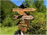 2
2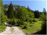 3
3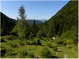 4
4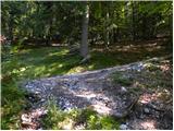 5
5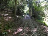 6
6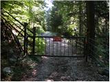 7
7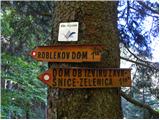 8
8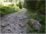 9
9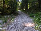 10
10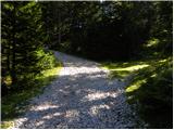 11
11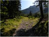 12
12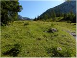 13
13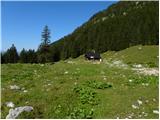 14
14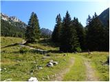 15
15 16
16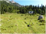 17
17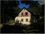 18
18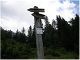 19
19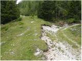 20
20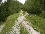 21
21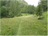 22
22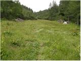 23
23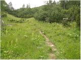 24
24 25
25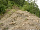 26
26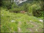 27
27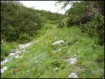 28
28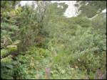 29
29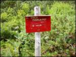 30
30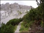 31
31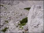 32
32 33
33 34
34 35
35 36
36 37
37 38
38 39
39 40
40 41
41 42
42 43
43 44
44 45
45
Discussion about the trip Tinčkova koča - Hochstuhl/Stol (via Smokuška planina)
To post a comment you must log in:
If you do not yet have a username, you must first
register.