Tolminske Ravne - Vogel (on mule track)
Starting point: Tolminske Ravne (924 m)
| Latitude/Longitude: | 46,22940°N 13,77150°E |
| |
Route name: on mule track
Walking time: 3 h 30 min
Difficulty: easy marked way
Elevation gain: 998 m
Elevation difference along the route: 1020 m
Map: TNP 1:50.000
Recommended equipment (summer):
Recommended equipment (winter): ice axe, crampons
Views: 12.250
 | 1 person like this post |
Access to starting point:
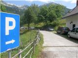
We drive to Tolmin, and then we continue driving in the direction of Žabče and Zadlaz (the turn-off from the main road is located on the left bank of Tolminka). When we get to Žabče, at the smaller crossroads we continue slightly to the right in the direction of the settlement Zadlaz. In the settlement Zadlaz-Žabče the road temporarily descends, where we cross Zadlaščica over a bridge, and then it again starts ascending steeply on a narrow but all the time asphalted road. After approximately 12 km from the main road we get to the marked parking lot in Tolminske Ravne, where we park.
Route description:
From the parking lot, we go on the path in the direction of the mountain hut Koča na planini Razor and mountain pasture Planina na Kalu. At first, we walk on a cart track which continues from the nearby house and leads us through a panoramic meadow. On the other side of the meadow, we cross a grazing fence and the path brings us to a marked junction, where we continue on the lower right cart track (slightly left Planina na Kalu).
Further on, we walk on a cart track which slightly descends towards the right, then flattens and continues for a few minutes without major changes in elevation. Behind the concrete trough the path splits once again, and we choose the lower gentle path (slightly left steep path), which continues on a wide cart track. A little further, after crossing the grazing fence, the cart track changes into a mule track, and from it we soon go slightly left onto a marked footpath which cuts a longer bend of the mule track. After a few minutes of ascent we return to the mule track, which we reach exactly at a smaller junction. We choose the upper right path, which ascends diagonally towards the right, and soon turns sharply to the left. Further on, we ascend gently to moderately on the mule track, which leads us diagonally towards the left, gradually transitioning to fairly steep slopes, where the passage is not demanding because the path is all the time fairly wide. When the higher slope flattens, the mule track turns somewhat to the right and brings us out of the forest onto the southwestern part of Planina Razor. From here follows a short moderate ascent and the path brings us to the cheese cottage and about a minute further to the mountain hut Koča na planini Razor.
From the hut we continue in the direction of Globoko, Vogel, Vrh nad Škrbino... on the path which crosses a belt of forest, then splits on a gentle grassy slope.
From the junction we continue right (straight Vrh nad Škrbino and Dom na Komni) and begin to ascend moderately. The path quickly returns into the forest and brings us to the next junction.
Again we continue right in the direction of Vogel (left Globoko) and gradually begin to ascend more steeply. We quickly leave the forest, then begin to ascend on a gradually steeper slope. With nice views on Tolminsko, higher we reach the southwestern ridge of Vrh Krnic, where the path temporarily flattens and turns left. The path ahead ascends diagonally and leads us above Krnica and on the slopes of Vrh Krnic. After crossing a smaller valley, where to the left branches an unmarked path which leads to the saddle between the mentioned peak and Vogel, the path passes onto the slopes of Vogel, where it ascends diagonally across a steep slope. Higher we reach the ridge of Vogel, where the path turns left (right Žabiški Kuk). There follows another good 10 minutes of ascent and the panoramic path brings us to the 1922 meters high peak of Vogel.
Tolminske Ravne - Planina Razor 1:45, Planina Razor - Vogel 1:45.
Description and pictures refer to the condition in the year 2016 (July).

Photos:
 1
1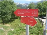 2
2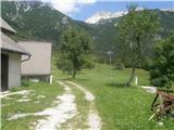 3
3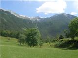 4
4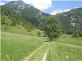 5
5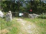 6
6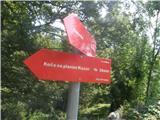 7
7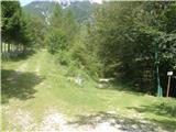 8
8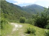 9
9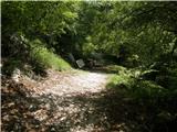 10
10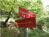 11
11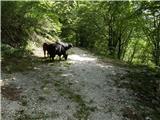 12
12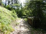 13
13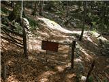 14
14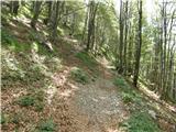 15
15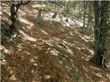 16
16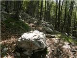 17
17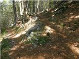 18
18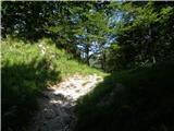 19
19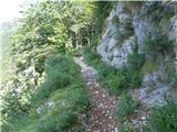 20
20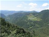 21
21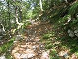 22
22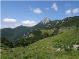 23
23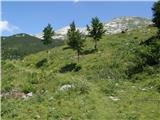 24
24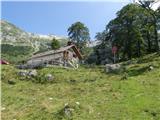 25
25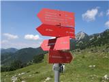 26
26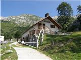 27
27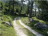 28
28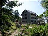 29
29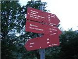 30
30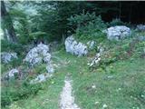 31
31 32
32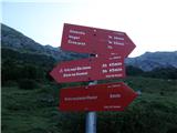 33
33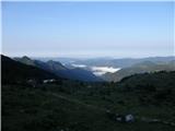 34
34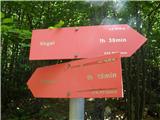 35
35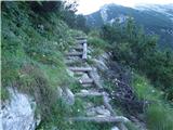 36
36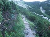 37
37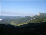 38
38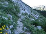 39
39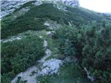 40
40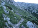 41
41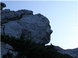 42
42 43
43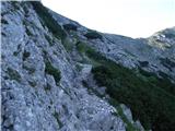 44
44 45
45 46
46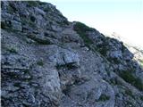 47
47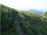 48
48 49
49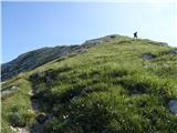 50
50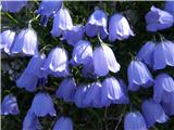 51
51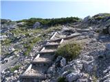 52
52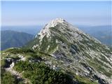 53
53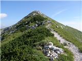 54
54 55
55 56
56
Discussion about the trip Tolminske Ravne - Vogel (on mule track)
|
| darinka430. 12. 2021 15:10:55 |
Yesterday 29.12. from Tolminske Ravne along the mulatjera to Planina Razor. Snow starts on the path below the planina. Up to here we didn't need winter equipment. The winter path to Vogel is known to us. But then there wasn't as much snow as now. Footprints were in the snow. Specifically more to the right, where you go in winter conditions. That's where we went. Since it was a cold morning, the snow was still okay and didn't break through. Footprints were all the way to the top, even though it was snowing in between. We didn't meet anyone. But the day was sunny. Only on the ridges it got a bit colder. On the descent the snow softened a bit. And caution was needed.
|
|
|
|
| ovi5. 06. 2023 20:36:39 |
8 days ago - great trail - only thing - it was Saturday - hut at Planina Razor closed - SPP stamp nowhere (by pure chance learned - it's in the so-called bivouac wtf) - website said otherwise - further to Vogel summit super (tons of blooming gentians etc) - pure enjoyment ) - summit not too crowded - mostly Hungarians and Czechs...
Recommend - our four-legged friend enjoyed it - suitable for dogs and children from 10 years up!
note: road from Tolmin to Tolminske Ravne is - mildly put - in sh...
|
|
|
|
| mirank6. 06. 2023 14:49:15 |
It's no coincidence that the stamp is in the bivouac when the hut is closed ; more coincidental that you have no experience, otherwise you'd know where to look ; more coincidental that you have no experience, otherwise you'd know where to look
|
|
|
|
| tulipan6. 06. 2023 19:26:05 |
those poor locals, right!
|
|
|
|
| funnyboy8. 06. 2023 13:24:36 |
The road to Tolminske Ravne is pure poetry 
|
|
|
|
| turbo8. 06. 2023 16:35:04 |
Yeah, especially on some cloudy foggy autumn day when it's pouring like crazy
|
|
|
|
| Tolminc9. 06. 2023 13:24:35 |
@mirank, nail on the head...
Regarding the road to Tolminske Ravne and to planina Stador, just this. Many, many years ago, the road to T. Ravne and to planina Stador, Lom and Podkuk was intended for locals and farmers who grazed livestock up here. There were no paragliders, autotourists and those that Garmin brings to these parts. It's being renovated and widened as much as possible, even the road to Čadrg isn't exactly "wide", yet people drive on it daily.
How it is elsewhere in Slovenia, I wouldn't even...
And my suggestion, if the roads to T. Ravne, to planina Podkuk and to planina Stador are too narrow and in sh.... you have the option to climb up there from Tolmin already. Everything is properly marked...
And safe steps
|
|
|
|
| ovi9. 06. 2023 16:24:09 |
@Miran and tulipan: - I'm just telling the truth - if logbooks and stamps can be (almost) everywhere attached to huts/peaks in aluminum/stainless steel boxes -...Experience?
Well, we can talk about that over tea (for you) and 2 dl for me ...
Locals have fu....d it up (however many still live up there permanently).
Have a nice weekend and safe steps!
|
|
|
|
| ovi9. 06. 2023 17:16:00 |
you're right (we use informal in the mountains). best regards
|
|
|
|
| ovi10. 06. 2023 19:05:56 |
@ Tolminc -
I think (as a collaborator with admin and trolls) you missed the point - hiking in the mountains has nothing to do with (political?) opinion - the truth is only one: - the path from Tolminske Ravne is beautiful, marked to the hut under Planina Razor and further to the top of Vogel. ; it is a fact - that on the Hribi.net forum you advertise the starting position from Tolminske Ravne (and you - of course - as a die-hard local recommend "pedestrian" from Tolmin (2 h min. on asphalt)- come on -
We didn't swim in the sour Styrian parish btw...( for that we need 2 days of vacation)
nice Sunday to all hikers - watch out for potholes (which have been there for quite some time, Styrian style...
and safe steps (so that mountain bikers don't run you over - who (wtf?) push bikes uphill to the hut (cheesery) next to the hut... well yeah (as yodelers would say)...
|
|
|
|
| ejas123411. 06. 2023 22:59:26 |
Hello
I took the path
Metalfleks Tolmin through Žabče to Koča na planini Razor in a bit more than three hours
|
|
|
|
| jprim11. 06. 2023 23:07:31 |
I read and read, but I really don't know why. Madonna, I'm stupid.
LP!
|
|
|
|
| jax12. 06. 2023 13:24:51 |
@ovi
No one is advertising any path. The path from Tolminske Ravne is simply described, which by no means means it's promoted in any way. Perhaps it's really only that the path from Tolmin isn't described, but it could be. That's true, but on the other hand anyone of us can tackle writing the description if they feel something is missing up here.
Secondly: the footpath from Tolmin towards planina Razor goes only a small part on asphalt. Mostly nicely routed paths.
Thirdly: yes, when I last drove towards Ravne (once this winter), there were works in the lower part and the road was quite dug up. Yes, we know it's narrow and winding, but it really looked like the road had seen better days otherwise too. But I agree, go slowly and you'll get there. To me this road still seems less problematic than the one to Jermanco, about which there are far fewer comments.
|
|
|
|
| mirank12. 06. 2023 13:40:37 |
Everything you wrote holds true, even the speed on this road is limited to 40km, I'd just add a sign below the sign saying If you dare
|
|
|
|
| ovi12. 06. 2023 14:48:54 |
@ mirank@jprim - please enlighten me - how to broach the topic "where with dog in SPP" - and - how to broach (create) a topic -?
thanks (about "ovi" your party, debate among yourselves...
lp
|
|
|
|
| turbo12. 06. 2023 16:43:31 |
You close your eyes and grip the steering wheel tighter . . .
|
|
|
|
| ppegan12. 06. 2023 18:28:48 |
@ Ovi, if you're already starting a new topic, at least make the title grammatically correct, i.e. Where to go with a dog on SPP (if it's the Slovenian Mountain Trail), if everything else flies by
|
|
|
|
| Jusk12. 06. 2023 21:12:13 |
Well, another dog topic looms for us
|
|
|
|
| ppegan13. 06. 2023 08:45:22 |
There's really no need for a new topic, as "Where with a dog?" already exists under General discussions, where SPP tours can also be posted. @ Ovi, I hope you take note
|
|
|
|
| darinka429. 04. 2024 22:14:25 |
We went today from the Ravne. We were the only hikers. The day was really beautiful.
|
|
|
|
| darinka41. 02. 2025 08:41:38 |
29.01.2025. From Tolminske Ravne. In a fairy-tale grayness we reached 1700 m altitude. We decided not to continue because visibility was very poor. There was quite a bit of snow on the path. Beautiful hike even without sun. On the road to Kozaršče we observed from the vehicle three deer crossing the road. They crossed very slowly. One after the other.
|
|
|
|
| darinka411. 12. 2025 07:22:07 |
10.12.2025 we were the only hikers. No tracks. We did it. The day was beautiful.
|
|
|
To post a comment you must log in:
If you do not yet have a username, you must first
register.