Tolminske Ravne - Zeleni vrh (via planina Razor)
Starting point: Tolminske Ravne (924 m)
| Latitude/Longitude: | 46,22940°N 13,77150°E |
| |
Route name: via planina Razor
Walking time: 4 h 20 min
Difficulty: difficult marked way
Elevation gain: 1128 m
Elevation difference along the route: 1245 m
Map: TNP 1:50.000
Recommended equipment (summer):
Recommended equipment (winter): ice axe, crampons
Views: 2.510
 | 1 person like this post |
Access to starting point:
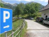
We drive to Tolmin, then continue driving in the direction of Žabče and Zadlaz (the turn-off from the main road is located on the left bank of the Tolminka). When we arrive in Žabče, at the smaller intersection we continue slightly to the right in the direction of the settlement Zadlaz. In the settlement Zadlaz-Žabče the road temporarily descends, where it crosses Zadlaščica over a bridge, then it again starts to ascend steeply on a narrow but continuously asphalted road. After approximately 12 km from the main road we arrive at the marked parking lot in Tolminske Ravne, where we park.
Route description:
From the parking lot, we head onto the path in the direction of the Koča na planini Razor hut and Planina na Kalu mountain pasture. Initially, we walk along a cart track that continues from the nearby house and leads us across a scenic meadow. On the other side of the meadow, we cross a grazing fence and the path takes us to a marked junction, where we continue on the lower right cart track (slightly left to Planina na Kalu).
Further on, we walk along the cart track, which descends slightly to the right, then levels out and continues for a few minutes without major changes in elevation. Beyond the concrete trough, the path splits once again, and we choose the left steep path (the path continuing straight also leads to Planina Razor, but it is longer and technically undemanding).
The path ahead starts ascending again, mostly towards the right, only occasionally making a hairpin turn. Higher up, we move onto steeper slopes, a bit further onto an exposed but, apart from the first few steps, well-secured ledge. When the traverse ends, the path temporarily returns to the forest, through which it ascends more steeply, then we exit the forest and the path levels out. From here, a few more minutes of walking follow with nice views of the mountains rising above the Zadlaščica river basin, and the path brings us past the cheese dairy to the Koča na planini Razor hut.
From the hut, we continue in the direction of Globoko, Vogel, Vrh nad Škrbino... along the path that crosses a strip of forest, then splits on a gentle grassy slope.
This time we continue straight in the direction of Vrh nad Škrbino and Dom na Komni (right: Vogel, Globoko and Črna prst), along the path that turns slightly to the left and then ascends a slope overgrown with dwarf pines. After a few minutes, the path temporarily levels out, then north of the indistinct peak Kopecko, after a short moderate ascent, it brings us to the next junction. We continue left in the direction of Škrbina saddle (right: Vrh nad Škrbino - south path). The path soon emerges from the dwarf pines onto interesting slopes, where on our right we will notice steep rock slabs forming an interesting wall for climbers, which is not overly steep. The path ahead ascends transversely across the scree to the Škrbina saddle, located at 1910 m.
When we step onto Škrbina, a nice view opens onto the Bohinj side, and at the junction we continue left in the direction of Kuka (right: Vrh nad Škrbino, straight down: Dom na Komni and Vogel ski slope). The path ahead begins to ascend transversely across steep slabs, then both the path and the slope level out somewhat. The path ahead passes below the short wall of Vrh Kont, then begins gently descending across occasionally steeper scree. Further on the Primorska side, the path crosses Podrto goro and Mali vrh, then returns to the main ridge of the Spodnje Bohinjske gore, which it reaches right at the saddle between Mali vrh and Zeleni vrh. From here we continue in the same direction, only the path moves from the slopes onto a locally exposed ridge. We follow the marked path, which occasionally ascends quite steeply, then with ever better views, all the way to the grassy Zeleni vrh.
Tolminske Ravne - planina Razor 1:15 planina Razor - Škrbina 2:00, Škrbina - Zeleni vrh 1:05.

Photos:
 1
1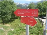 2
2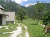 3
3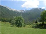 4
4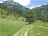 5
5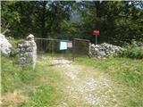 6
6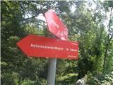 7
7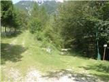 8
8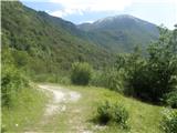 9
9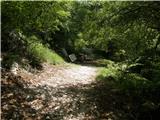 10
10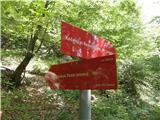 11
11 12
12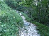 13
13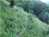 14
14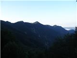 15
15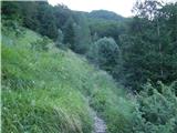 16
16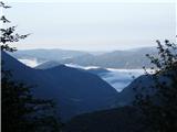 17
17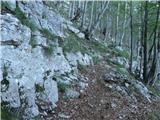 18
18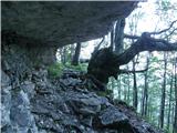 19
19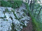 20
20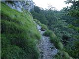 21
21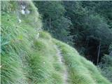 22
22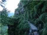 23
23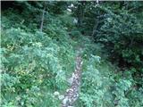 24
24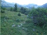 25
25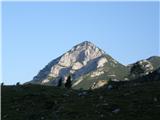 26
26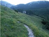 27
27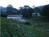 28
28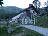 29
29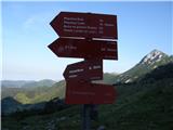 30
30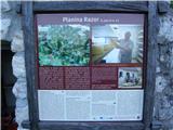 31
31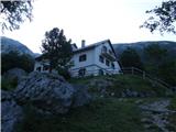 32
32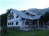 33
33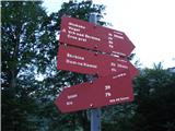 34
34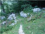 35
35 36
36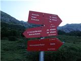 37
37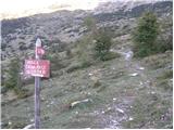 38
38 39
39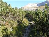 40
40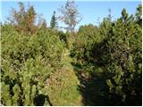 41
41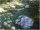 42
42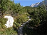 43
43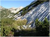 44
44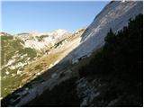 45
45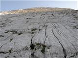 46
46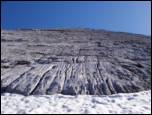 47
47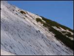 48
48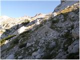 49
49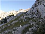 50
50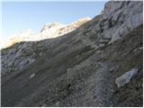 51
51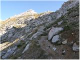 52
52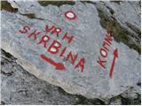 53
53 54
54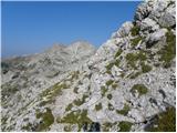 55
55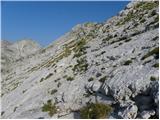 56
56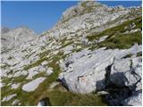 57
57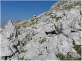 58
58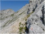 59
59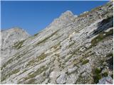 60
60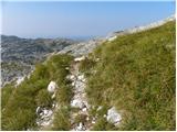 61
61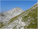 62
62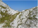 63
63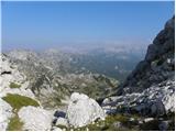 64
64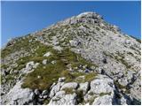 65
65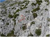 66
66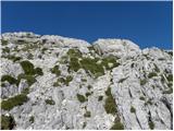 67
67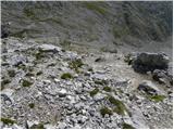 68
68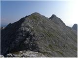 69
69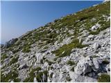 70
70 71
71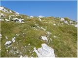 72
72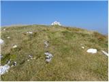 73
73 74
74
Discussion about the trip Tolminske Ravne - Zeleni vrh (via planina Razor)
|
| darinka42. 03. 2022 07:19:30 |
In summer I know this path. But now in the snow, not. We avoided planina Razor and headed up the steep slope on the shorter path. Below Škrbinska plošča, we turned left towards Kuka. Winter Zeleni vrh is a destination for skiers. And on foot it's also nice to reach via the winter path, if the snow is right for walking. And yesterday it was.
|
|
|
|
| darinka410. 01. 2023 21:44:15 |
Well, today we went along the known trail. After the snowfall, we roughly knew we'd have to break trail. That there would be wind at the summit was announced by the forecasters yesterday. And the last part icy and demanding. Views today stunning. Snow starts at the sign. Quite a bit has accumulated. Conditions mixed. We met no one.
|
|
|
To post a comment you must log in:
If you do not yet have a username, you must first
register.