Tomšičeva cesta (Jesenice) - Jelenkamen (via Šporn)
Starting point: Tomšičeva cesta (Jesenice) (600 m)
Route name: via Šporn
Walking time: 1 h 15 min
Difficulty: partly demanding unmarked way
Elevation gain: 496 m
Elevation difference along the route: 496 m
Map: Karavanke - osrednji del 1:50.000
Recommended equipment (summer):
Recommended equipment (winter): ice axe, crampons
Views: 3.133
 | 3 people like this post |
Access to starting point:
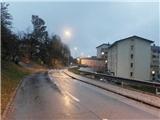
From the highway Ljubljana - Jesenice we take the exit Lipce, where we turn right towards Jesenice. In the settlement Slovenski Javornik, at the intersection with traffic lights we turn left towards the center of the town. At the second traffic light intersection (at the gymnasium) we turn sharply right, back along Tomšičeva cesta, past the primary school on the left. After a little less than a kilometer of driving, when the road is slightly descending, we arrive near the former store on Tomšičeva cesta (today bife "Čavs bar"). About 20 meters before that structure we notice the pedestrian crossing, which we will use on the path towards Jelenkamen. We park at an appropriate place nearby (or a few 100 meters ahead, below the hill, near the railway on the large turning area).
Route description:
We cross the road on the mentioned pedestrian crossing, and continue straight uphill on a steep asphalt road which leads us past a few houses. When the road flattens and crosses the stream, we will at the right turn by the first house on the left side notice a footpath which ascends uphill towards the north. We leave the road and step on this path, which moderately ascends towards the forest. We soon run into the fenced water catchment Šporen with the year 1957, and the path (at first cart track) by the streambed of the stream brings us into the forest, where we cross one of the branches of the stream. Our path by the cart track turns slightly to the right (cart track turns left) and for the second time crosses the stream, by which it ascends uphill. Near the source of the mentioned stream, the path again turns right and soon brings us onto a flat area with a junction. Here we go left towards the north, on gentle terrain by the edge of the clearing, where we ignore the left turn-off. When the path starts to slightly ascend, it first holds a little to the left, but soon turns sharply right and continues ascending in zigzags. After some time at the top of the southeast ridge of Jelenkamen the path briefly flattens, and then continues straight uphill towards the north. A little higher (at the lying trunk) the path turns sharply left, where it first crosses a somewhat steeper slope, then brings us to a small ridge, where there is a partly open space which offers a view of the Julian Alps and one of the viewpoints on the south slope of Jelenkamen. Here our path turns right (straight is the hunting path), quite steeply uphill and after a few hairpin turns it completely flattens. Only a few meters after that we will with some attention notice the left turn-off, onto which we head. Now after a gentle descent a somewhat poorly visible flat path among some rocks leads below the steep southeast slope of Jelenkamen, where we also encounter a few cairns. Then after a gentle and short ascent our path turns a little to the right and soon joins the marked path from Ukova. Here we go sharply right, steeply on the marked path towards the summit. After a short ascent we also get help from about 10 m of steel cable. Then, when the steepness briefly eases and views start opening up, the path for the last time steeply ascends towards the summit of Jelenkamen, where there are a bench and a box with a summit logbook on one of the trees. Here the view opens towards the Ljubljana Basin, Jesenice, Karawanks, Ratitovec and Mežakla, and Julian Alps with Triglav.

Photos:
 1
1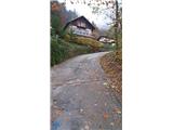 2
2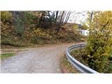 3
3 4
4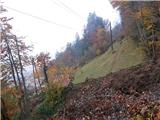 5
5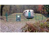 6
6 7
7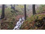 8
8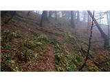 9
9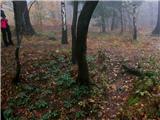 10
10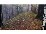 11
11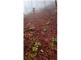 12
12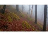 13
13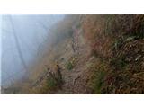 14
14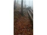 15
15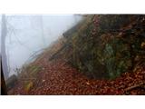 16
16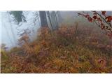 17
17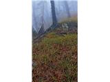 18
18 19
19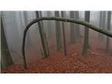 20
20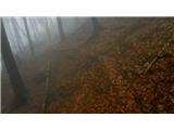 21
21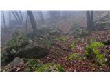 22
22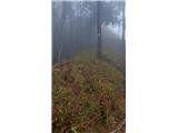 23
23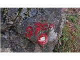 24
24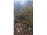 25
25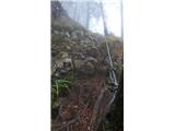 26
26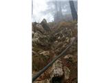 27
27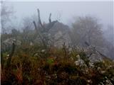 28
28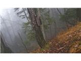 29
29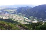 30
30
Discussion about the trip Tomšičeva cesta (Jesenice) - Jelenkamen (via Šporn)
|
| TrmaD19. 04. 2020 |
Today from Tomšičeva cesta via Jelenkamen to Pristava. However, via a slightly different initial part of the path.
From the Šporna spring, we cross only the first "channel" of the stream and a few meters higher we turn left along the trough and dry stream bed. From here we continue along the well-trodden path to the newly built forest road. On the road, we turn left towards the clearing with the spruce forest. We cross the clearing eastwards and past an interesting viewpoint along the well-trodden path continue to the marked path from Kalvarija. The path across the clearing to the path from Kalvarija is marked with yellow dots – local hiking path.
There were many people at Jelenkamen. Quite a few of them, with poor footwear, without poles, obviously unused to such paths, had great difficulties coming down from Jelenkamen towards Jesenice. Continuing towards Pristava, we didn't meet anyone.
However, the description of the path Tomšičeva cesta (Jesenice) - Jelenkamen (via Šporna) is quite outdated, as the former "Čavs bara" no longer exists for quite some years.
|
|
|
|
| Jusk19. 02. 2021 |
Jelenkamen has quite a few paths that only some know or you're lucky to find them most know the "duckboards path" which goes a bit further from Kalvarija towards Trebež, but there is also another path about 100-150m higher which is also marked with yellow dots like PPP, the start of the path is hidden along the marked path from Ukova, a bit further from the junction to Trebež, almost flat path crosses the steep slopes of Jelenkamen and later joins the unmarked path from Šporna.. in between on this path there is also a junction down to the duckboards path (PPP) most know the "duckboards path" which goes a bit further from Kalvarija towards Trebež, but there is also another path about 100-150m higher which is also marked with yellow dots like PPP, the start of the path is hidden along the marked path from Ukova, a bit further from the junction to Trebež, almost flat path crosses the steep slopes of Jelenkamen and later joins the unmarked path from Šporna.. in between on this path there is also a junction down to the duckboards path (PPP)
|
|
|
|
| Jusk20. 02. 2021 |
at picture 21 you don't need to take the left fork, you can also go straight on the path which joins the marked Jelenkamen-Pristava path after a few minutes of walking. We reach this marked path on the ridge a few minutes further from JK, so on the ridge turn left if the goal is JK. Picture 18 shows the fork of the path I mentioned yesterday, this path crosses the slopes and eventually joins the marked path a little further from Kalvarija
|
|
|
|
| heinz20. 02. 2021 |
Of course Jusk. There are a few more paths than descriptions. The one described above is just one of the variants. Considering that it is a wildlife habitat, there were too many descriptions submitted from my side. They happened at a time when not everyone was tempted up there, today the situation is quite different. Such a rush was not foreseen back then..
|
|
|
|
| Jusk20. 02. 2021 |
well I've been walking around here for quite a few years and sometimes exploring little paths, it's nice to go on one where you don't meet people, but it's true that there were a lot more people at least on marked paths last year, consequently also trash in the forest which really annoys me
|
|
|
To post a comment you must log in:
If you do not yet have a username, you must first
register.