Trbiž / Tarviso - Kamniti lovec / Cima del Cacciatore (on transport road)
Starting point: Trbiž / Tarviso (835 m)
| Latitude/Longitude: | 46,49690°N 13,57950°E |
| |
Route name: on transport road
Walking time: 4 h 25 min
Difficulty: easy unmarked way, difficult marked way
Elevation gain: 1236 m
Elevation difference along the route: 1340 m
Map: Julijske Alpe - zahodni del 1:50.000
Recommended equipment (summer): helmet
Recommended equipment (winter): helmet, ice axe, crampons
Views: 3.630
 | 1 person like this post |
Access to starting point:
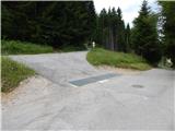
A) Via the Rateče border crossing we drive to Trbiž / Tarvisio, then at the beginning of the mentioned settlement we continue left in the direction of Bovec. When after a few hundred meters of further driving we reach the main road Trbiž - border crossing Predel, we only cross the mentioned road and continue driving in the direction of the golf course Golf Club Tarvisio. Further, we drive on the street Via Priesnig, where in the left bend a road branches off to the right towards the parking lot of the golf course. We continue on the main road which leads along the courses, on it we drive a few hundred meters more, or to the spot where the road starts descending. Here a road branches off to the left, which immediately splits. At the mentioned crossroad the described path begins, but there are no arranged parking spots.
B) Via the Predel border crossing we drive to Italy and continue driving towards Trbiž / Tarvisio. Before we enter the center of Trbiž, a road towards Kranjska Gora branches off to the right, but we continue left here, on the road in the direction of the golf course Golf Club Tarvisio. Further, we drive on the street Via Priesnig, where in the left bend a road branches off to the right towards the parking lot of the golf course. We continue on the main road which leads along the courses, on it we drive a few hundred meters more, or to the spot where the road starts descending. Here a road branches off to the left, which immediately splits. At the mentioned crossroad the described path begins, but there are no arranged parking spots.
Route description:
From the starting point we continue towards the west on the road closed to public traffic. Soon after the traffic sign the asphalt ends, and we moderately ascend on the road all the way to the junction with the ski slope. When we reach the ski slope we turn sharply left and continue the path on the service road, which continues across the ski slope. During the ascent some views occasionally open up to us, otherwise it is mostly obscured by the nearby forest. Higher up we leave the ski slope route for a while, but when we return to the ski slope beautiful views open up on the Julian Alps and the western Karawanks. After about an hour and a half of walking we arrive at the transmitters on the indistinct summit Breznik.
Here the road and ski slope turn to the southwest, where we bypass the accumulation reservoir on the right side. A few minutes of gentle ascent follow, then the service road becomes steeper, and from the path increasingly beautiful views open up, reaching across the Kanal Valley to the Carnic Alps, higher up even farther. We continue ascending on the service road, which runs across the ski slope, occasionally alongside it. Higher, when the road levels out, we reach the summit of Florjanka.
From Florjanka we continue straight and begin descending towards the southwest on the service road. After a short descent we arrive at the covered conveyor belt, where the path temporarily ascends slightly, then starts descending again. Another good 10 minutes of moderate descent follow, then the path levels out and only a slight ascent separates us from Višarska planina.
From Višarska planina we ascend on the service road first gently, then more steeply. During the ascent beautiful views open up on the left side towards Beraški križ, higher up we quickly reach the larger chapel on Višarsko sedlo, from where we continue left on the footpath in the direction of Kamniti lovec (straight to Zajzera, right to Svete Višarje).
From the saddle we ascend slightly, then the path continues for some time without major changes in elevation, or only slightly ascending. Further on the path begins to ascend moderately, higher up it ascends transversely across the slopes of Beraški križ, the summit we see to the left of the path. After a longer traverse to the right a shorter somewhat steeper section follows, then the path brings us into the basin V Klobuku, where the path temporarily levels out and turns more to the right again. When the path starts ascending again it turns left, then leads us across scree fields over which we walk all the way to the start of the more demanding section.
At the beginning of the secured section an arrow on the rock directs us right, where with the help of the steel cable we begin to ascend steeply. After a shorter steep ascent, the well-secured path turns right and ascends transversely to the gravelly gully, into which we descend along the still secured path. An ascent through the gully follows, where we must be very careful not to dislodge rocks, as a hiking path runs below us and every rock can be dangerous for numerous hikers below us, and likewise we must watch out for falling rocks dislodged by hikers above us. During the ascent through the gully, which is not particularly technically demanding, the steel cable also assists us at a few points. At the top of the gully we reach the ridge, where we continue right, then along the steep path in one minute of further walking we reach the panoramic summit.
Trbiž - Florjanka 2:30, Florjanka - Višarska planina 25 minutes, Višarska planina - Kamniti lovec 1:30.
Description and pictures refer to the condition in 2017 (July).

Photos:
 1
1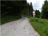 2
2 3
3 4
4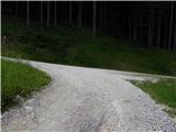 5
5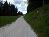 6
6 7
7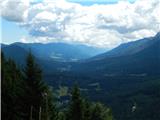 8
8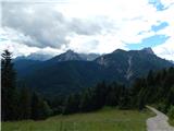 9
9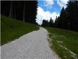 10
10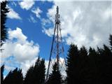 11
11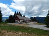 12
12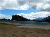 13
13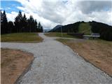 14
14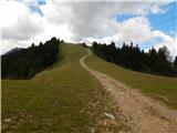 15
15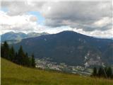 16
16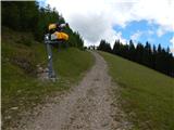 17
17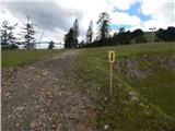 18
18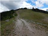 19
19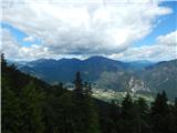 20
20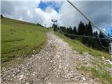 21
21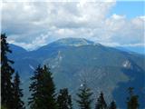 22
22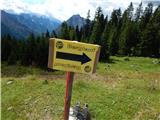 23
23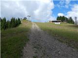 24
24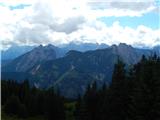 25
25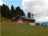 26
26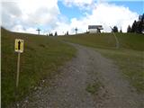 27
27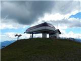 28
28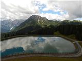 29
29 30
30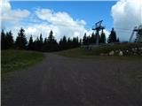 31
31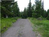 32
32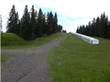 33
33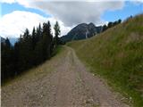 34
34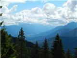 35
35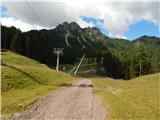 36
36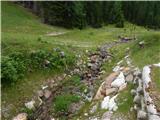 37
37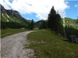 38
38 39
39 40
40 41
41 42
42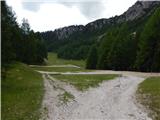 43
43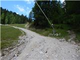 44
44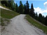 45
45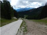 46
46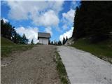 47
47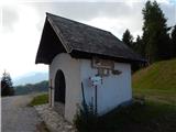 48
48 49
49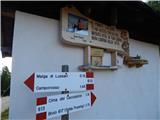 50
50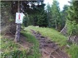 51
51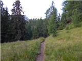 52
52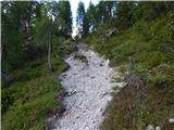 53
53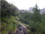 54
54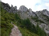 55
55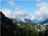 56
56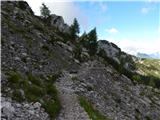 57
57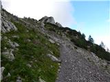 58
58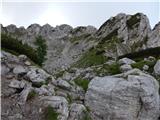 59
59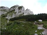 60
60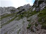 61
61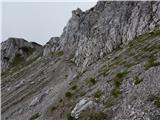 62
62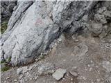 63
63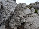 64
64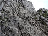 65
65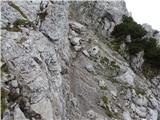 66
66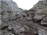 67
67 68
68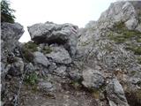 69
69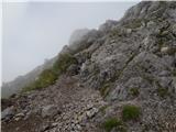 70
70 71
71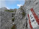 72
72 73
73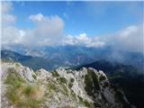 74
74
Discussion about the trip Trbiž / Tarviso - Kamniti lovec / Cima del Cacciatore (on transport road)
To post a comment you must log in:
If you do not yet have a username, you must first
register.