Tremerje - Veliki Slomnik (through gorge Potoki)
Starting point: Tremerje (231 m)
| Latitude/Longitude: | 46,19538°N 15,23067°E |
| |
Route name: through gorge Potoki
Walking time: 1 h 15 min
Difficulty: easy unmarked way, easy marked way
Elevation gain: 378 m
Elevation difference along the route: 390 m
Map: Celjska kotlina, 1:50000
Recommended equipment (summer):
Recommended equipment (winter):
Views: 3.160
 | 2 people like this post |
Access to starting point:
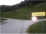
Tremerje is a settlement between Celje and Laško. From the direction of Celje on the way to Laško before the inn Hochkraut at the crossroads we turn right towards Tremerje. In the opposite direction of the turn at the crossroads there is a bridge over the Savinja, where on the other side of the Savinja there is the central wastewater treatment plant Celje, financed by EU funds, which is shown on the bulletin board. From the direction of Laško at that crossroads we turn left. Immediately after the turn the settlement is marked with the sign "Tremerje". We continue on the main road into the left bend, then straight through the settlement approx. 1 km towards the south, until we get to a large parking lot on the left side just by the railway. Near the parking lot on the opposite side of the road there is a sign for the Žerdonerjeva planinska pot to "Veliki Slomnik". Even otherwise, continuing further with the car no longer makes sense, because approx. 300 meters ahead the flat part of the road ends; once there was the Tremerje underpass, which was flooded several times.
Route description:
From the parking spot we set off along the asphalt road further south in the direction of Laško for only about 30 meters, to the first branch-off to the right into the forest, where the signpost for Veliki Slomnik also directs us. The path starts on a macadam forest road that runs alongside the stream in the gorge named Potoki, into which smaller streams from Mali Slomnik on the left and Veliki Slomnik on the right flow. We follow the marked path for only about 100 meters, until we reach the branch-off, where the so-called Žerdonerjeva pot to Veliki Slomnik continues to the right. We continue straight along the stream through the gorge. The road slowly turns into a cart track, which begins to ascend moderately. After 1.45 km of walking from the starting point, about 200 meters before the end of the gorge and right before the power line above us, a smaller path branches off slightly to the right upwards from the cart track; for recognizability, a stone cairn is placed at this junction. We continue on the smaller path; after a sharp left turn by the power line pylon, a view opens up on Mali Slomnik. We continue to the right, a few meters also slightly downwards, then again after a sharp left turn an even more beautiful view opens up on the southern hills, and at the same time also on the previously mentioned power line pylon. We continue to the right and slightly upwards, until we reach a junction with a cross, from where a marked path along the forest road from Liboj towards Veliki Slomnik comes from the left.
We continue right on the marked path. Soon a new pylon of the previously mentioned power line greets us on the left. The forest road turns into a narrower forest path, where we continue the ascent higher through somewhat more rocky terrain. Soon we reach the wonderful viewpoint Libojska stena, where we can rest our eyes with beautiful views of the nearby surroundings and also the somewhat distant world. After the views, a few more minutes of pleasant easy continuation along the ridge in the eastward direction, and we reach the summit of Veliki Slomnik, where a table with benches, new signposts (2020), a logbook, and a stamp await us.

Photos:
 1
1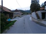 2
2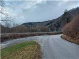 3
3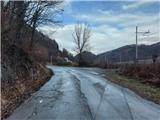 4
4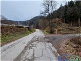 5
5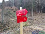 6
6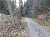 7
7 8
8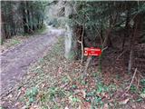 9
9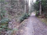 10
10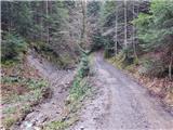 11
11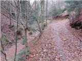 12
12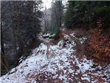 13
13 14
14 15
15 16
16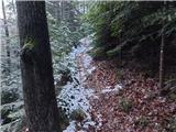 17
17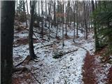 18
18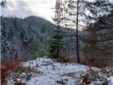 19
19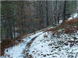 20
20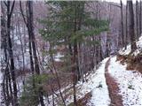 21
21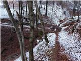 22
22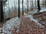 23
23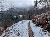 24
24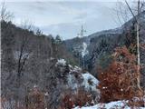 25
25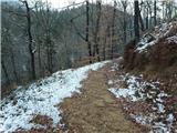 26
26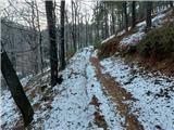 27
27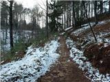 28
28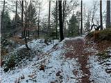 29
29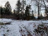 30
30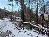 31
31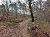 32
32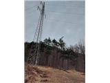 33
33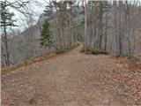 34
34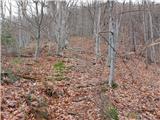 35
35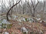 36
36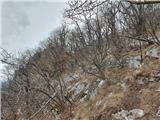 37
37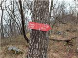 38
38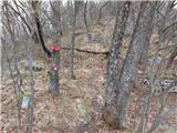 39
39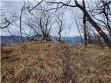 40
40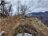 41
41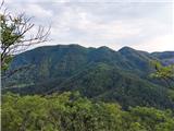 42
42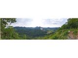 43
43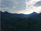 44
44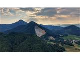 45
45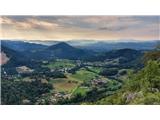 46
46 47
47 48
48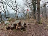 49
49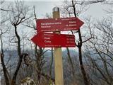 50
50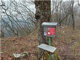 51
51 52
52
Discussion about the trip Tremerje - Veliki Slomnik (through gorge Potoki)
|
| janez52011. 03. 2021 |
I did find the junction on picture 13, but the path continuation does not match the description and pictures. You reach a stream where the path ends.
Also this path is very overgrown with spruces, obviously no one maintains it.
|
|
|
|
| zdejan11. 03. 2021 |
Hm. This described path is still fresh, so it couldn't have become overgrown by today. However, it's not marked, so you probably mistakenly turned onto some other smaller branch. If you continue straight along the cart track to the end of the gully, you can only go left up the hill, where higher up the path joins the marked path Tremerje - Šmohor.
|
|
|
|
| zdejan26. 04. 2021 09:43:00 |
For better recognizability, I placed a stone man at the junction in picture 13, and in pictures 14-16 I showed the junction even more precisely. Good luck to all hikers!
|
|
|
To post a comment you must log in:
If you do not yet have a username, you must first
register.