Starting point: Trkulji (610 m)
| Latitude/Longitude: | 44,43440°N 15,61680°E |
| |
Walking time: 45 min
Difficulty: difficult marked way
Elevation gain: 240 m
Elevation difference along the route: 260 m
Map:
Recommended equipment (summer):
Recommended equipment (winter):
Views: 2.260
 | 5 people like this post |
Access to starting point:
We leave the highway Zagreb-Split at exit Gornja Ploča. We go in the direction of Udbina, but only about a hundred meters from the toll station, where we go right in the direction of Lovinac and then at the next crossroad we go again right (after the crossroad there is a small bridge with a blue fence). At the next crossroad, we go left on macadam and then through the underpass below the highway. From here, every next crossroad is marked with tourist signposts, and also the orientation is easy because Zir is exactly in front of us. We park at an appropriate place at the turning point for buses a little before the village Trkulji.
Route description:
From the starting point, we quickly get to the village Trkulji, where a red signpost points us into the forest, where we at first gently ascend towards the west. When we leave the forest, the path turns towards the south, and then through a meadow we ascend back into the forest. Here we go past the entrance into a cave, which continues below a larger part of the hill and ends with a large underground lake. Above the entrance into the cave, we again leave the forest, and the path turns towards the east and becomes technically a little more demanding, the ground more rocky. Next follows a steep ascent and we soon reach the secondary peak, from which an outstanding view opens up on Ličko polje.
From the secondary peak follows a slight descent to a smaller saddle between the two peaks, where especially in wet conditions there is a greater danger of slipping. The path ahead takes us to the northern slopes, where the path becomes technically demanding, and leads us through a low forest and a strip of bushes. On this part we get some help from steel cables, which are in bad condition (data from the year 2020), and the most difficult part is the rock before we step out of the forest onto the summit slope of the mountain. Here we first bypass the summit on the right side, and then ascend along a trail to the panoramic summit.
The summit is not particularly spacious, there is space for around 10 people. Despite the relatively low altitude, the summit offers a very nice view in all directions.
I do not recommend the described path when it is wet.

Photos:
 1
1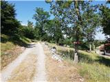 2
2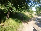 3
3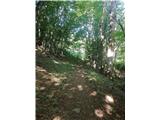 4
4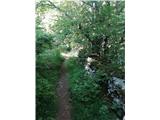 5
5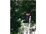 6
6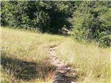 7
7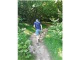 8
8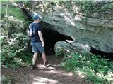 9
9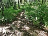 10
10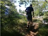 11
11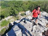 12
12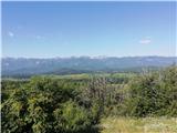 13
13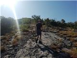 14
14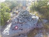 15
15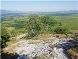 16
16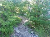 17
17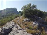 18
18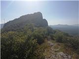 19
19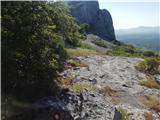 20
20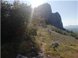 21
21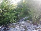 22
22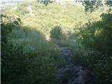 23
23 24
24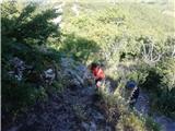 25
25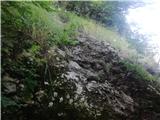 26
26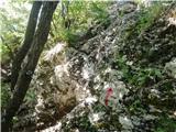 27
27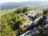 28
28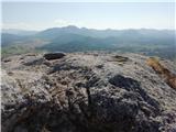 29
29
Discussion about the trip Trkulji - Zir
|
| Marx7. 07. 2021 09:56:03 |
Recently, the end of the path has been slightly secured. Now, somewhere around picture 28, a short micro via ferrata with steel cable and pegs has been made, and it ends exactly at the top. The other cables have also been renewed. The markings have faded a bit, but the path is so well-trodden that it's impossible to miss.
|
|
|
To post a comment you must log in:
If you do not yet have a username, you must first
register.