Starting point: Turjak (550 m)
| Latitude/Longitude: | 45,87640°N 14,61280°E |
| |
Walking time: 10 min
Difficulty: easy marked way
Elevation gain: -28 m
Elevation difference along the route: 15 m
Map:
Recommended equipment (summer):
Recommended equipment (winter):
Views: 3.269
 | 2 people like this post |
Access to starting point:
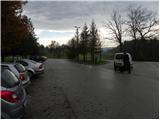
From Ljubljana, we drive towards Kočevje or vice versa, and we follow the road to the settlement Turjak. When we get to Turjak we continue right (from the direction Kočevje left) and then we park on a large parking lot by the cooperative home (Zadružni dom).
Route description:
From the parking lot, we go on an asphalt road in the direction of the castle Turjak. The road at first leads us past the cooperative home, and then we get to a marked crossing, where left downwards a marked path branches off towards Kurešček, and we continue straight on the asphalt road which gradually starts descending through the village. From the path soon a nice view opens up towards the castle, and a little lower, the path branches off to the right towards the waterfalls Bajdinški slapovi. Here we continue straight, and then at the next crossroad left towards the castle, which we reach after a shorter gentle ascent.
Photos:
 1
1 2
2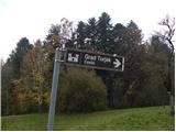 3
3 4
4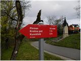 5
5 6
6 7
7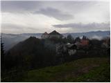 8
8 9
9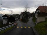 10
10 11
11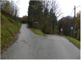 12
12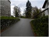 13
13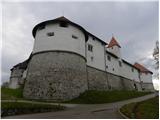 14
14 15
15
Discussion about the trip Turjak - Turjak Castle
To post a comment you must log in:
If you do not yet have a username, you must first
register.