Turkov rovt (Vrata) - Triglav (via Za Cmirom)
Starting point: Turkov rovt (Vrata) (941 m)
| Latitude/Longitude: | 46,41790°N 13,85800°E |
| |
Route name: via Za Cmirom
Walking time: 6 h 25 min
Difficulty: easy pathless terrain, very difficult marked way
Elevation gain: 1923 m
Elevation difference along the route: 2020 m
Map: Triglav 1:25.000
Recommended equipment (summer): helmet, self belay set
Recommended equipment (winter): helmet, self belay set, ice axe, crampons
Views: 61.089
 | 2 people like this post |
Access to starting point:
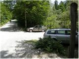
We leave the Gorenjska motorway at the Hrušica exit and follow the road further in the direction of Kranjska Gora. Just a little before the village of Dovje, a road branches off to the left from the main road, which leads to Mojstrana (Vrata, Kot and Krma). We continue along the road in the direction of the Vrata valley and drive along it to the road sign approximately 10.5 km. Here, on the left side of the road, we will see a smaller parking lot and a road that crosses the river. We park in such a way that we do not block the passage across the river (Triglavska Bistrica).
Route description:
From the parking lot we first cross the Bistrica river, then on the other side we head onto the footpath that moderately ascends through the forest (we do not continue on the worse road or along the Triglavska Bistrica Path). A little higher, a likewise unmarked path joins us from the right, which leads from Aljažev dom. We continue left and follow the clearly visible trail all the way to the extensive scree fields above the tree line. Here a path from the lower starting point joins us from the left almost imperceptibly, we continue slightly right along the well-trodden trail.
The path in continuation turns right and ascends on the scree to the foot of the walls. Along them we turn left and traverse ascending on the rubble. Higher we reach the belt of dwarf pines, where a somewhat less visible trail turns towards the left side of the valley (viewed in the direction of ascent). We continue across the steeper scree, then the path levels and brings us into the upper part of the Za Cmirom valley.
Here the trail becomes less distinct again, so we head to the right side of the valley, where we quickly notice a less trodden but followable trail. This traverses ascending towards the saddle on the right (northern) side of Begunjski vrh. Approximately 15 minutes below the saddle the trail completely disappears, so we continue the ascent along the steeper gully that brings us to the mentioned saddle.
At the saddle we step onto the marked path Staničev dom – Cmir. We follow it left and after a short traversing ascent we reach Begunjska vratca. From there we continue in the direction of Staničev dom, which we reach after 10 minutes of further walking.
We continue in the direction of Triglav and Triglavski dom na Kredarici (sharply left Kot valley, left Rjavina along the ridge path and Krma valley, right Vrata valley). The path soon turns slightly left and continues south in the direction of the nearby Rž. When we reach the scree under Rž, the path turns right and traverses ascending. Later a passage opens to the left towards the summit of Rž, we follow the marked path that approaches more and more the ridge between Rž and Kredarica. Here the path becomes technically more demanding and in places exposed, on the harder places the fixed protections help us. A short unsecured descent follows through crumbling terrain, then we transition to a panoramic and occasionally exposed ridge. When we approach the summit of Kredarica, the ridge widens, and we reach the cairn on the summit without major difficulties.
Behind the summit of Kredarica the path levels and turns left, then in a few minutes we descend to Triglavski dom na Kredarici, which stands above the chapel of Marije Snežne.
From the hut we continue in the direction of Triglav (left Krma and Pokljuka, right Vrata valley). Along a technically still undemanding path we descend to Ledeniški preval, from where we begin to ascend towards the wall of Mali Triglav. We follow the markings to the entry into the wall, where the very demanding path begins.
Initially we ascend on a moderately steep slope with the help of pegs and steel cables. When we enter the wall of Mali Triglav, we begin to traverse ascending to the left; the path is here well secured with steel cables that allow self-belaying. This is followed by some steep and exposed ascents, where great caution is needed against slipping. On the parts where there is scree on the path, we take care not to dislodge stones, as this is deadly dangerous for mountaineers below us. The path is quite narrow here, so during high traffic there are often queues when meeting.
Higher up the steepness eases and from the left the path from Dom Planika joins us. Shortly thereafter we reach the summit of Mali Triglav.
From Mali Triglav follows a short descent along an occasionally exposed ridge. When we start ascending again, the ridge narrows, the path becomes precipitous on both sides. In continuation there are still some steep ascents that are well secured with steel cables and pegs. Below the summit the path becomes somewhat less demanding, but remains exposed. Just below the summit a path branches left towards Staničevo zavetišče, and with careful walking on the last meters of the less steep path we reach Aljažev stolp on the summit of Triglav, the highest mountain in Slovenia.
Starting point - Dom Valentina Staniča 4:10, Dom Valentina Staniča - Kredarica 0.55, Kredarica - Triglavski dom na Kredarici 0:05, Triglavski dom na Kredarici - Ledeniški preval 0:05, Ledeniški preval - Mali Triglav 0:35, Mali Triglav - Triglav 0:35.

Photos:
 1
1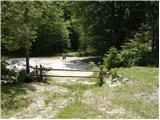 2
2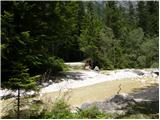 3
3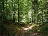 4
4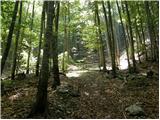 5
5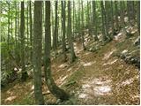 6
6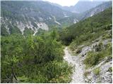 7
7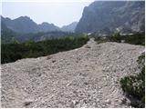 8
8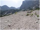 9
9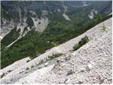 10
10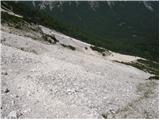 11
11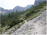 12
12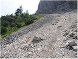 13
13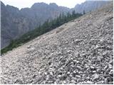 14
14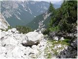 15
15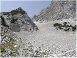 16
16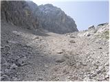 17
17 18
18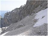 19
19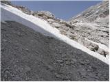 20
20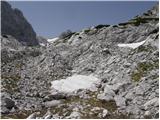 21
21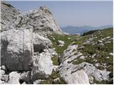 22
22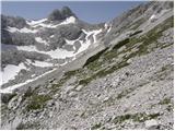 23
23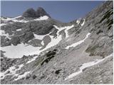 24
24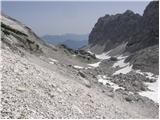 25
25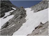 26
26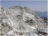 27
27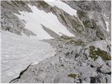 28
28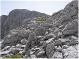 29
29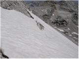 30
30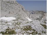 31
31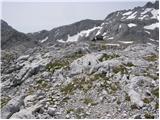 32
32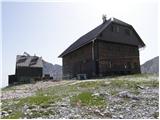 33
33 34
34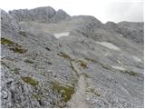 35
35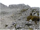 36
36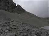 37
37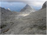 38
38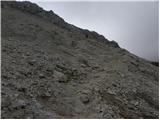 39
39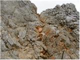 40
40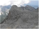 41
41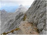 42
42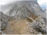 43
43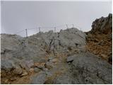 44
44 45
45 46
46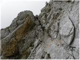 47
47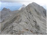 48
48 49
49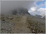 50
50 51
51 52
52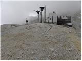 53
53 54
54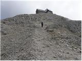 55
55 56
56 57
57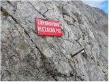 58
58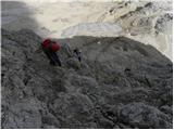 59
59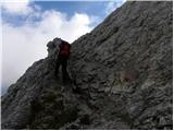 60
60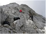 61
61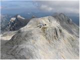 62
62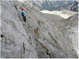 63
63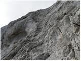 64
64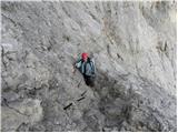 65
65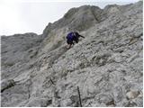 66
66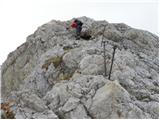 67
67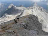 68
68 69
69 70
70 71
71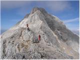 72
72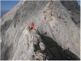 73
73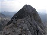 74
74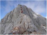 75
75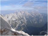 76
76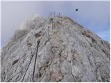 77
77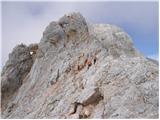 78
78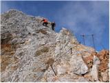 79
79 80
80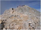 81
81 82
82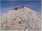 83
83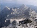 84
84 85
85
Discussion about the trip Turkov rovt (Vrata) - Triglav (via Za Cmirom)
|
| Virenque29. 06. 2010 |
Easy pathless terrain to the top of Triglav? Well, that's something new.
|
|
|
|
| Gorazd G29. 06. 2010 |
To me this doesn't seem like anything new. After the words "easy pathless terrain" there's a comma and then something else is written ... 
|
|
|
|
| Suriljana4. 09. 2013 |
The mentioned "pathless" route is the easiest and technically least demanding variant for the return from Staniča to Vrata. I put in quotes because the path (at least this year) is very visible, marked with cairns - you basically can't miss it. From Staniča go in the direction of Cmir and immediately when the path turns behind Begunjski vrh, a path branches off the marked trail directly down the scree - then keep left in the valley below Cmir. It's mostly a scree path, so you're in Vrata very quickly if you "slide" a bit. You arrive in Vrata at the road sign 10.5 km, so then another 1 km walk to the car. But I recommend it exclusively for descent, as uphill on scree the rule is 3 steps up, 2 down.
|
|
|
|
| Janez Seliškar4. 09. 2013 |
During the descent through the forest, we pass the left branch, hunting path, which takes us to the bed of Triglavska Bistrica. We cross it, then a nice forest path on the left takes us to Anceljnov rovt. From there we have just a few dozen meters to the parking lot in front of Aljažev dom. This way we avoid walking on the road from Turkov rovt to the parking lot in front of Aljažev dom.
|
|
|
|
| lepenatka25. 10. 2013 |
Hi,
does anyone have any information about the path through the valley Za Cmirom?
Any info welcome.
|
|
|
|
| matic46. 08. 2018 |
The path through the valley Za Cmirom is clearly visible, plenty of cairns. In the initial/upper part (looking downhill) stay as far left as possible (right are cliffs).
|
|
|
To post a comment you must log in:
If you do not yet have a username, you must first
register.