Türlwandhütte - Dachstein Südwand Hütte
Starting point: Türlwandhütte (1695 m)
| Latitude/Longitude: | 47,45010°N 13,61762°E |
| |
Walking time: 40 min
Difficulty: easy marked way
Elevation gain: 215 m
Elevation difference along the route: 215 m
Map:
Recommended equipment (summer):
Recommended equipment (winter):
Views: 3.190
 | 2 people like this post |
Access to starting point:
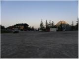
Through the Karawanks Tunnel, we drive into Austria, then continue driving on the Tauern motorway. Further, we drive through the Katschberg Tunnel and later also the Tauern Tunnel / Tauerntunnel, and we follow the motorway towards Salzburg only to the exit for Radstadt, Schladming. We continue on the road to the town of Schladming where we then turn left onto the ascending road following the signs for Ramsau. In the town of Ramsau, we continue a good 2 km on the mentioned road, then turn right onto the toll road, where signs for the gondola cable car direct us. We follow this road all the way to the large parking lot in front of the lower station of the gondola cable car.
Route description:
From the parking lot, we continue past the lower station of the cable car following the signs to Südwandhütte. The path first leads along the right side of the cable car through a sparse larch forest, later turns left and crosses the slopes towards the west. Soon a path branches off to the right towards the climbing garden (Klettergarten). We continue crossing the slopes towards the west and from the left a path from the lower starting point joins us. From the junction, there then follows approximately 10 minutes of walking along the scenic slope to the Südwandhütte hut.
Photos:
 1
1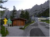 2
2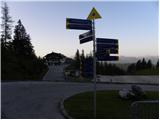 3
3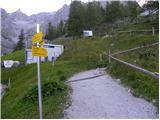 4
4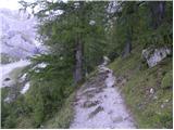 5
5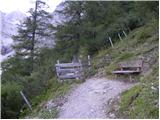 6
6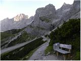 7
7 8
8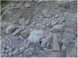 9
9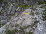 10
10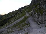 11
11 12
12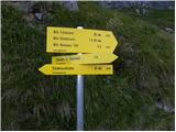 13
13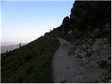 14
14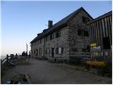 15
15 16
16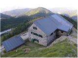 17
17
Discussion about the trip Türlwandhütte - Dachstein Südwand Hütte
To post a comment you must log in:
If you do not yet have a username, you must first
register.