Türlwandhütte - Großer Koppenkarstein (via Hunerscharte)
Starting point: Türlwandhütte (1695 m)
| Latitude/Longitude: | 47,45010°N 13,61762°E |
| |
Route name: via Hunerscharte
Walking time: 4 h 50 min
Difficulty: very difficult marked way
Via ferrata: B/C
Elevation gain: 1170 m
Elevation difference along the route: 1220 m
Map:
Recommended equipment (summer): helmet, self belay set
Recommended equipment (winter): helmet, self belay set, ice axe, crampons
Views: 3.725
 | 2 people like this post |
Access to starting point:
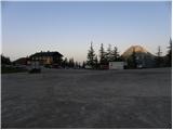
Through the Karawanks Tunnel, we drive into Austria, and then we continue driving on the Tauern motorway. Further, we drive through the Katschberg Tunnel and later also the Tauern Tunnel / Tauerntunnel, while we follow the motorway towards Salzburg (also Solnograd) only to the exit for Radstadt, Schladming. We continue on the road to the town of Schladming where we then continue left on the ascending road following the signs for Ramsau. In the town of Ramsau, we continue a good 2 km on the mentioned road, and then we turn right onto a toll road, where signs for the gondola cable car direct us. We follow this road all the way to the large parking lot in front of the lower station of the gondola cable car.
Route description:
From the parking lot, we continue past the lower cable car station following the signs Südwandhütte. The path first leads on the right side of the cable car through a sparse larch forest, later turns left and crosses the slopes towards the west. Soon the path to the climbing garden (Klettergarten) branches off to the right. We continue crossing the slopes towards the west and from the left the path from a lower starting point joins us. From the junction, approximately 10 minutes of walking follows on a scenic slope to the hut Südwandhütte.
At the hut, we continue right following the signs Hunerscharte and ascend a short grassy ridge above the hut. The path then brings us to the southern mostly grassy slopes below the summit Scheiblingstein. We cross the slopes in a gentle ascent towards the east and the path brings us into the valley below the gondola cable car. Here the path turns left and begins to ascend up the valley. During the ascent up the valley, we have a nice view towards the peaks Türlspitz, and soon a view also opens towards the summit Hunerkogl to which the gondola cable car leads. The path continues along the right side of the valley and begins to ascend somewhat more steeply. Higher up, the path turns slightly left and ascends the scree slope, which brings us to the more demanding part of the path.
The path first ascends along the steel cable, then becomes slightly steeper and some pegs and staples assist us. We continue ascending along the steel cable and soon arrive below the wall of Hunerkogl where the extremely demanding climbing path Skywalk Klettersteig branches off to the left.
Our path here turns right and begins to ascend steeply along the steel cable with the help of numerous pegs and staples (difficulty B). The path then becomes slightly less steep for a short time (difficulty A/B), then follows an ascent up a steep gully with the help of pegs towards the notch Hunerscharte (B).
On the notch where a view opens towards the north, we continue right following the signs Koppenkarstein. After a short ascent, we quickly reach the start of the secured path to Koppenkarstein. The path ascends the secured ridge (difficulty up to B) from which there is a very nice view of the glacier Schladminger Gletscher below us. The path along the ridge then brings us to a large sign intended for air traffic, which is visible from afar. We continue along the ridge and after a somewhat steeper ascent (B) the path brings us to a suspension bridge. A little before the bridge there is also a junction where we can bypass the bridge on the left side. Across the long suspension bridge we cross the notch Austriascharte and continue along the ridge. The path then ascends somewhat more steeply for a short time along the narrow ridge (B/C) and a somewhat less steep ascent follows along the steel cable on the panoramic ridge to the summit Kleiner Koppenkarstein.
From the summit, we continue along the ridge and then descend steeply with the aid of two ladders (B). A short steep ascent follows (B/C), then we walk for a while along the ridge beside the steel cable (A/B). Later the path descends slightly again and brings us above the natural window. The path then ascends somewhat more steeply again (B/C), then a somewhat easier ascent follows along the ridge to the panoramic summit.

Photos:
 1
1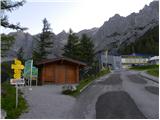 2
2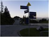 3
3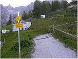 4
4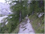 5
5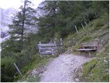 6
6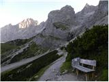 7
7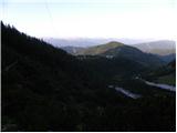 8
8 9
9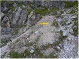 10
10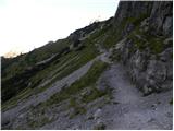 11
11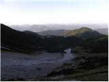 12
12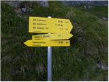 13
13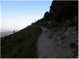 14
14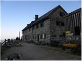 15
15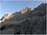 16
16 17
17 18
18 19
19 20
20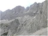 21
21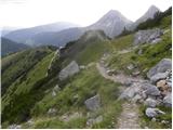 22
22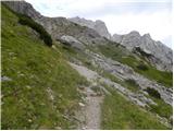 23
23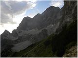 24
24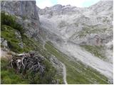 25
25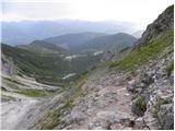 26
26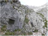 27
27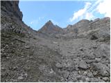 28
28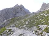 29
29 30
30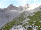 31
31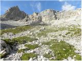 32
32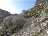 33
33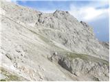 34
34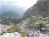 35
35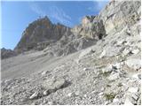 36
36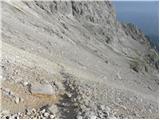 37
37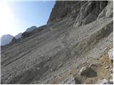 38
38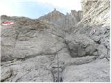 39
39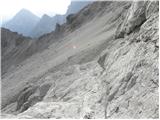 40
40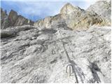 41
41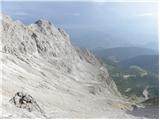 42
42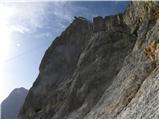 43
43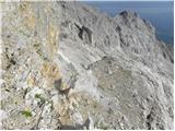 44
44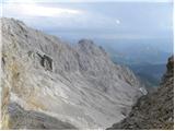 45
45 46
46 47
47 48
48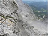 49
49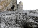 50
50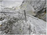 51
51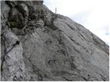 52
52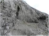 53
53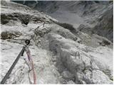 54
54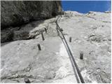 55
55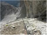 56
56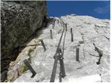 57
57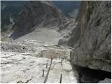 58
58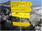 59
59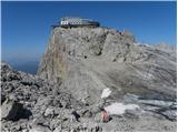 60
60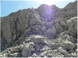 61
61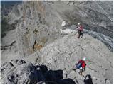 62
62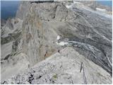 63
63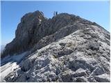 64
64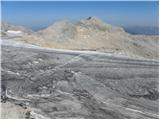 65
65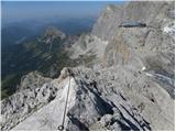 66
66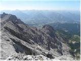 67
67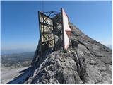 68
68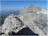 69
69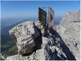 70
70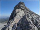 71
71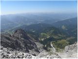 72
72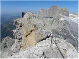 73
73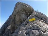 74
74 75
75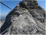 76
76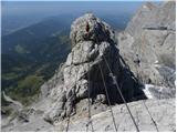 77
77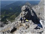 78
78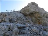 79
79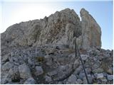 80
80 81
81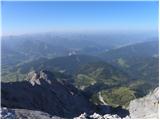 82
82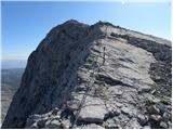 83
83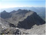 84
84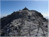 85
85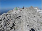 86
86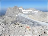 87
87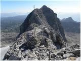 88
88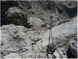 89
89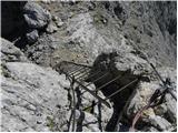 90
90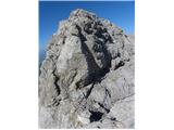 91
91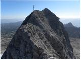 92
92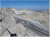 93
93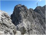 94
94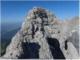 95
95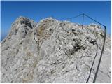 96
96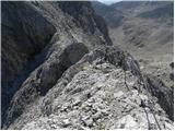 97
97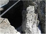 98
98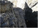 99
99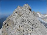 100
100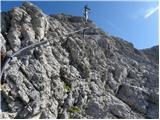 101
101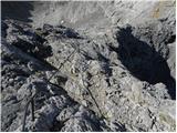 102
102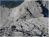 103
103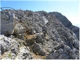 104
104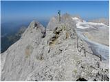 105
105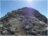 106
106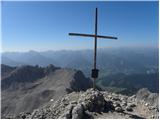 107
107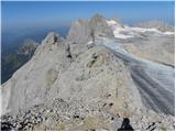 108
108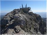 109
109 110
110 111
111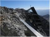 112
112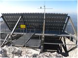 113
113 114
114
Discussion about the trip Türlwandhütte - Großer Koppenkarstein (via Hunerscharte)
To post a comment you must log in:
If you do not yet have a username, you must first
register.