Turrach - Eisenhut (via Straßburger Spitz)
Starting point: Turrach (1269 m)
| Latitude/Longitude: | 46,95950°N 13,88240°E |
| |
Route name: via Straßburger Spitz
Walking time: 5 h
Difficulty: easy marked way
Elevation gain: 1172 m
Elevation difference along the route: 1360 m
Map:
Recommended equipment (summer):
Recommended equipment (winter): ice axe, crampons
Views: 408
 | 1 person like this post |
Access to starting point:
A) Via the Ljubelj border crossing we drive into Austria, and then we follow the road towards Celovec / Klagenfurt. In Celovec at all crossroads we continue straight, when the main road turns sharply to the right, we leave it a little further on and continue left towards the places Dhovše pri Celovcu / Lendorf and Trg na Koroškem / Feldkirchen in Kärnten. When we arrive at the highway junction, we go left towards the place Trg na Koroškem, and when we arrive at the mentioned place we continue to follow the signs for the alpine pass Turracher Höhe. After approximately 90 km from the Ljubelj border crossing we arrive at the mentioned pass, from which we begin to descend towards Predlitz, but we drive only to the beginning of the place Turrach, where near the road sign that marks the start of the settlement the described path begins. We park in a suitable place nearby.
B) Through the Karawanks Tunnel we drive into Austria, then on the highway to the highway interchange, from which we continue towards Špital ob Dravi / Spittal an der Drau and continue the drive on highway A10. We quickly leave the A10 highway and take the exit for Osojsko jezero / Ossiacher See, at the nearby roundabout we take the third exit (if there were no roundabout we would go left) and then we drive along Millstätter Strasse. Along the mentioned road we drive to the place Radenče / Radenthein, where we turn right towards the settlement Bad Kleinkirchheim. We then drive through the mentioned place, a few kilometers further in the settlement Patergassen we turn left towards the alpine pass and ski area Turracher Höhe. When we arrive at the mentioned pass there follows a descent to the place Turrach a few kilometers away, where near the road sign that marks the start of the settlement the described path begins. We park in a suitable place nearby.
Route description:
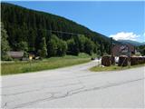
From the starting point, we head onto a side road towards the summit Eisenhut, first passing a few houses, before crossing the stream the settlement Turrach ends. The path continues along a gently sloping macadam road, passing a pleasant bench, behind it and the nearby hut we continue on foot along the forest road, which is closed to public traffic with a barrier and traffic sign. A little further, another path joins from the right over a wooden bridge, which branches off from the main road a little higher and leads to the lower station of the nearby cable car.
We continue along the road, from which a little further to the right another path branches off towards the lower station of the nearby chairlift, a few minutes higher we leave the wider macadam road and continue slightly left onto the road already overgrown with grass. From this road after a few steps we go left onto an overgrown cart track, directed there by a yellow hiking signpost. There follows an ascent along the path overgrown with high grass, crossing an older cart track in between and higher up a worse road too, then the path enters the forest where it becomes clearer. There follow a few minutes of traverse ascent, where the path takes us past a mighty spruce, then past the toilet we arrive at the hunting hut Geißeckhütte.
At the hut we step onto the road, at the nearby junction we go straight ahead. There follows a few minutes' easy descent, after crossing the stream we continue slightly left along the upper road. Along the road we then ascend diagonally amid ever finer views, after crossing the next stream we leave it and continue left onto the marked path which a few dozen steps higher turns right and ascends diagonally into the belt of forest. There follows a few minutes' ascent through the forest, then we cross the pasture fence and shortly after join the path from the Turracher Höhe pass.
We continue straight along the increasingly poor cart track, from it we soon go slightly left (still along the Lattersteig, Lattersteighöhe and Bretthöhe cart track) and begin to ascend a small valley along which a small brook flows. There follows ascent up the western grassy slopes along which we ascend on a barely visible path to the Rapitzsattel saddle, where there is a marked junction.
From the saddle we continue left towards the summits Eisenhut and Wintertalernock (straight to Flattnitz, right to Lattersteighöhe), the path running along the ridge or slightly left of it splits.
Slightly left the direct path to Eisenhut leads, we however continue slightly right towards Wintertalernock. There follows an ascent up the panoramic grassy slope, crossing a wire fence, then with views reaching from Triglav to the High Tauern we ascend to Straßburger Spitz, where a wooden cross with a summit logbook stands.
From the summit we continue slightly left and begin to descend the panoramic north-western ridge of the Straßburger Spitz summit. Lower we reach the ridge connecting the summit from which we have just descended and Eisenhut, along it we continue with a few shorter ascents and descents. A little further we reach spot height 2333, from which a few minutes' descent follows to the marked junction where we join the direct path.
We continue straight, passing a watering hole, behind it we begin to ascend more steeply towards the highest peak of the Gurktal Alps. There follows over 20 minutes of ascent along the edge of the southern ridge and we reach the 2441 m high summit.
Turrach - Geißeckhütte 1:30, Geißeckhütte - Rapitzsattel 1:40, Rapitzsattel - Straßburger Spitz 0:50, Straßburger Spitz - Eisenhut 1:00.
Description and pictures refer to the condition in 2019 (June).

Along the route: Geißeckhütte (1664m), Rapitzsattel (2088m), Straßburger Spitz (2404m)
Photos:
 1
1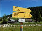 2
2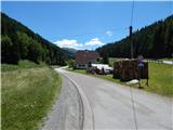 3
3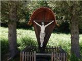 4
4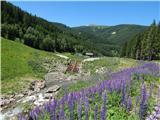 5
5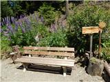 6
6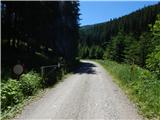 7
7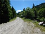 8
8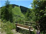 9
9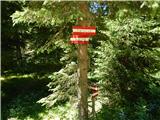 10
10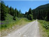 11
11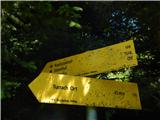 12
12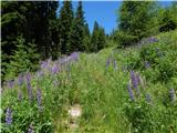 13
13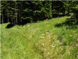 14
14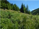 15
15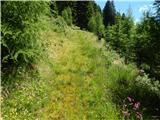 16
16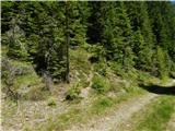 17
17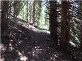 18
18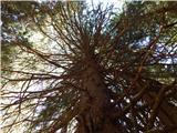 19
19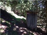 20
20 21
21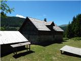 22
22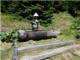 23
23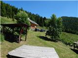 24
24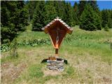 25
25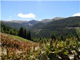 26
26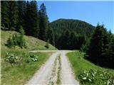 27
27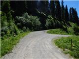 28
28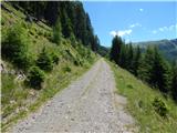 29
29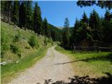 30
30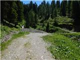 31
31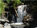 32
32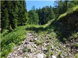 33
33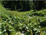 34
34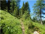 35
35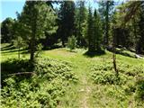 36
36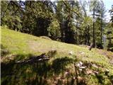 37
37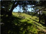 38
38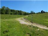 39
39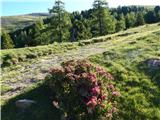 40
40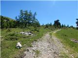 41
41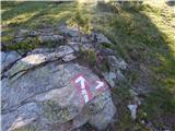 42
42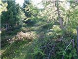 43
43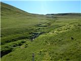 44
44 45
45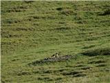 46
46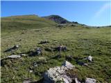 47
47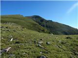 48
48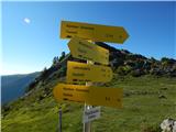 49
49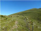 50
50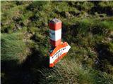 51
51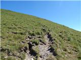 52
52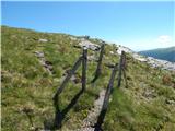 53
53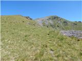 54
54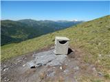 55
55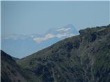 56
56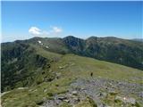 57
57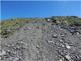 58
58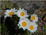 59
59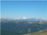 60
60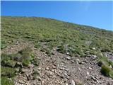 61
61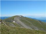 62
62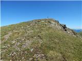 63
63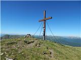 64
64 65
65 66
66 67
67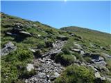 68
68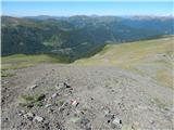 69
69 70
70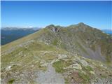 71
71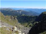 72
72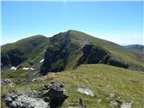 73
73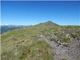 74
74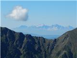 75
75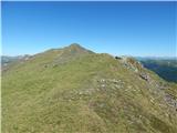 76
76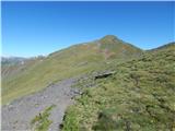 77
77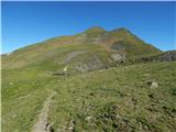 78
78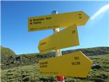 79
79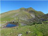 80
80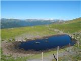 81
81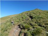 82
82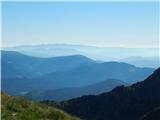 83
83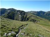 84
84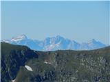 85
85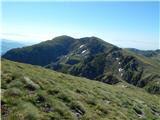 86
86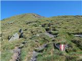 87
87 88
88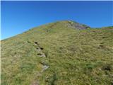 89
89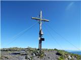 90
90 91
91
Discussion about the trip Turrach - Eisenhut (via Straßburger Spitz)
To post a comment you must log in:
If you do not yet have a username, you must first
register.