Ullachtal - Passauer Hütte
Starting point: Ullachtal (878 m)
| Latitude/Longitude: | 47,45278°N 12,75577°E |
| |
Walking time: 3 h
Difficulty: difficult marked way
Elevation gain: 1173 m
Elevation difference along the route: 1190 m
Map:
Recommended equipment (summer):
Recommended equipment (winter): ice axe, crampons
Views: 577
 | 2 people like this post |
Access to starting point:
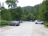
Through the Karawanks Tunnel, we drive to Austria, and then we continue driving on the Tauern highway. Further, we drive through the Katschberg tunnel and later also the Tauerntunnel, but we follow the highway towards Salzburg (also Solnograd) only up to the exit for Bischofshofen, from where we continue driving on a four-lane road towards the already mentioned town. From Bischofshofen we follow the signs for Zell am See and then for Saalfelden and Lofer. In Saalfelden we then turn left towards Leogang. In Leogang we leave the main road and continue right on a narrow road where the signs for the mountain hut Passauer Hütte point us. Further, we follow the signs for the mountain hut Passauer Hütte and parking lot Parkplatz Ullachtal. We park on the mentioned parking lot by which there are also a few information boards and signposts.
Route description:
At the starting point, we head onto a macadam road where signposts for the mountain hut Passauer Hütte direct us. The macadam road runs through the forest and quickly brings us to a wide riverbed of a torrent. Across the riverbed of the torrent the road is somewhat ruined and poorly visible, then it becomes nicer again and brings us to a marked junction.
At the junction, we leave the macadam road and head right upwards, starting to ascend grassy slopes. The path then crosses a grazing fence and continues ascending up the mountain pasture, bringing us to another marked junction.
To the left a path branches off towards the Birnbachloch cave from which the Birnbach stream originates, and we continue right towards the mountain hut Passauer Hütte. The path soon brings us into the forest and along the path we will notice numerous information boards describing various plants and animals. After a short ascent through the forest, another path branches off to the left towards the already mentioned Birnbachloch cave, and we continue right again. We then ascend through the forest for a long time, occasionally crossing shorter clearings from which views open onto the surrounding peaks. Along the path there is occasionally also a bench. At the spot named Kaserstein, beside the bench there is also a table and a small woodshed.
Further on, the slope becomes a shade steeper and the path leads us from the forest into dwarf pine scrub from which we have increasingly beautiful views of the surrounding peaks. A little higher the path leads past yet another bench where the path turns right and soon becomes somewhat more demanding.
Further, the path ascends a fairly steep slope and steel cables assist us; on a few spots stairs have also been made for easier ascent. From the right the path over the Plattenkopf peak soon joins us. We continue left on a well-maintained path which is occasionally still secured with a steel cable. Such a path then brings us to the Hochtor saddle from which a view opens towards the mountain hut Passauer Hütte.
On the saddle where there is a junction, to the right a path branches off towards the extremely demanding climbing route Leoganger Süd, and we continue straight ahead and then cross exposed slopes in a gentle ascent on the southwestern side of the Westliche Mitterspitze peak. The slope then becomes less steep and an ascent follows on an increasingly scenic path to the Mittagsscharte notch where there is a marked junction.
To the right the path leads towards the secured route Leoganger Nord, straight ahead the path leads into the valley towards the settlement Weißbach, and we continue left with only a short ascent remaining to the mountain hut Passauer Hütte, which we already see ahead.

Along the route: Kaserstein (1460m), Hochtor (1922m), Mittagsscharte (2033m)
Photos:
 1
1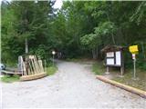 2
2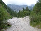 3
3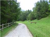 4
4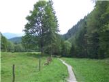 5
5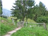 6
6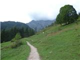 7
7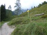 8
8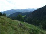 9
9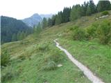 10
10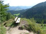 11
11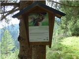 12
12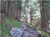 13
13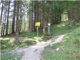 14
14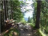 15
15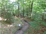 16
16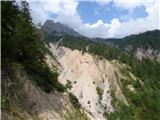 17
17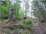 18
18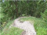 19
19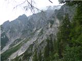 20
20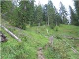 21
21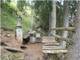 22
22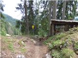 23
23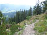 24
24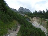 25
25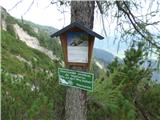 26
26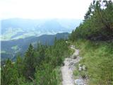 27
27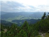 28
28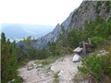 29
29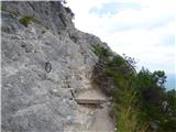 30
30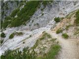 31
31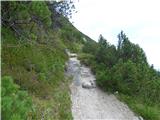 32
32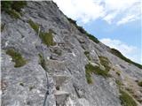 33
33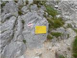 34
34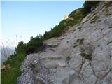 35
35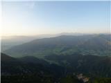 36
36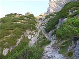 37
37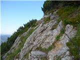 38
38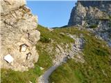 39
39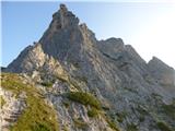 40
40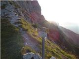 41
41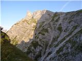 42
42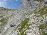 43
43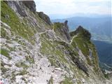 44
44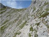 45
45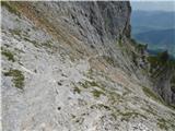 46
46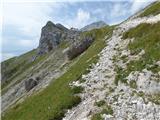 47
47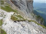 48
48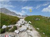 49
49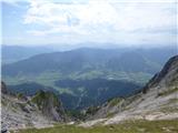 50
50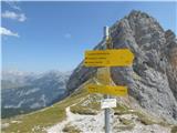 51
51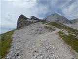 52
52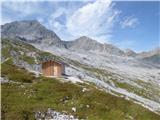 53
53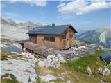 54
54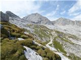 55
55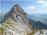 56
56
Discussion about the trip Ullachtal - Passauer Hütte
To post a comment you must log in:
If you do not yet have a username, you must first
register.