Untere Valentinalm - Mahderkopf
Starting point: Untere Valentinalm (1240 m)
| Latitude/Longitude: | 46,62250°N 12,92880°E |
| |
Walking time: 4 h
Difficulty: partly demanding marked way, easy unmarked way
Elevation gain: 915 m
Elevation difference along the route: 1200 m
Map:
Recommended equipment (summer): helmet
Recommended equipment (winter): helmet, ice axe, crampons
Views: 2.209
 | 1 person like this post |
Access to starting point:
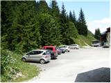
Via the border crossing Rateče or Predel we drive to Trbiž/Tarvisio, then we continue driving on the highway in the direction of Videm/Udine. At the settlement Carnico, we leave the highway and first follow the signs towards the settlement Tolmezzo, then signs for Austria and the pass Passo di Croce Carnico/Plöckenpass. From the pass, we descend to the Austrian side, and then after a few kilometers we notice signs for Untere Valentinalm, which direct us to the left onto an ascending road. We follow the mentioned road to the mountain hut on the mentioned mountain pasture, near which there is also a parking lot, where we park.
Access from the Gailtal valley (Austria) is also possible.
Route description:
From the parking lot, we head onto the road closed by a ramp in the direction of Wolayer See lake. Soon a marked path branches off to the right from the road, which then several times crosses the mentioned mountain road. After approximately 1 hour of walking, we reach the mountain pasture Obere Valentinalm, on which a shepherd hut stands.
From the mountain pasture, from which a nice view opens up on the walls of the peak Kellerspitzen (2769 m) and partly grassy Rauchkofel, we continue slightly right on a poorly visible footpath, which soon joins a wide path that leaves the road only a few 10 m before the mountain pasture. When both paths join, the path flattens entirely and brings us into a nice high mountain valley surrounded by mighty walls. Initially wide and grassy, the valley soon narrows a little, turns slightly to the left and brings us below the extensive scree of Monte Cogliansa. The valley, along the edge of which the mountain path also runs, slowly turns to the right. Higher up the path moves a little to the right from the valley, where in a moderate ascent it crosses the slopes of Rauchkofel. After two and a half hours of walking from the starting point along a varied and panoramic path, we reach the saddle Valentintörl, where there is a junction.
Just a few meters before the signposts on the mentioned saddle, we will notice a torrent gully on the right side. The marked path that leads to Rauchkofel ascends the mentioned gully. During the ascent through the torrent gully, some fixed safety gear helps us (the safety gear was in quite bad condition in July 2009), which in dry conditions is not necessarily needed (this part is also exposed to falling stones). After a short ascent the steepness eases and the path brings us from the gully onto gentle and extensive grassy slopes. At the end of the grassy plain the path turns slightly to the left and after a short ascent brings us to a marked junction.
We continue straight (right Rauchkofel) on the path, which starts to descend and turns somewhat to the left. After a short descent we reach a small bog, where we leave the marked path and continue right on a poorly visible footpath, which further gently descends across extensive grassy slopes. The path soon transitions to an indistinct ridge, where it starts to gradually disappear. We continue the path on and along the mentioned ridge, which brings us with nice views to a small watering place for animals. Only a short descent follows, then the "path" starts to ascend again. We follow this poorly visible path, which further moderately ascends, all the way to the summit of Mahderkopf.

Photos:
 1
1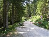 2
2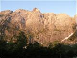 3
3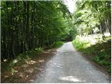 4
4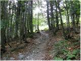 5
5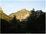 6
6 7
7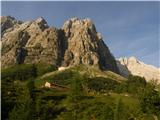 8
8 9
9 10
10 11
11 12
12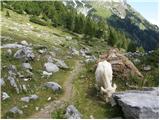 13
13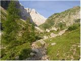 14
14 15
15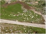 16
16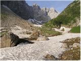 17
17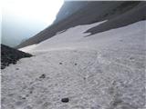 18
18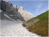 19
19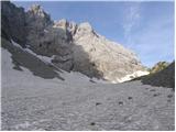 20
20 21
21 22
22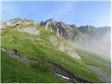 23
23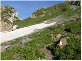 24
24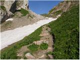 25
25 26
26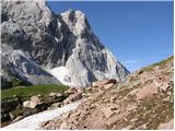 27
27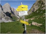 28
28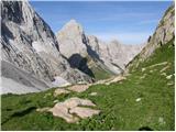 29
29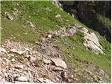 30
30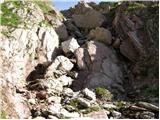 31
31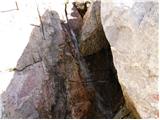 32
32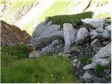 33
33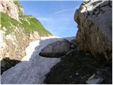 34
34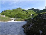 35
35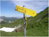 36
36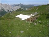 37
37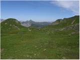 38
38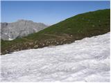 39
39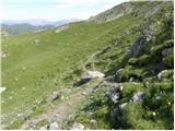 40
40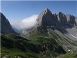 41
41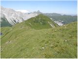 42
42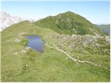 43
43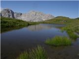 44
44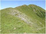 45
45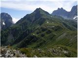 46
46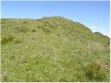 47
47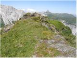 48
48
Discussion about the trip Untere Valentinalm - Mahderkopf
To post a comment you must log in:
If you do not yet have a username, you must first
register.