Untere Wolayeralm - Rauchkofel
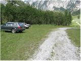
Starting point: Untere Wolayeralm (1218 m)
| Latitude/Longitude: | 46,64220°N 12,86530°E |
| |
Walking time: 3 h 45 min
Difficulty: partly demanding marked way
Elevation gain: 1242 m
Elevation difference along the route: 1250 m
Map:
Recommended equipment (summer):
Recommended equipment (winter): ice axe, crampons
Views: 3.997
 | 1 person like this post |
Access to starting point:
Over the border crossing Korensko sedlo we descend into Austria, and there at the first major intersection we continue left towards the village Podklošter/Arnoldstein. In the mentioned village we arrive at a roundabout, where we continue right towards "Hermagor". Further we drive on a wide road which leads us through the Gailtal valley. At the settlement Mauthen we continue left towards the mountain pass Plöckenpass, then after a few hundred meters right towards the Lesachtal valley. Further we drive on a narrower and quite winding road, which we follow to the place where a road branches off to the left towards the village Wodmaier. The road soon above the village loses its asphalt surface, and at the next intersections we follow it towards the lake Wolayer See. We then follow this very poor and occasionally quite steep road to the parking lot on the alpine pasture Untere Wolayeralm.
Route description:
From the parking lot we continue on the traffic-closed forest road, which soon starts to ascend more steeply. The quite panoramic and serpentine road then brings us higher to the nice waterfall Hildenfall.
After the waterfall the road passes into a belt of sparse forest and levels out a bit higher, crosses a grazing fence and after a few minutes of further walking brings us to the alpine pasture Obere Wolayeralm, on which stands a somewhat larger shepherd's hut (to here we need 1.5 hours).
From the alpine pasture where livestock grazes in summer we continue on a somewhat worse mountain road, which after a short ascent brings us into a nice high-alpine cirque. At the end of the cirque the road turns slightly to the right and ascends more steeply. We then follow this road (higher also on the marked path) to the mountain hut by Lake Wolayer See.
From the mountain hut we continue left on the marked path towards the summit Rauchkofel. The path, which first ascends gently, soon stands "upright" and then ascends over relatively steep grassy slopes. The path higher levels out and turns slightly to the left, where it then brings us in a moderate ascent to a small saddle where there is a junction. We continue left on the relatively steep path, which ascends over the grassy slopes of the mountain. The path higher turns slightly to the left and brings us to the main ridge. We continue slightly right on the increasingly steep path, which then ascends over very steep grassy slopes. Further the path brings us to steel cables, with the help of which we then in a few minutes of further walking ascend to the panoramic summit.

Photos:
 1
1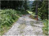 2
2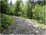 3
3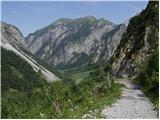 4
4 5
5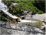 6
6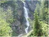 7
7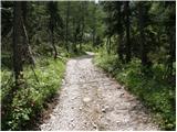 8
8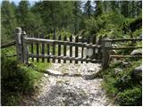 9
9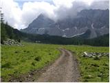 10
10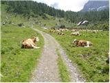 11
11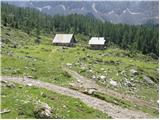 12
12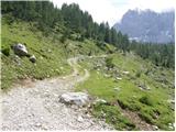 13
13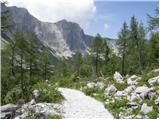 14
14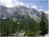 15
15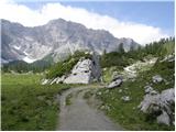 16
16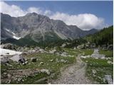 17
17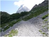 18
18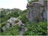 19
19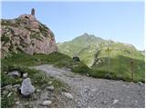 20
20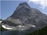 21
21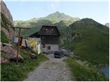 22
22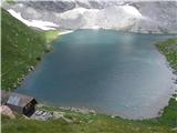 23
23 24
24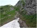 25
25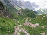 26
26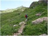 27
27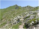 28
28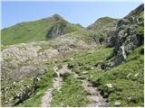 29
29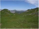 30
30 31
31 32
32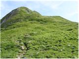 33
33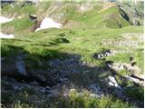 34
34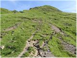 35
35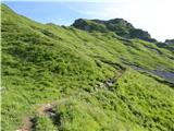 36
36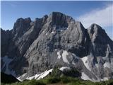 37
37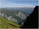 38
38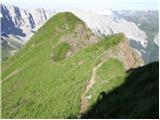 39
39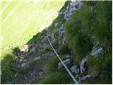 40
40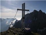 41
41 42
42
Discussion about the trip Untere Wolayeralm - Rauchkofel
|
| rovka15. 10. 2017 |
New larger arranged parking lot is located about 100 m lower, right after the bridge at the chapel of St. Hubert. The road itself is still in poor condition. The variant is somewhat longer, ca. 200m further from the settlement Nostra also a gravel road, its junction is behind the settlement Birnbaum.
The path itself runs partly on the old, partly on the new supply path, currently still under construction (to the upper pasture it lacks only a few serpentines).
From the pasture I headed directly to the western ridge of Mahderkopf and along it to Rauchkofel.
|
|
|
To post a comment you must log in:
If you do not yet have a username, you must first
register.