Unterpirkach - Hochstadel
Starting point: Unterpirkach (636 m)
| Latitude/Longitude: | 46,75920°N 12,92490°E |
| |
Walking time: 6 h
Difficulty: partly demanding marked way
Elevation gain: 2045 m
Elevation difference along the route: 2060 m
Map: Kompass, Lienzer Dolomiten/Lesachtal 1:50.000
Recommended equipment (summer):
Recommended equipment (winter): ice axe, crampons
Views: 4.188
 | 3 people like this post |
Access to starting point:
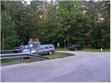
From Ljubljana through the Karawanks Tunnel and then on the highway to Spittal. We continue driving in the direction of Lienz, but we drive through the Drautal valley to Oberdrauburg, where we turn left in the direction of Kötschach and the Plöckenpass mountain pass. Immediately after the river Drau and the railway track we turn right (at the crossroad we notice many signs, among them also for the mountain hut Hochstadelhaus), and then on a somewhat narrower road we reach Unterpirkach. Next we drive past a larger chapel and only a few meters ahead across the bridge over the Pirkner stream. Immediately after the bridge we turn left and park on the parking lot by the hiking signposts.
Route description:
From the parking lot, we continue on a gently sloping cart track which runs on the right side of the nearby stream. After a few minutes, the cart track splits into two parts. The left one after a few 10 meters ends by the stream, and we continue on the right one, which gradually starts ascending steeper. The marked path soon leaves the increasingly rough cart track and continues to the right, where it ascends diagonally over occasionally somewhat steeper slopes. Higher, the path returns to the cart track, and we continue along it to its end.
The marked footpath continues in the same direction, then after some time turns to the left, where the climbing path soon joins us.
We continue on a well-beaten path, which higher crosses a road (the road is closed to public traffic), then returns to the forest and past Hilda's smoking bench brings us again to a forest road. We leave the road immediately; higher, the marked path crosses it a few more times or follows it briefly. Higher the forest thins out, so beautiful views open up to the eastern side, where we clearly see the river Drau and part of the Gailtal Alps. The path higher returns to the road, which we then follow all the way to the mountain hut Hochstadelhaus.
From the mountain hut, we continue slightly to the right (direction Hochstadel) and through a short stretch of forest ascend to the mountain pasture Unholdenalm. Here we walk to the right side of the pasture, where at a few huts we step back onto the road. A short gentle ascent follows along the increasingly poor road, then we arrive at a marked junction.
We continue slightly to the right in the direction "Hochstadel - path no. 218, 3 h" and continue the ascent on a moderately ascending path. The path, which further runs across extensive grazing areas, higher turns to the right and ascends steeply for a short time. The path soon turns to the left and becomes almost completely level. A gentle traversing ascent follows under the walls of the 2283 m high Rudnigkofel. When the traverse ends, the path turns right and ascends in a few switchbacks over steep slopes that are especially dangerous for slipping when wet. After a shorter steep ascent, we step onto a panoramic ridge, where the path turns sharply to the left and levels out again. A short traverse of the exposed ridge follows, then the path moves to less steep slopes. Further we ascend on an increasingly scenic path, which leads us through a series of several smaller basins. Higher the path becomes somewhat steeper and just below the summit slightly exposed in a few places. We follow this very panoramic path, which in the final section runs just a few meters from the mighty precipice, all the way to the summit of Hochstadel.

Photos:
 1
1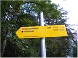 2
2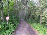 3
3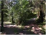 4
4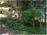 5
5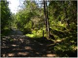 6
6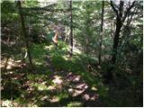 7
7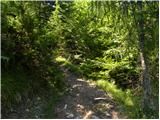 8
8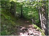 9
9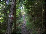 10
10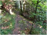 11
11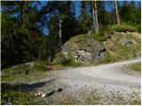 12
12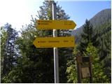 13
13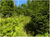 14
14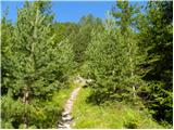 15
15 16
16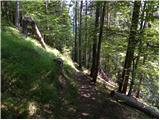 17
17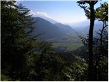 18
18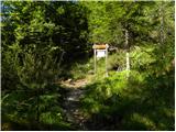 19
19 20
20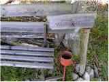 21
21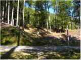 22
22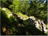 23
23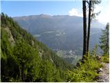 24
24 25
25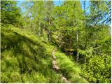 26
26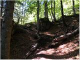 27
27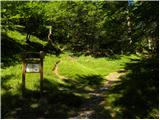 28
28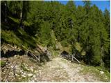 29
29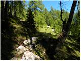 30
30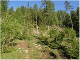 31
31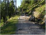 32
32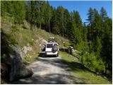 33
33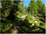 34
34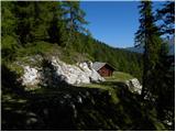 35
35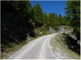 36
36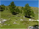 37
37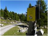 38
38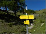 39
39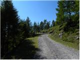 40
40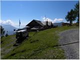 41
41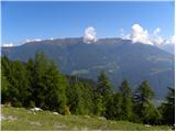 42
42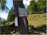 43
43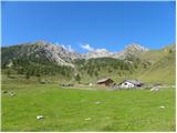 44
44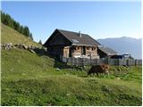 45
45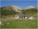 46
46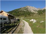 47
47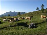 48
48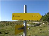 49
49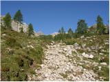 50
50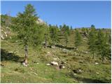 51
51 52
52 53
53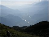 54
54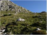 55
55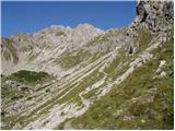 56
56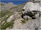 57
57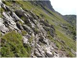 58
58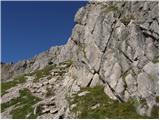 59
59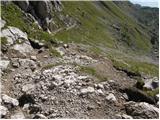 60
60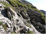 61
61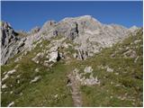 62
62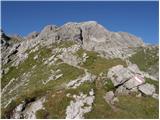 63
63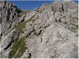 64
64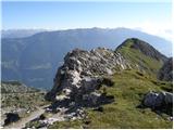 65
65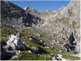 66
66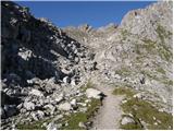 67
67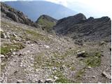 68
68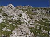 69
69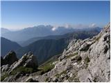 70
70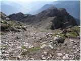 71
71 72
72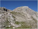 73
73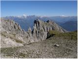 74
74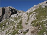 75
75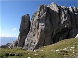 76
76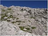 77
77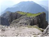 78
78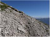 79
79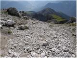 80
80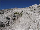 81
81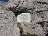 82
82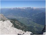 83
83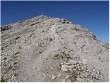 84
84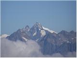 85
85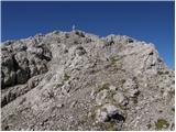 86
86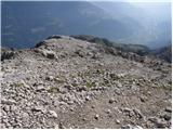 87
87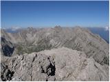 88
88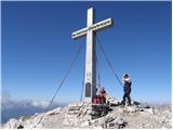 89
89
Discussion about the trip Unterpirkach - Hochstadel
|
| cebelca23. 09. 2011 |
Does anyone know how much snow fell on Hochstadel in the previous days? Thanks.
|
|
|
To post a comment you must log in:
If you do not yet have a username, you must first
register.