Uskovnica (Lom) - Dom Valentina Staniča (via Planina Spodnji Tosc)
Starting point: Uskovnica (Lom) (1076 m)
| Latitude/Longitude: | 46,31330°N 13,90540°E |
| |
Route name: via Planina Spodnji Tosc
Walking time: 6 h
Difficulty: difficult marked way
Elevation gain: 1256 m
Elevation difference along the route: 1515 m
Map: TNP 1:50.000
Recommended equipment (summer): helmet
Recommended equipment (winter): helmet, ice axe, crampons
Views: 1.320
 | 1 person like this post |
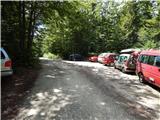
Access to starting point:From the Ljubljana-Jesenice motorway, take the Lesce exit and follow the road towards Bled and further towards Bohinjska Bistrica. Just before Bohinjska Bistrica, at the settlement of Bitnje, continue sharply right towards Pokljuka. After a short ascent, the road flattens and quickly brings us to the Upper Bohinj Valley. At the intersection here, continue left (right to Pokljuka) and follow the road further to Srednja vas. In the second part of the village, notice the signs for Uskovnica (7 km), which direct us right onto a narrower road, initially still asphalted. Then follow this road, which ascends most of the time, to the "Lom" parking lot, where there is a sign prohibiting further driving (further driving permitted only to landowners).
Traffic regime in the Pokljuka and Uskovnica area from 15.6. to 15.10.
Route description:
From the parking lot continue in the direction of Koča na Uskovnici along the road, after which we quickly emerge from the forest, where we notice signs for cheese, milk and home-made products. Some tens of metres further, a short path branches left from the road leading to the nearby dairy at Ulčnek, where during the grazing season we can buy the aforementioned products; otherwise continue straight to the marked junction a few steps away, where we continue right in the direction of Koča na Uskovnici. The path first leads past a monument (cross), then continues between pastures. When the pastures end on the right side, a marked path from Srednja vas (path "Za Ribnico") joins from the right.
Continue straight, then past weekend cottages arrive at a water trough and a few steps further to the spot where signs for the already known hut direct us left onto a cart track. A short ascent along the cart track follows and the path brings us to Koča na Uskovnici.
From the hut continue towards Tosca, Draški vrh, Viševnik, Vodnikov dom, Rudno polje and Praprotnica along the path that first crosses a pasture fence, then quickly joins a gravel road which we follow to the right. The road then leads between hummocky meadows, then to cross the next fence we quickly reach a junction or crossroads by the chapel of Mary Queen of Peace on Uskovnica.
After the chapel continue left (straight to planina Konjščica, right to Rudno polje) along the level road that leads across extensive Uskovnica meadows, then the path reaches the edge of the forest where it begins to turn into an initially wide cart track. The cart track ahead begins a moderate ascent and has a few junctions, but we follow it towards Vodnikov dom on Velem polju and Triglav. Higher up, the cart track, which mostly runs through forest, turns into a footpath which quickly brings us to a pleasant spring below Mesnova glava called Štapce. At the spring continue straight (right to hunter's hut) and continue the ascent on a gentle path that a bit further brings us to steep slopes. Soon after reaching the steep slopes, fixed protection assists us in crossing a steep gully. The path continues across relatively steep slopes that are particularly prone to slipping when wet. During the crossing of the steep slopes the path several times steeply ascends for a short while and then descends again. In the last part of the crossing we cross several very steep gullies over which the path is locally completely ruined (high slipping risk). The crossing ends at a larger streambed (usually a spring) after which we enter a softer grassy terrain.
A few minutes of easy walking follow and the path brings us to the abandoned planina Spodnji Tosc. The path ahead begins to ascend moderately and soon brings us to a small junction where we continue sharply right (straight on old, partly abandoned path) along a well-traceable path. The path ahead begins to ascend ever more steeply and quickly takes us from the belt of sparse forest into dwarf pines where it begins to turn increasingly left. The path soon levels out and from the dwarf pines brings us onto grassy slopes over which we ascend in a few minutes of further walking to the Pokljuka - Triglav path where we turn left.
The path ahead crosses the southern slopes of Tosca, then in a slight descent crosses a short belt of sparse forest after which we reach the steep slopes of Tosca. A bit further the path along an artificially made wide ledge in a slight descent crosses the precipitous slopes of the same mountain. Since the path is quite wide it presents no difficulties (caution due to falling stones, rockfall in 2008). The path then rises slightly again and brings us to a junction where we continue right towards Vodnikov dom (sharply left to Voje and Stara Fužina, slightly left to Velo polje). Another approx. 10 minutes of walking follow without major ascents or descents and we reach Vodnikov dom on Velem polju where there is the next junction.
Here too continue straight towards Triglav; the path begins to ascend across the slopes of Vernar, higher up also becoming technically demanding. Some crossing follows where chain assists us, higher up we reach a steep drop where using numerous pegs and chain we ascend stone steps.
The path ahead levels out, the slope becomes less steep and near Konjsko sedlo also somewhat more grassy.
We easily descend to Konjsko sedlo; from the marked junction on the saddle head straight onto the path towards Triglavski dom na Kredarici and Staničev dom pod Triglavom (left Dom Planika pod Triglavom, right dolina Krma); a few steps further the path forks again.
Here the inscription on the rock Staničev dom directs us slightly right onto a nice traceable but less worn little path. The path ahead with some short ascents and descents crosses slopes to the right, crossing some gullies that may still be snow-covered in early summer. The path ahead crosses a belt of dwarf pines then passes onto a grassy slope across which it ascends transversely. The path then levels and shortly further crosses the path leading from Krma via Kalvarija to Kredarica.
Continue towards Staničev dom (inscription on rock) and continue ascent on a moderately steep path that draws nearer to the screes below Rž. Along a pleasant path over Ržke pode we reach the aforementioned screes across which we begin transverse ascent. Upon reaching the other side of the scree the path turns slightly left and begins steep ascent through rugged rocks. Steepness quickly eases and after a few minutes further walking we join the path from Krma.
Continue left towards Triglav and Staničev dom along a gradually easier path that brings us to the junction at the start of the ridge leading towards Dovška vrata and further to Rjavina.
Here a marked path to Rjavina also branches right; we gradually begin descending towards the more plateau-like terrain around Dom Valentina Staniča pod Triglavom.
Lower the path levels and from the next junction continue straight towards the nearby mountain hut.
Start - Koča na Uskovnici 0:15, Koča na Uskovnici - chapel on Uskovnica 0:05, chapel on Uskovnica - Štapce 0:50, Štapce - Planina Spodnji Tosc 1:15, Planina Spodnji Tosc - Planina Zgornji Tosc 0:30, Planina Zgornji Tosc - Na Zagonu 0:20, Na Zagonu - Vodnikov dom 0:20, Vodnikov dom - Konjsko sedlo 0:30, Konjsko sedlo - Pod Kalvarijo 0:30, Pod Kalvarijo - Ravnica pod Ržjo 1:10, Ravnica pod Ržjo - Dom Valentina Staniča 0:15.

Along the route: Koča na Uskovnici (1154m), Kapela Kraljice miru na Uskovnici (1177m), Izvir Štapce (1452m), Planina Spodnji Tosc (1663m), Planina Zgornji Tosc (1849m), Na Zagonu (1819m),
Vodnikov dom (1817m), Konjsko sedlo (2020m), Pod Kalvarijo (2084m), Apnenica (2337m), Ravnica pod Ržjo (2371m)
Photos:
 1
1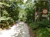 2
2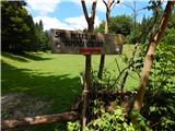 3
3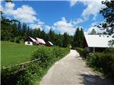 4
4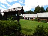 5
5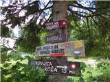 6
6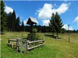 7
7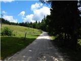 8
8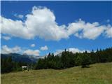 9
9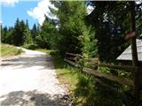 10
10 11
11 12
12 13
13 14
14 15
15 16
16 17
17 18
18 19
19 20
20 21
21 22
22 23
23 24
24 25
25 26
26 27
27 28
28 29
29 30
30 31
31 32
32 33
33 34
34 35
35 36
36 37
37 38
38 39
39 40
40 41
41 42
42 43
43 44
44 45
45 46
46 47
47 48
48 49
49 50
50 51
51 52
52 53
53 54
54 55
55 56
56 57
57 58
58 59
59 60
60 61
61 62
62 63
63 64
64 65
65 66
66 67
67 68
68 69
69 70
70 71
71 72
72 73
73 74
74 75
75 76
76 77
77 78
78 79
79 80
80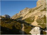 81
81 82
82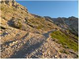 83
83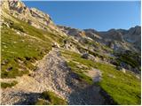 84
84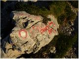 85
85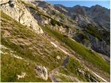 86
86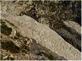 87
87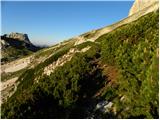 88
88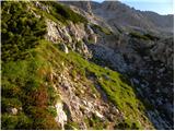 89
89 90
90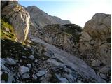 91
91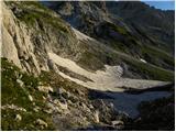 92
92 93
93 94
94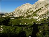 95
95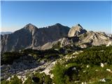 96
96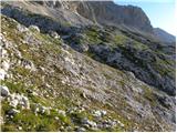 97
97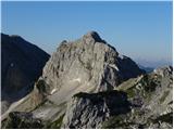 98
98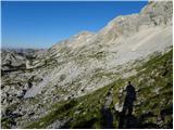 99
99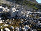 100
100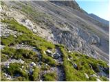 101
101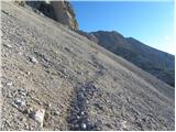 102
102 103
103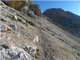 104
104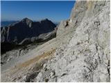 105
105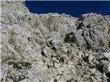 106
106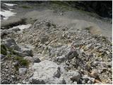 107
107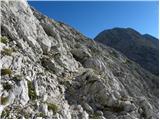 108
108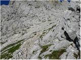 109
109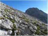 110
110 111
111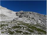 112
112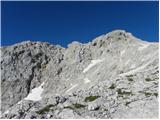 113
113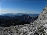 114
114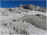 115
115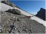 116
116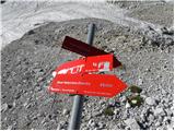 117
117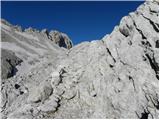 118
118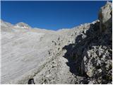 119
119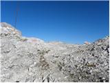 120
120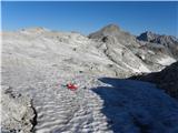 121
121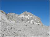 122
122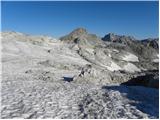 123
123 124
124 125
125 126
126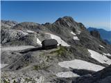 127
127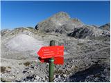 128
128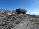 129
129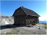 130
130
Discussion about the trip Uskovnica (Lom) - Dom Valentina Staniča (via Planina Spodnji Tosc)
To post a comment you must log in:
If you do not yet have a username, you must first
register.