V Koncu - Bivak pod Grintovcem (via Kokrsko sedlo)
Starting point: V Koncu (900 m)
| Latitude/Longitude: | 46,34200°N 14,56820°E |
| |
Route name: via Kokrsko sedlo
Walking time: 3 h 30 min
Difficulty: difficult marked way
Elevation gain: 1200 m
Elevation difference along the route: 1300 m
Map: Kamniške in Savinjske Alpe 1:50.000
Recommended equipment (summer):
Recommended equipment (winter): ice axe, crampons
Views: 30.682
 | 3 people like this post |
Access to starting point:
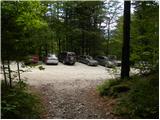
We drive to Kamnik and follow the road ahead towards the valley of Kamniška Bistrica. From the hut in Kamniška Bistrica we continue driving on the forest road which higher brings us to a crossroad, where we continue straight (right Jermanca, starting point for Kamniško sedlo). The road then past Žagana peč brings us to the parking lot at the lower station of the cargo cableway to Kokrsko sedlo.
Driving from the Koča in Kamniška Bistrica to the parking lot V Koncu is now forbidden (traffic sign), this extends the path by a little less than an hour.
Route description:
From the parking lot at the cargo cableway we go on a footpath in the direction of Kokrsko sedlo and Grintovec. The path which runs through the forest is at first only gently ascending, but this part of the path is short. Already after a few minutes of walking, the path starts ascending steeply and a little higher we have fixed safety gear for help, which come in handy when the ground is wet and slippery (when dry undemanding). Well visible and still steep path higher starts turning a little towards the right. For a short time the ascent becomes less steep and the path brings us out of the forest on avalanche slopes below Kokrsko sedlo. Here the path becomes steep again and with increasingly beautiful views (those are most beautiful on peaks above the valley of Kamniška Bistrica) it is ascending by the foot of the walls of Kalška gora and Mali vrh. Easy to follow, but because of a lot of stones (slightly overgrown scree) strenuous path, after a good 2 hours of walking, it brings us to Kokrsko sedlo, where there stands Cojzova koča.
From the saddle, we continue right in the direction of Grintovec, Kočna and Skuta. The path immediately above the saddle steeply ascends and a little higher brings us to a junction, where a path towards the bivouac pod Grintovcem and Skuta branches off to the right (straight Grintovec over Streha and Kočna). We go on this at first a little poorly visible footpath which in a moderate ascent brings us to scenic passage over Mala vratca. After the narrow passage Mala vratca, the path starts descending on a steep and occasionally slightly exposed slope. By the end of the descent, which takes approximately 100 altitude meters, there are some pegs for help. Next follows crossing of the gully and then ascent on high mountain terrain to bivouac below Grintovec.
V Koncu - Kokrsko sedlo 2:15, Kokrsko sedlo - Bivak pod Grintovcem 1:15.

Photos:
 1
1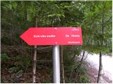 2
2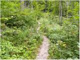 3
3 4
4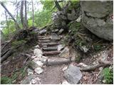 5
5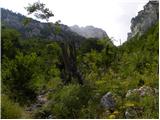 6
6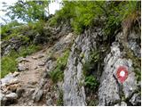 7
7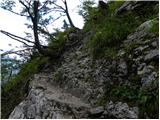 8
8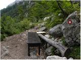 9
9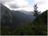 10
10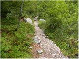 11
11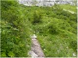 12
12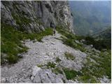 13
13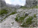 14
14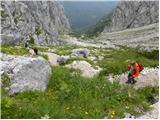 15
15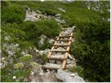 16
16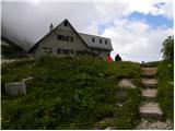 17
17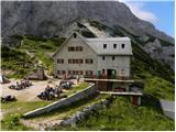 18
18 19
19 20
20 21
21 22
22 23
23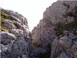 24
24 25
25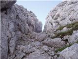 26
26 27
27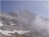 28
28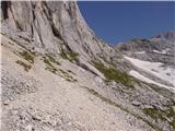 29
29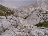 30
30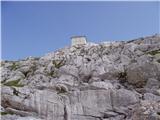 31
31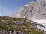 32
32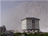 33
33
Discussion about the trip V Koncu - Bivak pod Grintovcem (via Kokrsko sedlo)
|
| Gost8. 07. 2007 |
Brane V. passed by it last Monday on the way back from Skuta. Unfortunately, it almost doesn't deserve that name, because it's in a desperate state. It could provide decent rest for a tired mountaineer, but sadly everyone avoids it. Everything needs to be renovated. Rating 1 for the caretaker.
|
|
|
|
| velkavrh4. 08. 2008 |
Today passed by again on the way to Grintovec. Condition same as a year ago. Inside there is really a torn notebook with entries. I suggest introducing stamp cabinets and logbooks for bivouacs as well.
|
|
|
|
| 03183338521. 10. 2010 |
What's the path to it like these days?
|
|
|
|
| fant26. 10. 2010 |
oo
would anyone go check out this bivouac a bit?
|
|
|
|
| smatjaz4. 09. 2013 |
The bivouac urgently needs a new logbook
|
|
|
To post a comment you must log in:
If you do not yet have a username, you must first
register.