Starting point: V Koncu (900 m)
| Latitude/Longitude: | 46,34200°N 14,56820°E |
| |
Walking time: 5 h 30 min
Difficulty: very difficult marked way
Elevation gain: 1620 m
Elevation difference along the route: 1725 m
Map: Kamniške in Savinjske Alpe 1:50.000
Recommended equipment (summer): helmet, self belay set
Recommended equipment (winter): helmet, self belay set, ice axe, crampons
Views: 10.304
 | 2 people like this post |
Access to starting point:
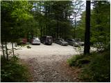
We drive to Kamnik and follow the road ahead towards the valley of Kamniška Bistrica. From the hut in Kamniška Bistrica we continue driving on the forest road which brings us higher up to a crossroads, where we continue straight (right Jermanca, starting point for Kamniško sedlo). The road then past Žagana peč brings us to the parking lot at the lower station of the cargo cableway to Kokrsko sedlo.
Driving from the hut in Kamniška Bistrica to the parking lot V Koncu is now forbidden (traffic sign), this extends the path by less than an hour.
Route description:
From the parking lot at the cargo cableway we head onto the initially gentle footpath in the direction of Kokrsko sedlo. The path first crosses a belt of bushes, then transitions into dense forest, where it starts to ascend more steeply. Higher up the forest becomes somewhat sparser, so some views open up on the surrounding peaks. The path, which continues steeply ascending, brings us higher to two successive steel cables (in dry completely undemanding), behind which we reach a pleasant resting place with a bench.
The path ahead returns to dense forest, then starts turning to the right, where the steepness eases for a short time. Further on the path exits the forest, crosses an indistinct gully and brings us to avalanche slopes below Kokrsko sedlo. Here the path turns slightly left and starts steeply ascending a mostly rocky slope. Quite strenuous path (due to scree), which runs below the walls of Kalška gora on the left and less known Mali vrh on the right, finally brings us to Cojzova koča na Kokrskem sedlu amid ever finer views.
From the saddle we continue right towards Grintovec and Kočna (left Kalški greben, straight down Kokra) along the path which steeply ascends for a short time. The steepness soon eases and after a few minutes of further walking the path brings us to a marked junction, where we continue straight towards Grintovec (slightly right Skuta). There follows a few minutes' traverse of the slopes along a path turning increasingly left. After a slight descent the path brings us to flatter terrain (lower part of Jam), then starts traversing up towards Streha Grintovca. At the top of the traverse we reach a marked junction.
We continue left towards Kočna, right the path leads to the summit of Grintovec. The path then crosses steep grassy slopes westwards and starts descending. Later it turns right, continuing slightly downhill across slightly exposed slopes to gentle grassy slopes (Srednji Dolci). Here we join the path over Grdi graben, a few metres later we are again at the junction.
We head left towards the bivouac and Kokrska Kočna, right the path goes towards Dolška škrbina and then on to Jezerska Kočna or Grintovec. The path then crosses scree to the left and ascends a short gully.
A little above the gully an unmarked path branches left towards Bivak pod Kočno, which we can already see and which is only a few minutes' walk from the marked path. We continue uphill to the right on the marked path and soon begin ascending scree. In the upper part of the scree the path turns left, bringing us to a somewhat more difficult rocky section. Here we turn slightly right again and ascend the slope with easy scrambling. The path here is not secured, but there are sufficient holds in the rock, so the ascent presents no major difficulties. Towards the summit the path steepens a little more and some steel cables assist.

Photos:
 1
1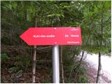 2
2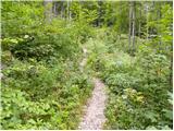 3
3 4
4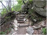 5
5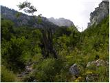 6
6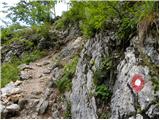 7
7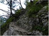 8
8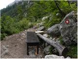 9
9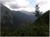 10
10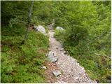 11
11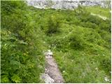 12
12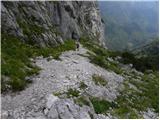 13
13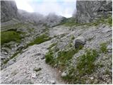 14
14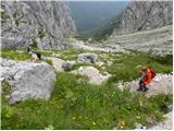 15
15 16
16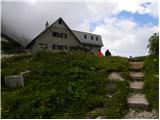 17
17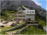 18
18 19
19 20
20 21
21 22
22 23
23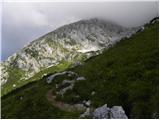 24
24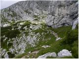 25
25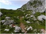 26
26 27
27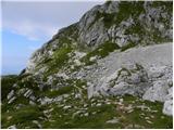 28
28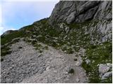 29
29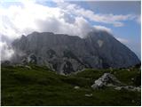 30
30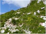 31
31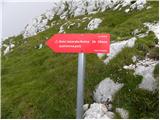 32
32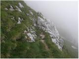 33
33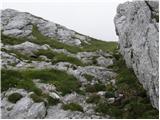 34
34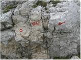 35
35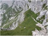 36
36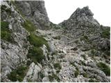 37
37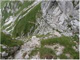 38
38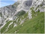 39
39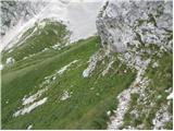 40
40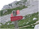 41
41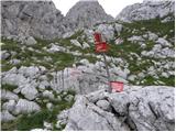 42
42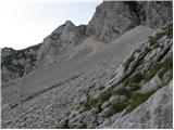 43
43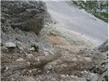 44
44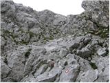 45
45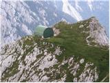 46
46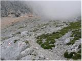 47
47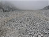 48
48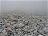 49
49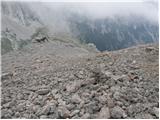 50
50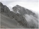 51
51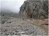 52
52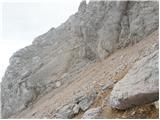 53
53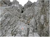 54
54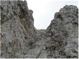 55
55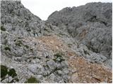 56
56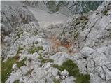 57
57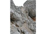 58
58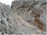 59
59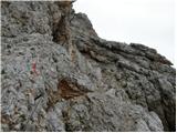 60
60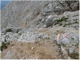 61
61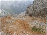 62
62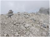 63
63
Discussion about the trip V Koncu - Kokrska Kočna
|
| jax23. 07. 2012 |
Haha, I just went to check what is written here as recommended equipment. On this path there is exactly ONE (1) wire rope. So is a self-belay kit sensible? Let everyone judge for themselves.
|
|
|
To post a comment you must log in:
If you do not yet have a username, you must first
register.