Vajont - Diga del Vajont (Via Ferrata della Memoria)
Starting point: Vajont (605 m)
| Latitude/Longitude: | 46,26930°N 12,31539°E |
| |
Route name: Via Ferrata della Memoria
Walking time: 2 h 20 min
Difficulty: extremely difficult marked way
Via ferrata: D
Elevation gain: 117 m
Elevation difference along the route: 260 m
Map: Tabacco 21 1:25.000
Recommended equipment (summer): helmet, self belay set, lamp
Recommended equipment (winter): helmet, self belay set, ice axe, crampons, lamp
Views: 4.410
 | 2 people like this post |
Access to starting point:
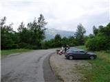
Access from Gorenjska: Through the border crossing Rateče or Predel to Trbiž / Tarvisio and then on the highway in the direction of Videm / Udine to the Tolmezzo exit. From Tolmezzo we follow the road in the direction of the village Ampezzo and the mountain pass Passo della Mauria. The road then descends and brings us to a crossroad, where we continue left in the direction of the town Belluno. Further on, we follow the signs for the town Belluno all the way to the town Longarone. In the town Longarone, we then turn left following the signs »Diga del Vajont«. The road then crosses the river Piava and soon starts ascending. We follow the ascending road to the 6th serpentine where the signs »Ferrata« direct us right onto a narrow road. We then follow this road to the parking lot before the tunnel.
From the Primorska side: We drive on the highway towards Venice / Venezia. At the town Portogruaro we leave the highway towards Venice and continue right on the highway towards the town Pordenone. At the next highway junction near the town Conegliano we continue right towards the town Belluno. Near Belluno the highway ends, and at the next junctions we continue in the direction of the town Auronzo and the pass Passo Mauria. We follow this road only to the town Longarone where we turn right following the signs »Diga del Vajont«. The road then crosses the river Piava and soon starts ascending. We follow the ascending road to the 6th serpentine where the signs »Ferrata« direct us right onto a narrow road. We then follow this road to the parking lot before the tunnel.
Route description:
From the parking lot we continue to the information boards where a signpost directs us right onto a narrow path that runs through the forest. The path initially descends slightly and soon brings us to steep slopes above the gorge and then to the entrance of the tunnel. For walking through the narrow and low tunnel we will need a headlamp. From the tunnel the path brings us to a ledge where the secured path also begins.
The path further crosses precipitous slopes above the Vajont stream along the ledge for quite some time. From the path we have a nice view here of the gorge and the old road leading towards the dam. Higher above us also runs the main road, the consequence of which is unfortunately litter along the path. From the ledge the path then climbs a ladder steeply upwards to the left. Here the path becomes significantly more demanding and above the ladder ascends mostly vertically for quite some time (difficulty C/D and D). On the most difficult sections we are assisted by a few pegs. The path then turns slightly right and ascends a steep gully upwards to the right (difficulty C, D). Above the gully the difficulty eases slightly. First follows a shorter less demanding traverse along the ledge to the left, then an ascent along the cable (difficulty B/C, C) and then another traverse along the ledge.
Further on the path becomes steeper again and runs mostly along an almost vertical wall (difficulty C). Here a view also begins to open up towards the Diga del Vajont dam, which is located at the end of the gorge. The path then becomes less demanding for a while and also leads us through a short stretch of forest.
The path soon brings us back to steeper slopes where we ascend along the cable upwards. On this section we will also often hear traffic noise, as the path bypasses the tunnel through which the main road runs. Above the tunnel the path continues ascending along the cable (difficulty B/C). The slope here is mostly slightly less steep than in the first part of the path (difficulty up to B/C). Along such a slope we then ascend all the way to a somewhat larger ledge where the path becomes somewhat easier. Along the ledge we traverse the wall to the right, slightly descending at the same time. This brings us to the logbook box.
From the logbook box there follows still an ascent over a ladder, after which the secured path soon ends. After the end of the secured path we continue along a hiking path through the forest that brings us to a junction.
Left the path leads towards the village Casso, while we continue right downwards towards the Diga del Vajont dam. From the junction the path continues descending all the way to the main road. After crossing the road we continue right and soon reach the Diga del Vajont dam and the memorial chapel.
We return to the starting point through the tunnel. When walking through the tunnel, be cautious. Traffic through the tunnel is alternately one-way, which allows us to avoid walking on blind sections of the tunnel when vehicles are coming towards us from the opposite direction.
On the other side of the tunnel we then head left onto the hiking path that brings us back to the starting point.
The described path is extremely demanding and for the ascent we will obligatorily need a helmet and via ferrata kit. In the initial tunnels we also need a headlamp. The use of climbing gloves is also recommended.
The secured climbing path Via Ferrata della Memoria was created in 2015 in memory of the victims of the catastrophic disaster that occurred in 1963. Due to the reservoir above the dam, which saturated the ground, a huge landslide was triggered from Mount Monte Toc and filled the lake. The landslide pushed the water over the dam and a large wave then flooded the village of Longarone in the valley of the Piave River. 1917 people died in the disaster.

Photos:
 1
1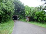 2
2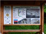 3
3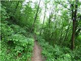 4
4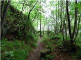 5
5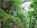 6
6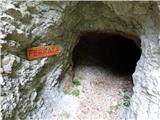 7
7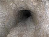 8
8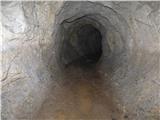 9
9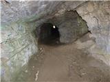 10
10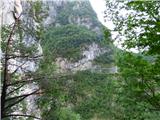 11
11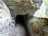 12
12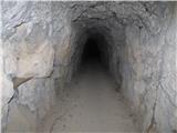 13
13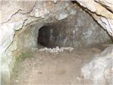 14
14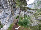 15
15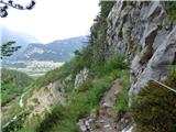 16
16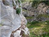 17
17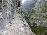 18
18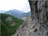 19
19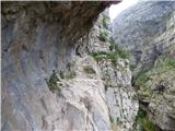 20
20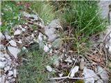 21
21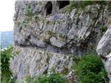 22
22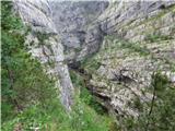 23
23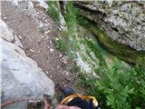 24
24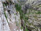 25
25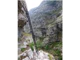 26
26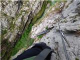 27
27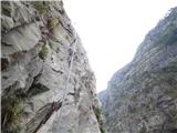 28
28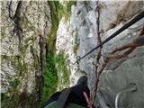 29
29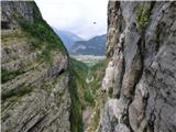 30
30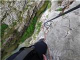 31
31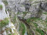 32
32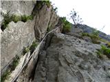 33
33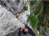 34
34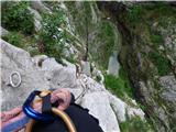 35
35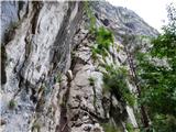 36
36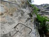 37
37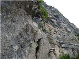 38
38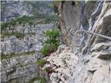 39
39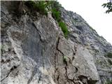 40
40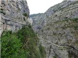 41
41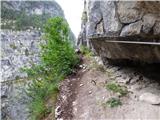 42
42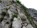 43
43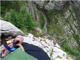 44
44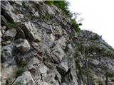 45
45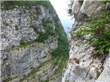 46
46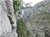 47
47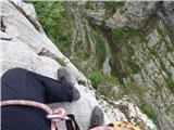 48
48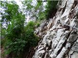 49
49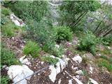 50
50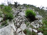 51
51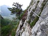 52
52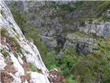 53
53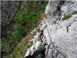 54
54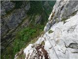 55
55 56
56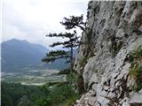 57
57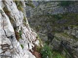 58
58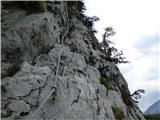 59
59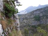 60
60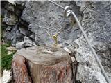 61
61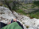 62
62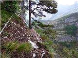 63
63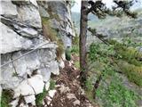 64
64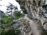 65
65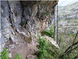 66
66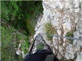 67
67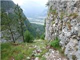 68
68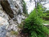 69
69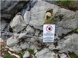 70
70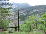 71
71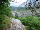 72
72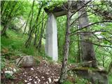 73
73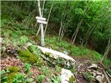 74
74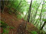 75
75 76
76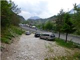 77
77 78
78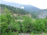 79
79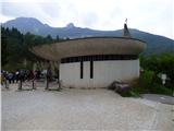 80
80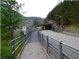 81
81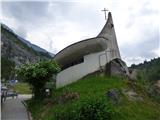 82
82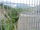 83
83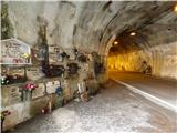 84
84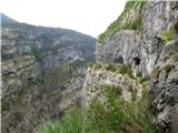 85
85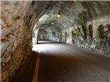 86
86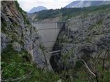 87
87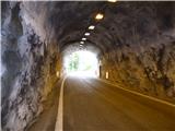 88
88
Discussion about the trip Vajont - Diga del Vajont (Via Ferrata della Memoria)
|
| anka 26. 06. 2017 |
Škratek swapped Pordenone instead of Longarone in the last sentence 
|
|
|
|
| VanSims27. 05. 2018 |
In the lower part there is indeed a somewhat longer D detail, the rest occasionally exceeds C, if at all. Even on Bergsteigen this part is somewhat overrated.
At the end the via ferrata kind of eases up, I'd say some parts are even B.
|
|
|
|
| dragon11. 06. 2020 |
Very interesting and tragic story
|
|
|
To post a comment you must log in:
If you do not yet have a username, you must first
register.