Ovčja vas/Valbruna - Svete Višarje / Monte Lussari
Starting point: Ovčja vas/Valbruna (807 m)
| Latitude/Longitude: | 46,49640°N 13,50060°E |
| |
Walking time: 2 h 30 min
Difficulty: easy marked way
Elevation gain: 959 m
Elevation difference along the route: 959 m
Map: Julijske Alpe - zahodni del 1:50.000
Recommended equipment (summer):
Recommended equipment (winter): ice axe, crampons
Views: 51.551
 | 1 person like this post |
Access to starting point:
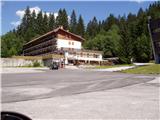
From Kranjska Gora over the border crossing Rateče we drive to Trbiž / Tarvisio. Further, we drive on the old road towards Videm / Udine. Already after a few kilometers from Trbiž / Tarvisio, the road into Ovčja vas / Valbruna branches off to the left. We follow the road to a large parking lot at the bottom station of the old circular cabin cable car.
Route description:
From the parking lot, we continue on the road ahead, but only about a minute, because we then notice a worse forest road which turns left upwards. The road, which at first ascends, later barely noticeably ascends. After approximately 20 minutes of walking from the parking lot, the road crosses a torrent, about 10 meters before the torrent a marked path to Svete Višarje branches off to the left. Already at the very beginning of the footpath we encounter an overgrown path, which through high grass and bushes brings us into the forest. The path through the forest is easier to follow, but quite steep. Further ahead the path is marked, but the blazes are already faded. The steep path leads us along locally very steep slopes, which when wet are dangerous for slipping. The steepness decreases when the path brings us to a forest-covered ridge. The steepness then continues to decrease, and the path brings us to the ruins of old wooden huts. On this section the path crosses an overgrown area, then it starts to ascend moderately again. The path further leads us past two similar ruins, then ascends below the old cableway.
The marked path from here onwards gets lost in high grass, so it is recommended that we head right upwards, where in a few steps we reach the ski slope.
The path ahead continues on a stony cart track that runs along the edge of the ski slope.
In winter walking on the ski slope is forbidden!
While walking on the ski slope beautiful views open up. A little higher we reach the junction of two ski slopes, and we head right steeply upwards. Here ahead of us we see the transmitters on Svete Višarje. When the steepness eases we bypass the transmitters on the left and the path brings us to the upper station of the circular cabin cable car.
Only a short ascent to the church remains. A few meters above the church there is a wonderful view of the surrounding mountains.

Along the route: Planina Limerca (1300m)
Photos:
 1
1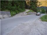 2
2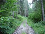 3
3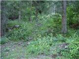 4
4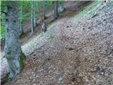 5
5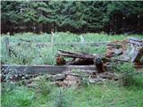 6
6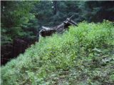 7
7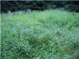 8
8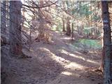 9
9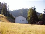 10
10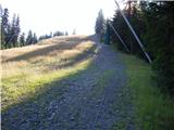 11
11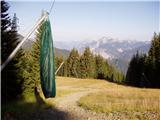 12
12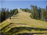 13
13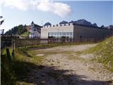 14
14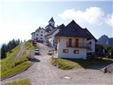 15
15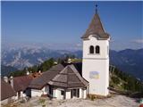 16
16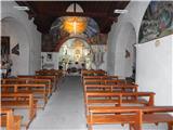 17
17
Discussion about the trip Ovčja vas/Valbruna - Svete Višarje / Monte Lussari
|
| VanSims9. 12. 2013 |
The markings on this path are nicely renewed (walked in the opposite direction in June this year), so the path could perhaps be moved to marked ones.
|
|
|
|
| klm10. 12. 2013 |
The described path was marked long before the time of the path description, so it has always been a marked path. After all, it is also one of the oldest Višarje pilgrimage paths.
Its start is actually in the center of the village, opposite the Saisera hotel, where there is also arranged parking.
|
|
|
|
| POLJANC10. 12. 2013 |
I wonder if the path is trodden in winter time. Regards.
|
|
|
|
| klm10. 12. 2013 |
This path is rarely visited even in dry conditions, in winter it is deserted. CAI 613 from Žabnica or from the hamlet Visarje (Lussari) is trodden in winter.
|
|
|
To post a comment you must log in:
If you do not yet have a username, you must first
register.