Dolina potoka Žep - Koča na Travniku
Starting point: Dolina potoka Žep (790 m)
| Latitude/Longitude: | 46,39770°N 14,82790°E |
| |
Walking time: 2 h 20 min
Difficulty: easy marked way
Elevation gain: 758 m
Elevation difference along the route: 800 m
Map: Kamniške in Savinjske Alpe 1:50.000
Recommended equipment (summer):
Recommended equipment (winter): ice axe, crampons
Views: 11.386
 | 2 people like this post |
Access to starting point:
From the Ljubljana - Maribor highway we take the Šentrupert exit and follow the road ahead towards Logarska dolina. In the village Ljubno ob Savinji the signpost for Smrekovec directs us right. The road then takes us through the center of the village, where we turn left again following the signs for Smrekovec. The road then brings us to Ljubenske Rastke, where at the crossroads near the church we continue left. We follow this road to the sharp right turn, in the middle of which a macadam road branches off straight ahead, which we follow to the mountain signposts for Žep, Robnik and hunting cottage. We park on one of the smaller parking lots by the road (more appropriate space is a little higher).
Route description:
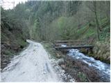
First, with the help of a wooden bridge we cross the stream Žep; then the signposts direct us onto an initially quite overgrown and steep footpath. The path quickly passes into a dense spruce forest, where it continues steeply ascending. We soon step out of the forest onto grassy slopes, where the footpath vanishes. Here, a little higher on a tree, we will notice a blaze which directs us straight up the slope. After a short ascent, we cross the cart track and the path brings us to the ruins of a former farm.
Further, we continue on a poorly visible but marked path, which ascends parallel to a somewhat wider cart track. Higher, the path joins the cart track, which immediately splits. We continue sharply left on a somewhat steeper cart track, which higher turns into a footpath that soon brings us to a forest road, which we follow to the right. After a few minutes of walking on the road, we come out of the forest, where before us we see the expansive Počka planina.
From the mountain pasture we continue ahead on the road, which quickly brings us to a crossroads, where we continue left in the direction of Komna and Travnik (right partisan hospital). The road, which further gently ascends, then brings us to the next crossroads, where we continue left towards the hunting cottage Robnik.
From the hunting cottage we continue towards the south on the road, which slightly descends for a short time, then after a short ascent joins the marked path from Ljubno ob Savinji.
We continue sharply right on the marked cart track, which begins to ascend more steeply through the forest. The cart track higher brings us out of the forest onto a quite overgrown clearing (the path is also like that), then turns left and brings us onto a panoramic grassy ridge from which a wonderful view opens onto Ojstrica and part of the Dleskovška planota. We continue the ascent along the edge of the panoramic grassy slope until the path brings us to a small saddle next to which we notice a cross and a memorial plaque. A short descent follows and the path brings us to the shepherd's hut on the mountain pasture Mali Travnik.
From the mountain pasture we continue on a wide marked path which bypasses the peak of Mali Travnik on the right side. The path soon enters the forest, where it slightly descends, then continues in a gentle ascent. A little further the path brings us out of the forest, where from the right side a path joins from the higher starting point (starting point Kolarica).
We continue on a pleasant gently sloping path, which after 5 minutes of further walking brings us to the mountain hut Koča na Travniku.

Photos:
 1
1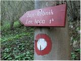 2
2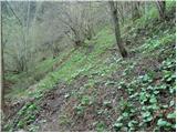 3
3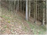 4
4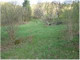 5
5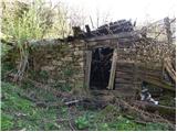 6
6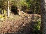 7
7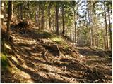 8
8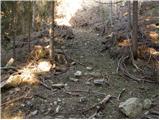 9
9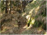 10
10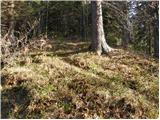 11
11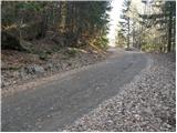 12
12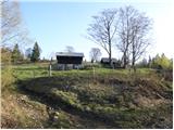 13
13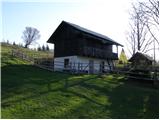 14
14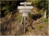 15
15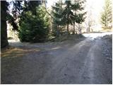 16
16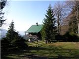 17
17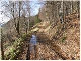 18
18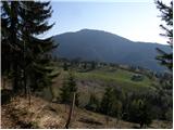 19
19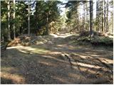 20
20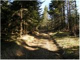 21
21 22
22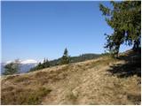 23
23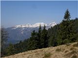 24
24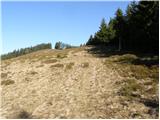 25
25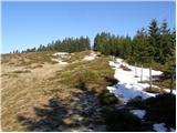 26
26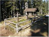 27
27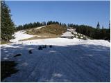 28
28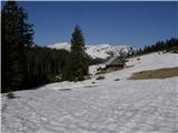 29
29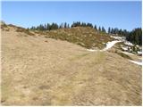 30
30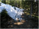 31
31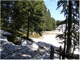 32
32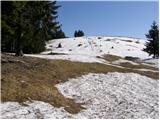 33
33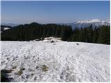 34
34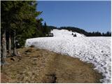 35
35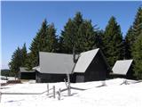 36
36
Discussion about the trip Dolina potoka Žep - Koča na Travniku
To post a comment you must log in:
If you do not yet have a username, you must first
register.