Dolina potoka Žep - Komen
Starting point: Dolina potoka Žep (887 m)
| Latitude/Longitude: | 46,39840°N 14,82730°E |
| |
Walking time: 2 h 30 min
Difficulty: easy unmarked way
Elevation gain: 797 m
Elevation difference along the route: 797 m
Map: Kamniške in Savinjske Alpe 1:50.000
Recommended equipment (summer):
Recommended equipment (winter): ice axe, crampons
Views: 7.815
 | 1 person like this post |
Access to starting point:
From the highway Ljubljana - Maribor we go to the exit Šentrupert and we follow the road ahead towards Logarska dolina. In the village Ljubno ob Savinji the signpost for Smrekovec directs us right. The road then runs through the center of the village, where we turn left again following the signs for Smrekovec. The road then brings us to Ljubenske Rastke, where at the junction near the church we continue to the left. We follow this road to the sharp right turn, in the middle of which a macadam road branches off straight ahead, which we follow to a smaller parking lot at the end of it.
Route description:
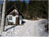
From the parking lot at an old mill over a small bridge we cross the tributary of the stream Žep and then we ascend on a cart track which ascends alongside the stream Žep. After a few minutes of walking we will notice a footpath which turns sharply right and for a short time steeply ascends. After a short ascent the path brings us out of the forest onto a smaller clearing on which stands the log cabin Planinc.
We continue slightly left on a worse cart track that starts gently ascending parallel with a torrent gully which we notice right below. The cart track then crosses the mentioned torrent after a while and right after it brings us to a junction. We continue on the right cart track which first crosses slopes towards the right and then in numerous zig-zags starts ascending steeper. Higher we reach a forest road along which a marked path leads towards Celje hospital, but we continue straight. Only a little higher we cross another forest road and then on a somewhat less visible path we start steeply ascending. The path, which runs through the forest, joins higher the marked path from Ljubenske Rastke. We continue on the path which ascends transversely through the forest; when it comes out of the forest it turns sharply left, where it bypasses the peak Bezovec on which a hunting observatory is situated.
Ahead we carefully follow the blazes as the path leads us across numerous junctions of forest roads and cart tracks. The not very steep path then brings us to Telečje peči where a smaller wooden cottage stands. Here the path turns right and starts ascending steeper. Higher the path joins a cart track which we then follow to the upper slope of Komen. Higher the path emerges from the forest onto increasingly panoramic grassy slopes along which we ascend to a smaller wooden chapel (dedicated to Saints Cyril and Methodius), where there is also a junction. We continue straight upwards in the direction of Komen (left Travnik, right Smrekovec) along the path which after 10 minutes of further walking brings us to the panoramic peak.
In the lower part, where the path is not marked, orientation is very difficult due to numerous cart tracks and forest roads.

Photos:
 1
1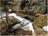 2
2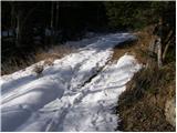 3
3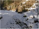 4
4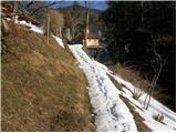 5
5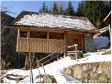 6
6 7
7 8
8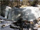 9
9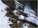 10
10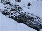 11
11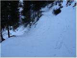 12
12 13
13 14
14 15
15 16
16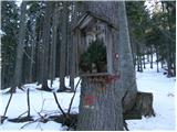 17
17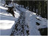 18
18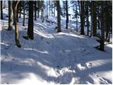 19
19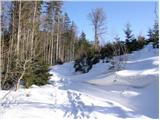 20
20 21
21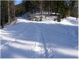 22
22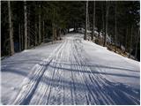 23
23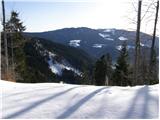 24
24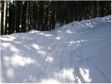 25
25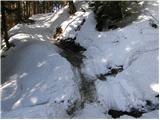 26
26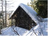 27
27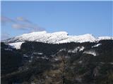 28
28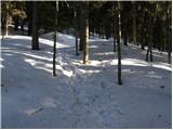 29
29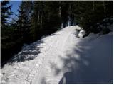 30
30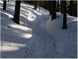 31
31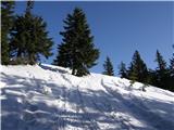 32
32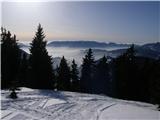 33
33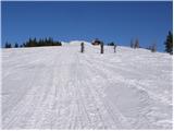 34
34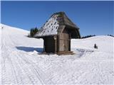 35
35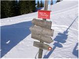 36
36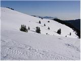 37
37 38
38 39
39 40
40 41
41 42
42
Discussion about the trip Dolina potoka Žep - Komen
To post a comment you must log in:
If you do not yet have a username, you must first
register.